Where Have We Been in 2012?
12
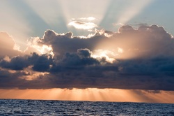
Sunrise over the Indian Ocean
January 5 – 9, 2012
Passage from Durban to Knysna, South Africa
3.25 days - 559.0 n.m.
Sailing the Agulhas Currrent took “Horizon” down the entire stretch of South Africa’s wild coast. It is so named due to the uninhabited landscape and lack of secure anchorages in which to escape severe weather. This means you must sail from Durban to the nearest safe harbor, East London, a distance of 250 n.m., in favorable weather conditions. The Agulhas Current, one of the unique ocean features of the world, can reach speeds of up to 6 knots so, in the event of strong southwesterly winds, abnormal waves have been recorded up to 20 meters (over 60 feet) in height. The passage from Durban, past East London and on to Port Elizabeth, puts sailors into the heart of the Agulhas, so we undertook this passage with the utmost caution. Favorable winds and a southwest-setting current make for a smooth ride and incredibly fast passage. We found the current running between 2 and 3 knots (sometimes up to 4 knots between East London and Port Elizabeth) and we did not encounter any contrary waves. Conventional wisdom instructs sailors to time their departure from Durban to occur just as the wind switches from the southwest to the southeast (after a low pressure system passes through) and then scoot out to the current to take advantage of the 2-4 day weather window, before the next low pressure arrives. In this case, it meant we had to get “Horizon” ready to depart, and then sit idly until 4:30 p.m. (when the wind shifted) and then hurry up to get out of Durban harbor before sunset. It was raining when we left; what we hoped was a passing shower ended up being an all-night drizzle, punctuated with intense lightning as thunderstorms brewed nearby. We expected the seas would initially be a bit choppy – and they were – but it didn’t last and within 5 or 6 hours we found the Agulhas Current. Unfortunately, the east/northeast winds took longer to arrive than forecast, so we had to motor more than we hoped, but when they did show up, we took full advantage. The skies became clearer as we left the humidity of Durban behind (which meant less lightning!)
12
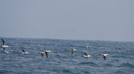
Gannets flying close to ocean surface.
Pods of Rizzos Dolphins and Striped Dolphins fed in the squid-rich waters near East London. Yellow-nosed Albatross, Great Winged Petrels and Gannets appeared in greater numbers as we passed Port Elizabeth, soaring inches over the surface of the waves. We had to time our entrance into Knysna (pronounced nigh-zznuh) to coincide with the slack tide, so we intentionally slowed down the last 100 or so miles and enjoyed a leisurely trip down to the south tip of Africa. But we still reached the narrow entrance between the Knysna Heads just before sunrise and it was necessary to wait another 4 hours until the tide turned to slack. As it was, we still surfed between breaking waves on our starboard and steep, jagged cliffs close to our port. Our adrenaline was rushing full force by the time we reached the calm inner lagoon.
12
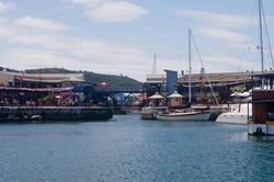
Horizon at Knysna resort waterfront
January 9 - 17, 2012
Knysna Harbour, Knysna South Africa
34º05 S / 23º 02 E
Several members of the Knysna Yacht Club made sure we felt welcome and the harbormaster found a suitable spot for “Horizon” to rest alongside the resort waterfront. Our friends, Ian, Jo, Gillen and Keely from “Chaotic Harmony” and Steve from “Rover of Tacoma” arrived the following day. We also met up with fellow Americans (and OCC Members!) Bob and Eric of s/v “Blue Heron” who left Durban shortly before us and had a similarly fast voyage.
.
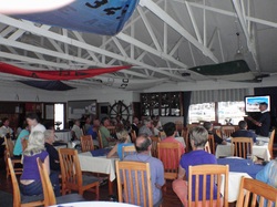
Joseph speaking at the Knysna Yacht Club
Some people reportedly come to Knynsa and never leave … and we can understand why. The folks at the Knysna Yacht Club are warm and gracious. Upon our arrival, we were asked if we could speak at a club meeting a couple of days later, for a “few people.” We are always happy to share our cruising adventures but were surprised that there were so many people in attendance! Our fellow American cruisers (and OCC members!), Bob and Eric Frantz of s/v “Blue Heron,” and Steve Way of s/v “Rover of Tacoma” were there to offer support, as were our friends, Ian, Jo, Gillen and Keely on s/v “Chaotic Harmony,” (whom we met back in Malaysia several months ago, and new OCC members!) Incidentally, the Knysna Yacht Club serves an amazing breakfast … so it’s a good thing our weather window has opened up so we can continue along the coast – otherwise we’d have to buy bigger clothes!
1.
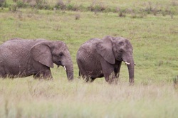
"Ellies" at the Knysna Elephant Park
We rented a car along with Steve on s/v “Rover of Tacoma” and spent a couple of days touring the nearby countryside. The Knysna Elephant Park is located less than an hours’ drive from Knysna and is home to over a dozen orphaned elephants who have been relocated to this reserve, along with the two who were born here. These incredible animals have free range throughout the park but prefer to sleep in a covered enclosure near the reception area. A loft bedroom has been created where guests can stay and “sleep with the elephants.” Joseph was feeding an elephant some special fruits and veggies provided by the staff, until another impatient “ellie” decided to take the bucket from his grasp and eat the contents. (Joseph managed to recover the bucket.) A guide walked with us into the grasslands as we walked alongside the giants, fed them and scratched behind their massive ears (something they apparently appreciate).
..
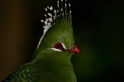
Livingstone's Turaco (Tauraco livingstonii)
We then went to the nearby Birds of Eden, reportedly the largest free-flight aviary in the world. They’ve done a lovely job of creating habitats within the aviary for a wide variety of birds from around the globe; previously caged birds who can now live in safe environments suited to their needs. Marci was in “photographer heaven” as her digital camera clicked away, only to find more interesting and exotic species around the corner. Joseph and Steve finally took refuge in a nearby coffee shop to wait while she spent a ridulous amount of time watching a female Blue Crane fuss over her four eggs. A lot more bird photos are in our Knysna gallery.
..
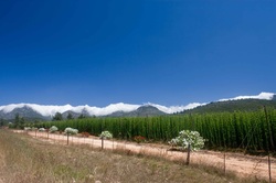
Hops growing west of Outeniqua Mountains
The following day we drove the other direction towards Mossel Bay and out behind the Outeniqua Mountains to the town of Oudtshoorn. We were thrilled when we stopped at the top of the mountain pass to smell grasses and sages similar to those we have back in the States after all these months at sea and in the tropics. Outdshoorn is famous for its ostrich farms and we saw both free range and penned animals in great numbers as we approached the city. But, for us, the real pleasure came from the steep, rocky hills and cool air. One canyon was reminiscent of “that road up near Yosemite” while another valley reminded us of the Owens Valley in California. The roads in this part of the country are very well maintained and we had a great day just looking around.
..
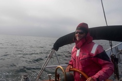
Joseph at the helm on a cool South African morning
January 17-19, 2012
Passage from Knysna to Hout Bay, South Africa
48 hours - 291.1 n.m.
Leaving Knysna requires timing; having a weather window large enough to safely round Cape Agulhas and the Cape of Good Hope, not having a heavy southerly swell which could close out The Heads, (see a great panoramic photo of The Heads in the Knysna Gallery) and being able to leave on a slack, high tide during daylight hours. It looked like we had an excellent window with which to leave that appeared nearly perfect, so we reluctantly said goodbye to our new friends and left the dock early on a sunny morning. Our outbound pass through The Heads was non-eventful and we expected the winds to be initially light once we got offshore, but assumed they would fill in according to the forecast. They did not. We didn’t get much wind at all on this trip, until we reached Cape Agulhas – where we found a lovely breeze.
..
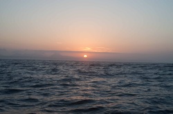
Sunrise over the Cape of Good Hope.
On January 18, 2012 at 1206 UTC, "Horizon" rounded the southern-most part of the African continent, Cape Agulhas at 20'00 E Longitude. She then slipped into the Atlantic Ocean, leaving the Indian Ocean behind with all its different smells and curries ... all the Indians that eat with their fingers, the lightning in the Malacca Strait, the busy Sunda Strait, that obnoxious southerly swell that is responsible for damaging equipment on numerous yachts, and the oppressive heat and humidity associated with that part of the world. But, aside from that, we had a Great Time in the Indian Ocean. Really.
,
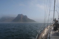
Sentinel Rock in morning fog.
January 19 – February 3, 2012
Hout Bay Yacht Club Marina, Hout Bay, South Africa
34º03S / 18º20 E
On a map, you will find Hout Bay a few miles west of the Cape of Good Hope, just south of Cape Town. It is centrally located and our plans are to stay here 2-3 weeks. The entrance into Hout Bay is dramatic with Sentinel Rock on the port side and Chapmans Peak on the starboard – both appearing out of nowhere in the thick morning fog. It was the first real fog we’ve seen since California, nearly 2 years ago. South African Fur Seals are plentiful in the area and several cavorted around “Horizon” as she made her way into the Hout Bay Yacht Club marina. These are a favorite food source for great white sharks and it is here that the sharks' breaching behavior has become a draw for tourists. We are definitely in the influence of the cold, South Atlantic current. The weather here is much cooler and a nice afternoon breeze keeps things comfortable.
.
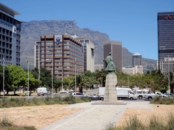
Cape Town Central Business District
Our first order of business once we reached Cape Town, as in all of South Africa, was to check in with immigration. Getting into Cape Town from Hout Bay is not easy; you must either take a taxi (expensive) or catch a bus (easy once you know where the bus actually stops) or take a mini-bus (of questionable safety). We took a mini-bus ride on our first trip and the driver was kind enough to keep the volume of his radio down to reasonable decibels as he explained where we needed to walk once he delivered us at the train station in the center of town. The business district of Cape Town is impressive; tall, modern buildings interspersed with British and Dutch colonial architectural masterpieces nestled in narrow streets with trees, fountains and statues of various historical figures. And there is a cacophony of noise as drivers here are keen to honk at each other at the slighted provocation; hawkers sell food, newspapers, household goods and even jokes at the intersections, and people all shout to each other to be heard above the din. But it’s a polite city as well. People go out of their way to give directions on the streets and in the malls, often stopping to ask where we are from and asking “are you enjoying your visit to South Africa?” and “where have you been so far?”
..
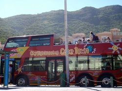
Hop on - Hop off tour bus at Hout Bay stop
We spent one day on board a double-decker City Sightseeing Hop on – Hop off bus. This is a great way to see the greater Cape Town area, although we probably should have gone with the two-day pass because it’s impossible to see the whole thing in one day. The price of the ticket includes personal headphones with which to hear a narrative explaining areas of interest along the way. The view from the upper deck of the bus was often dizzying as the bus followed the winding cliff roads near Camps Bay and the afternoon heat drove us downstairs as we crept through rush-hour traffic downtown. But our route then took us into the cool canopy of trees in the Constantia wine region, the original wineries of South Africa where rows of ancient vines are nestled against the back of Table Mountain. We had the option of a “Township tour,” where (for a fee) a guide takes tourists through Imizamo Yethu to share this “cultural experience.” Imizamo Yethu is a squatters’ camp that sprung up roughly 25 years ago as migrants from poorer (and less politically stable) countries to the north flooded the borders. It is a collection of corrugated metal shacks with limited access to power and sanitation and its residents are subject to increased exposure to violence as unemployment and populations increase. The commentary explained how various philanthropists donate money to build brick homes for the residents, but there is still a significant housing shortage in the area. We fail to understand how a tour of this slum falls under the category of “cultural experience,” since most of the residents are relatively new to South Africa; at best, it seems exploitative.
.
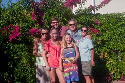
Ceri-Ann, Emily, Alan, Olivia and Joseph & Marci
One of the greatest aspects of cruising are the people you meet along the way and the friendships you develop that span the miles and years between visits. We met Alan and Ceri-Ann, and their daughters Emily and Olivia, when they arrived in Manihi in the Tuamotus on board s/v “Stealaway” back in May, 2010. We were only able to spend a short time together in Papeete before our paths diverged and they continued their fast voyage home to South Africa. But we kept in touch and looked forward to seeing them when we caught up. Alan is an experienced sailor and we took advantage of his local knowledge when compiling information about cruising the Wild Coast and entering the Knysna Heads, in addition to valuable information on game parks and touring in the KwaZulu Natal. It’s hard to believe how much the girls have grown in just the past 18 months, can it really be that long ago? Alan and Ceri-Ann hosted a proper “braai” at their suburban home, introducing us to their family and friends, and gave us a thorough tour of the False Bay area as well. We look forward to reciprocating the hospitality when they return to the Pacific, hopefully in the not-too-distant future.
..
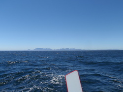
Table Mountain fading from view
February 4 – March 22, 2012
Passage from Hout Bay, South Africa to Prickly Bay, Grenada
Passage Distance: 6210.5 n.m.
Passage Time: 47 days, 11 hours
We left Hout Bay early in the morning ahead of an anticipated frontal system expected to bring several days of gusty wind to the area. Once we cleared Sentinel Point and found deep water, the fresh breeze took us quickly up the coast and Table Mountain faded from view before the end of the first day; our last look at Africa. We caught the Benguela Current and logged an impressive 66 miles during an 8-hour stretch, but our joy was short-lived as the influence of the current diminished the further we got from the continent. Our course was simple; sail 3,540 on a heading of 301º until we reach the Equator (at roughly 32º West Longitude), then change course to 295º for another 1,885 to a point north of Tobago, and then the final 90 miles (or so) to Grenada. The total rhumb-line distance was 5,438 n.m from Hout Bay, South Africa to St. Georges Bay, Grenada (the capitol city) and we calculated the trip should take 45 days, 7 hours if we could maintain a 5-knot average.
.
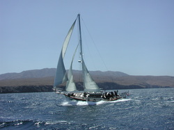
The prevailing winds in the South Atlantic this time of year are southeasterly; that is, they blow from the southeast to the northwest, between 8-12 knots of wind strength. Most sailors will tell you their boats don’t go “dead downwind” very well. “Horizon” doesn’t go dead downwind at all – she simply isn’t designed to do so. The wind needs to be on either side of the boat, and the closer to the beam, the happier she is. So, if our course is 301º and the wind comes from 120º, we must make a decision, do we put the wind on the starboard side, which means we are sailing due north or possibly northeast (in light conditions), or put the wind on the port side and sail as close to due west as possible? We ended up alternating between the choices as the wind shifts decreed. On days where the southeast winds had a more southerly “taste,” we’d work our way westward; days with a more easterly component gave us our chance to get “northing” in. This stair-step approach worked quite well, aside from the fact that we were often required to jybe 4 or 5 times per day, constantly adjusting the sails, grinding the winches and working the boat all hours, day or night, and it added significantly more miles to an already long passage. Plus, when the wind direction shifted between 35-40 degrees, it created havoc with the sea state, generating steep, short, confused chop that tossed “Horizon” carelessly about – particularly in lighter breeze.
It was a slog; a slow, tortuous, miserable, frustrating slog. And to think, it only took us 33 days to get to the Equator. Since we know “Horizon” is easily capable of logging 145 – 160-mile days in steady succession, only being able to scratch out 120-mile days was hard to take. Plus, we weren’t heading straight for our waypoint; that desired spot on the Equator where the Inter-Tropical Convergence Zone is generally at its narrowest, so our V.M.G. (Velocity Made Good [to destination]) was rarely higher than 70%. Each day brought new data regarding the weather forecasts, as well as reports from other cruisers making this passage via our daily SSB radio schedule, and we’d carefully analyze and strategize … and then go where we could put the boat on her best point of sail.
12
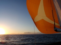
Sunset with "Bob" the Big Sail in light winds
When the wind got light, we sailed slowly and only used the engine when the wind failed altogether and the seas became glassy. Another critical aspect of such a long, non-stop passage is resource management; managing fuel, water, food and sleep. Because the doldrums (and I.T.C.Z.) can often cover an area spanning hundreds of miles – and it’s impossible to predict the exact location and dimensions at any given time – we opted to conserve as much fuel as possible so we could “drive” through this area, rather than languishing beneath the squalls as was done in the days of old. Our solar panels do an excellent job of keeping up with our daily electrical requirements (primarily navigation equipment) so we don’t need to run the engine to keep our batteries charged. The plentiful sunshine also powered our Spectra watermaker and we were able to keep our water tanks topped off every few days. Of course, the fresh produce was eaten within the first week, and it’s always a challenge not to eat all the snacks and treats early on – but we had plenty of essentials to last us the entire voyage. Once we get into the rhythm of a passage, we are usually able to rotate our watches in such a way as to allow plenty of rest for both of us, but the frequent wind shifts and subsequent lumpy seas (and noisy rigging) often disrupted our rest. Imagine “Horizon” gliding along comfortably and, suddenly, the stern catches on a peak and she lurches forward, backfilling the sails and causing the boom to swing laterally, the sails slap and the rig shudders. And then it happens again, seconds later, as she belly rolls in response because there is no longer enough wind to maintain forward momentum. “Horizon” corrects and marches on … and then it happens again … and again. This uncomfortable motion quickly loses its considerable charm and it’s impossible to get any rest in these conditions. We were weary by the time we reached the Equator and the promise of steady northeast Trade Winds. We reached the Equator at 2201 U.T.C. on March 7, 2012 at 31º13W beneath starry skies. We reached that point having run the engine less than 32 hours … so we still had plenty of diesel in reserve. We returned to the Northern Hemisphere and it was as though a switch suddenly turned the wind to the northeast and we were on a gentle reach, straight for the Caribbean. Of course, we dealt with a couple of squalls; one in particular brought spectacular rain, but our timing was excellent and we crossed the I.T.C.Z. in a narrow pulse that lasted less than 12 hours. The light wind was on the beam and “Horizon” was finally on a comfortable reach. Life was good. But we heard from vessels ahead of us stories of lumpy seas and irregular winds further west and the conditions gradually deteriorated as we got closer to Grenada. It was bizarre; we had between 12-15 knots of wind out of the northeast, yet our seas were 2-to-3 meter chop that is normally associated with much higher wind … and it was confused chop at that. Where did it come from? But the miles ticked away and “suddenly” we were within 50 miles of Grenada.
Our headsail has over 40,000 miles on it and, at 0230 on our last night out, we dropped off of a sharp swell, the sail backfilled and snapped, and the foot blew out. Dang. Then the wind died at sunrise but, since we had plenty of fuel, this is no problem – we’ll just motor that last 30 miles; charge the batteries, run the fridge and watermaker and have hot showers and cold drinks when we get into port. Joseph checked the oil prior to starting the engine (as always) and off we went. But we hadn’t been motoring an hour yet when the oil pressure alarm went off! Joseph checked the dipstick and, yes, the oil pan was dry. We hit the kill switch for the engine … and it didn’t work! The alarm is screaming and we couldn’t get the engine to shut off! This is Not Good. We got the Yanmar manual and found the emergency kill switch and got the motor off before it overheated … but not before Joseph saw where oil was squirting out of the lube oil return line for the fuel injection pump. So, at least we knew where the oil came from … but, as usual, it was nearly impossible to reach and patching it was a three-hour ordeal. The high-pressure tube is tiny (1/8th of an inch) and it ruptured, so we took epoxy putty, a piece of fuel hose, and two small hose clamps to seal the rupture long enough to get into port. In the meantime, the wind filled in and “Horizon” sailed along towards Grenada while all this took place. As usual, we carry enough spare engine oil to facilitate a complete oil change, if necessary, so were able to refill the crank case and safely run the engine. We checked in to our daily SSB radio sched and Paul and Natalie on “Renegade” advised us that the entrance to Prickly Bay, on Grenada’s south coast was open (enough to sail into if necessary), and it’s a Port of Entry, so we opted to make landfall there, rather than going an additional four miles around to the north coast into St. Georges Bay. Our repair held and we entered the harbor under our own power, with Paul cheerfully spinning donuts in his dinghy over an excellent anchor location nearby. We were enveloped by the lush green hills surrounding the calm anchorage and we could finally relax. We got our hot showers, partook of cold beverages, and got a blissful night’s sleep.
Our headsail has over 40,000 miles on it and, at 0230 on our last night out, we dropped off of a sharp swell, the sail backfilled and snapped, and the foot blew out. Dang. Then the wind died at sunrise but, since we had plenty of fuel, this is no problem – we’ll just motor that last 30 miles; charge the batteries, run the fridge and watermaker and have hot showers and cold drinks when we get into port. Joseph checked the oil prior to starting the engine (as always) and off we went. But we hadn’t been motoring an hour yet when the oil pressure alarm went off! Joseph checked the dipstick and, yes, the oil pan was dry. We hit the kill switch for the engine … and it didn’t work! The alarm is screaming and we couldn’t get the engine to shut off! This is Not Good. We got the Yanmar manual and found the emergency kill switch and got the motor off before it overheated … but not before Joseph saw where oil was squirting out of the lube oil return line for the fuel injection pump. So, at least we knew where the oil came from … but, as usual, it was nearly impossible to reach and patching it was a three-hour ordeal. The high-pressure tube is tiny (1/8th of an inch) and it ruptured, so we took epoxy putty, a piece of fuel hose, and two small hose clamps to seal the rupture long enough to get into port. In the meantime, the wind filled in and “Horizon” sailed along towards Grenada while all this took place. As usual, we carry enough spare engine oil to facilitate a complete oil change, if necessary, so were able to refill the crank case and safely run the engine. We checked in to our daily SSB radio sched and Paul and Natalie on “Renegade” advised us that the entrance to Prickly Bay, on Grenada’s south coast was open (enough to sail into if necessary), and it’s a Port of Entry, so we opted to make landfall there, rather than going an additional four miles around to the north coast into St. Georges Bay. Our repair held and we entered the harbor under our own power, with Paul cheerfully spinning donuts in his dinghy over an excellent anchor location nearby. We were enveloped by the lush green hills surrounding the calm anchorage and we could finally relax. We got our hot showers, partook of cold beverages, and got a blissful night’s sleep.
12
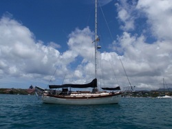
"Horizon" in Prickly Bay, Grenada
March 23 - April 29, 2012
Prickly Bay, Grenada
11º59N / 61º45 W
The island of Grenada was originally occupied by a peace-loving group of people from South America known as the Arawaks. Their comfortable lifestyle was disrupted by the cannibalistic Carib people, who dominated until the arrival of Christopher Columbus on his third voyage in 1498. The lush, steep slopes of the mountains reminded the Spanish of those above Granada in the Andalusian area of Spain – thus the island was called Grenada. The island has subsequently been under English and French control according to various wars and treaties until finally becoming an associated state of the English Commonwealth in 1967, and an independent member in 1974. Political unrest in the early 1980’s led to American military involvement after which the country was well on the way to recovery, until Hurricane Ivan brought devastation in 2004. A dear friend of ours lost his beloved yacht “Harmony” on the rocky shores of Prickly Bay – what has been previously considered a “bullet-proof” hurricane hole. We’ve not seen any evidence of damage during our initial forays ashore and understand the residents of Grenada have worked decisively to rebuild their own country in the wake of the storm.
So, we are in Grenada, the southernmost island of the Lesser Antilles, where parts and services are readily available in a beautiful setting. Our goals when we arrived were to put a permanent fix on the oil leak problem, acquire a new headsail, and take care of the standard post-passage, housekeeping tasks (laundry, interior wipe down, clean the bottom, etc) … and rest. Then we’d be able spend a little time exploring this island before continuing our westward trek towards the Panama Canal.
1.
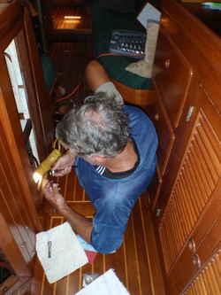
Joseph removing the old oil line
The first order of business was to locate a Yanmar dealer and get a new oil line. Fortunately, at 7:30 a.m. each weekday, a VHF cruisers’ radio net takes place which discusses the weather, new arrivals (and departures), events, local business services/promotion, and gives people the opportunity to “query” the rest of the fleet regarding various issues they are facing or specific products or services they need. We simply asked if anyone knew if there was a Yanmar dealer on the island and were referred to Anro Agencies, which happened to be a short walk from Prickly Bay. Because we have the service manual for our Yanmar diesel engine, ordering a new part was a relatively simple task since we had the exact part number. During the nine days it took to ship the part (FedEx) from the U.S., we managed to find plenty of other jobs to keep us busy.
The second-most important task was to arrange a meeting with Richard Szyjan of Turbulence Sails to come out to “Horizon” and take the measurements for a new headsail. After 40,000 miles, ours had finally reached the end and we still have a long way to go to get back to California, so we need a new one. Richard also measured for a new staysail (although ours still appears to be in good shape) and we decided to go ahead and get a new one built as well, while we’re at it. We’ve been graciously permitted to visit the loft while the new sails are being built and included photographs of the process in our “Horizon’s New Sails – Again” page.
The second-most important task was to arrange a meeting with Richard Szyjan of Turbulence Sails to come out to “Horizon” and take the measurements for a new headsail. After 40,000 miles, ours had finally reached the end and we still have a long way to go to get back to California, so we need a new one. Richard also measured for a new staysail (although ours still appears to be in good shape) and we decided to go ahead and get a new one built as well, while we’re at it. We’ve been graciously permitted to visit the loft while the new sails are being built and included photographs of the process in our “Horizon’s New Sails – Again” page.
1.
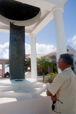
Joseph at the Campus memorial
We anchored next to Paul and Natalie Schneider of s/v “Renegade” whom we met in Durban, South Africa over the Christmas holiday, and got to spend a little time with them before they set off for Bonaire and Panama (where we hope to see them again next month). They kindly directed us to the closest New York Deli (where we got our first real bagel since leaving California) and the best grocery stores (an I.G.A. with American products), as well as the low down on taxi services, phone/Internet providers and the best pizza joints in town. All of these luxuries are within a mile or two of Prickly Bay so we make a point of taking a long walk every day in an effort to get our muscles back in shape after 47 days at sea.
Paul and Natalie introduced us to friends of theirs whom they met here in Grenada when they began cruising (12 years ago), Mike and Beth Smith on s/v “Justin’s Odyssey II”. Mike is better known as Dr. Michael Smith, Professor of Anatomy at the Veterinary College at St. Georges University. St. Georges University was the medical school whose American students and faculty were ostensibly threatened by the armed Marxist coup that took place in October, 1983 under the support of Soviet-backed Cuban “advisors.” At the time of the American action, which began on October 25th, the entire island was under a curfew and anyone found on the streets could be summarily executed; the former leader of the party, Maurice Bishop, and several of his highest ranking officials were executed a week earlier at Fort St. George. A bronze monument honoring the nineteen American service personnel who lost their lives during this action stands beneath an American and Caribbean flag in the heart of the St. Georges University Campus. Several individuals made a point of letting us know that they appreciate America’s intervention and each year the country celebrates October 25th as Thanksgiving Day.
Paul and Natalie introduced us to friends of theirs whom they met here in Grenada when they began cruising (12 years ago), Mike and Beth Smith on s/v “Justin’s Odyssey II”. Mike is better known as Dr. Michael Smith, Professor of Anatomy at the Veterinary College at St. Georges University. St. Georges University was the medical school whose American students and faculty were ostensibly threatened by the armed Marxist coup that took place in October, 1983 under the support of Soviet-backed Cuban “advisors.” At the time of the American action, which began on October 25th, the entire island was under a curfew and anyone found on the streets could be summarily executed; the former leader of the party, Maurice Bishop, and several of his highest ranking officials were executed a week earlier at Fort St. George. A bronze monument honoring the nineteen American service personnel who lost their lives during this action stands beneath an American and Caribbean flag in the heart of the St. Georges University Campus. Several individuals made a point of letting us know that they appreciate America’s intervention and each year the country celebrates October 25th as Thanksgiving Day.
1.
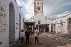
Beth and Joseph with Claudius Chris
Mike and Beth enjoy sharing the attractions of Grenada with new cruisers and we spent a lovely morning visiting some of the old forts and churches surrounding St. Georges Bay. Many were built by the British and French forces as they rotated possession of the island and we had fun imagining the cannon’s blazing as they tried to defend the forts against the various ships passing offshore. We also visited the St. Georges Anglican Church which suffered significant damage when Hurricane Ivan passed directly over the island in 2004. We met Claudius Chris, a Sexton of the church who shares information with visitors about the history of the church and her future. He told us that services are still held twice-weekly in the less damaged sanctuary adjacent to the main sanctuary, which no longer has a roof, or floor tiles, or pews. Parishioners are currently attending services in the “daughter” churches in various locations throughout the island while they work to repair this facility. The clock tower and altar (which were at opposite ends of the building) were spared and still contain their original stained glass.
12
Derelict abandoned Soviet airplane
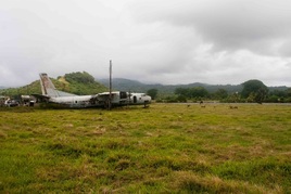
Another day found us following the narrow, windy road high into the interior mountains through the lush rainforest of the Grand Etang Forest Reserve. The rain held off just long enough for Marci to take some photos of the lovely Annandale Falls but low clouds obscured much of our views of the peaks. We passed through several small hamlets with brightly colored homes flanked with brilliant bougainvillea on our way to the old Pearls Airport, which still houses the remains of an Soviet-era plane, left behind after the action in October, 1983. Goats and cattle now tend the grounds surrounding the disused runway.
1

Baby billy goat in pasture at The Goat Dairy
Our journey continued northward to the Belmont Estates, home of The Grenada Chocolate Company which bills itself as producing the finest chocolates in the world. We would have to conduct further ‘research’ to verify this claim, but we can say the chocolate was quite good. The Goat Dairy is also located at the Belmont Estates. Beth introduced us to her friend, Christine Curry, who is one of the founders of the non-profit, sustainable agriculture project. Christine has devoted the past four years to creating the Dairy; building a herd on-site, developing relationships with local herders to provide high quality, organic milk, bringing in state-of-the-art sanitation equipment, and teaching Grenadians the art of making delicious Chévre goat cheese. Their products are available at stores throughout Grenada, and many restaurants proudly feature goat cheese salads on their menu.
12
Leading edge of a Caribbean squall
April 30, 2012 – May 11, 2012
Passage from Prickly Bay, Grenada to Colon, Panama
Passage Distance: 1,406.7 n.m.
Daily Average: 136.1 n.m.
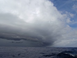
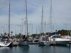
Slog: (slðg) v 1. To walk with a slow, labored gait. 2. To work diligently for long hours, toil. This definition, according to The American Heritage Dictionary, could be supplemented with a third choice: 3. Sailing downwind with insufficient wind strength necessary to power up the keel to propel a yacht through uncomfortable seas over the course of several consecutive days. While “Horizon’s” performance on this passage was considerably better than our trip up from South Africa, it still fell under the category of a “slog.” We left Prickly Bay late in the afternoon of April 30th and found excellent wind conditions just off Grenada, but the seas were unaccountably rough for the first 48 hours which made it difficult to get into “passage mode.” Our course was essentially due west … and the wind was essentially due east … so we ended up adding over 150 miles to the rhumb-line distance between the two points by putting the wind closer to the beam (and improving the speed and comfort). We like to think that our excellent new headsail and staysails from Turbulence Sails in Grenada added to our performance … they certainly looked good pulling us towards Panama! This passage is often fraught with unpleasant squalls and thunderstorms but we must have caught a break because the squalls generally missed us – at least until the last 36 hours. We would have reached the Panama Canal Zone one hour after sunset but, in keeping with our preference of making landfall during daylight hours, it was necessary for us to slow down (!) and then stand off outside the harbor until first light. We spent 11 hours drifting among super-sized cargo vessels in darkness beneath heavy clouds as cells of lightning and torrential downpours passed every 60-90 minutes. Needless to say, sunrise was a welcome relief. The entrance to the Shelter Bay Marina is just inside the Panama Canal Zone and Frank, the Dock Master, promptly assigned us a slip and helped us contact an Agent who will assist us in our Canal transit. It is a bit surreal to realize we are less than 60 miles from our home waters of the Pacific Ocean.
1
"Horizon" at the Shelter Bay Marina
May 11, 2012 – May 30, 2012
Shelter Bay Marina, Colon, Panama
9º22 N / 79º 57 W
The Republic of Panama is situated on the isthmus between North and South America with Costa Rica on the north border and Colombia to the south. Archeological evidence indicates people have used this bridge between the continents for many thousands of years for commerce as well as many permanent villages near hunting and gathering resources. Spanish explorers were the first Europeans to arrive in 1501 A.D. and they claimed “ownership” of the area encompassing present-day Panama, Colombia and Venezuela in 1538. It remained under colonial rule until 1830, when it became part of the Republic of Colombia. Panama seceded from Colombia in 1903 which paved the way for the United States Army Corps of Engineers to take over the construction of the Panama Canal. The construction of the Canal originally began in 1880 under the leadership of Ferdinand de Lesseps, who built the Suez Canal, with French financial backing but it eventually faltered. An excellent book on the subject, “The Path Between the Seas” by David McCullough chronicles the challenges of building the Panama Canal. We look forward to seeing first-hand this marvel of technology in the coming weeks.
1
Erick Galvez of Centenario Consulting with Joseph
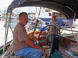
There is a fair amount of paperwork necessary to transit the Panama Canal, in addition to the usual Customs/Immigration/Port Official clearance documents that must be completed each time we enter or leave a country, so we decided to hire an Agent to assist us. Erick Galvez, of Centenario Consulting, came highly recommended (via on-line cruisers’ forums) so we contacted him as soon as we arrived at the Shelter Bay Marina. He met us a couple of hours after our arrival and, within a few minutes, clarified the entire procedure and arranged for “Horizon” to be measured and scheduled for her transit. Throughout the measurement process and subsequent scheduling of our upcoming transit, Erick has been attentive and thorough, and our transit is re-scheduled to take place Wednesday, May 30th.
1
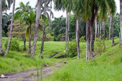
Grounds of abandoned Fort Sherman
The recent lead-time between being measured and transiting the Canal has been up to 21 days, and we planned to spend much of that time touring nearby islands on the Caribbean side of the Canal. But we are assigned an earlier transit date so there isn’t enough time to cruise the islands and prepare for the upcoming Pacific voyage back to the United States. Fortunately, the Shelter Bay Marina is located next to pristine rainforest jungle where we could walk among lovely birds, Capuchin and howler monkeys, and sloths. The Marina also provides a free daily shuttle to an excellent grocery store in Colon where Marci has been able to provision for the long voyage ahead. We’ve also enjoyed the amenities here which include a small mini-mart, restaurant, swimming pool and wi-fi. It’s been a great stop and we can understand how easy it is for so many cruisers have gotten comfortable here.
1
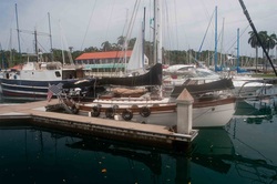
"Horizon" waiting to leave Shelter Bay Marina
May 30 – June 1, 2012
Transit through the Panama Canal
Isthmus of Panama, Republic of Panama
We awoke early on Wednesday, May 30th full of anticipation for the first day of our scheduled two-day transit of the Panama Canal. We got word the previous evening that our transit advisor was set to arrive at 5:30 p.m., which would have caused the first stage of the transit to take place after dark, but we were subsequently notified he would arrive at 2:30 p.m. We made several new friends among cruisers waiting for their own transits and Jean-Louis and Genevieve Le Dentu (s/v “Ichtus”) asked to come along and work as line-handlers to get some experience with the process before taking their own yacht through next spring. Another gentleman, Kent, was crewing on a delivery that had been delayed so he asked to come along as well. Marci would be the required fourth line-handler while Joseph would be responsible to drive “Horizon” during the transit. Our Crew arrived at 12:00 p.m., their gear was stowed and we bade farewell to the Shelter Bay Marina in Colon.
1
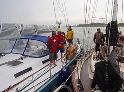
"Antipodes" and "Horizon" approaching Gatun Locks
We motored to the Flats anchorage and waited for our Transit Advisor, Roy, to arrive along with the Advisor for s/v “Antipodes,” a Santa Cruz 72 scheduled to transit at the same time. The Advisors determined that our two yachts should be rafted together and share the locks behind cargo vessel “Cap Portland.” Because “Antipodes’” 100 horse-power engine is considerably larger than “Horizon” (66 hp), her Captain, Alan Tillyer was given the greater responsibility of steering the raft as we entered the chambers, while Joseph was charged with supporting the raft in the event of excessive turbulence when the locks are flooded, or from “Cap Portland’s” propeller. The forward lines were handled on “Antipodes” because of her greater length while “Horizon’s” crew handled the aft port line and made sure the two yachts were nested properly. It stopped raining as we entered the Gatun Locks at 4:00 p.m where the first two locks elevated the boats nearly 60 feet above sea level and the final lock brought us to the elevation of Gatun Lake; 81 feet above sea level. See the Panama Canal folder in our Around the World Gallery for more photos!
1
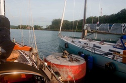
"Horizon" and "Antipodes" rafted on Gatun Lake
It was dark when we reached the large mooring buoy where our two boats were instructed to tie for the night and await the 6:30 a.m. arrival of our Advisors. “Horizon’s” crew feasted on pasta Bolognese and baguettes before settling down for the night; Jean-Louis and Genevieve slept in the saloon while Kent slept in the cockpit. Kent probably had the best bunk on the boat because it didn’t rain all night, a rarity in itself here in Panama, and it was much cooler outside. We were up at dawn on May 31st, finishing our coffee and getting ready to finish our transit and get “Horizon” back in the Pacific Ocean when the Advisor delivery boat sped out to our mooring … with only one Advisor! He climbed on board “Antipodes” and had to be the one to break the news to us that the Advisor assigned to “Horizon” did not show up for work today so, since yachts cannot transit the canal without an Advisor, we must spend the day in Gatun Lake, tied to the mooring buoy, until June 1st. To make matters worse, Kent, our line handler, had reservations to fly out of Panama City early on June 1st back to his home in Australia, so he hopped on “Antipodes” and they left, leaving us short one Advisor and one line handler. We spoke with Erick Galvez, our Agent, who diligently arranged a line handler to receive special transportation out to Gatun Lake along with our second Advisor early on June 1st. So, we had nothing to do Thursday, May 31st, but swim in the cool, fresh water of Gatun Lake, or relax in the shade of the cockpit reading and while away the hours. Fortunately, Jean-Louis and Genevieve are excellent company and good sports about being kept away from their own boat an extra day.
1
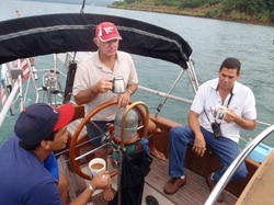
Nicky, Joseph and Harold crossing Gatun Lake
We were delighted to see the Advisor delivery boat arrive at 7:15 a.m. on June 1st, carrying both Harold, our Advisor, and Nicky, our line-handler, and it took just a few minutes to get their kits stowed before we were off the mooring ball to begin the 30-mile voyage across Gatun Lake. Vessels are required to feed the Advisors and line-handlers during the transit so Marci made sausage and egg breakfast burritos while we motored towards the “down” locks at the other side of Gatun Lake. Harold proudly shared historical facts and technical information about the construction, maintenance and operation of the Panama Canal throughout the day. At 11:30 a.m., we passed Gold Hill – the continental divide - and contemplated the reality of how few yachts go over such a geologic feature.
1
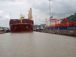
Seabord Peru and Oronoco Star in Miraflores Locks
We arrived at the Pedro Miguel lock at noon and, because we were the only yacht scheduled to transit, were assigned “center chamber” in front of cargo vessel, “Seaboard Peru.” Marci and Genevieve were assigned to handle the lines on the bow, Nicky and Jean-Louis were given the stern lines, and Harold made sure each of us were comfortable with our responsibilities before we entered the Pedro Miguel lock. Joseph drove “Horizon” into position inside the lock and the dock-side linemen threw a light line attached to a monkey-fist down to the boat. “Horizon’s” line-handlers had to tie our heavy, 125 ft long lines to the monkey-fist and quickly feed the thick line back towards the canal walls; then tighten the lines to hold “Horizon” near the center of the lock. Four electric locomotives slowly pulled “Seaboard Peru” into position behind us and got the lines secured, and the heavy doors closed behind her. Thousands of gallons of water were released and our two vessels dropped nearly 30 feet in the Pedro Miguel lock to reach Miraflores Lake, a small reservoir between the Pedro Miguel lock and the two Miraflores locks. “Horizon” made the descent easily and we quickly crossed Miraflores Lake, caught the light lines with the monkey-fist without anyone getting beaned in the head by the flying weights, and repeated the process down the last two locks. We passed beneath the Bridge of the Americas at 2:15 in the afternoon and a Panama Canal Authority launch arrived to take Harold ashore. We continued on to the Balboa Yacht Club at 3:00 p.m. A water taxi appeared out of nowhere and, before we knew it, we were saying hasty goodbyes and well wishes to our stalwart crew.
1
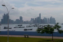
Panama City - from the "Causeway"
June 1 – 4, 2012
Balboa Yacht Club
Amador, Republic of Panama
8º56 N / 79 º 33 W
Although we had just a short stay near Panama City, we quickly came to the conclusion that this is a city worth another visit. We took a City Tour “Hop On-Hop Off” bus ride our last day in Panama which gave us an excellent overview of Panama City and the nearly Miraflores Locks. The Panamanian citizens have made a conscious effort to preserve as much of the nearby rainforest as possible, while allowing the city to prosper and grow. As such, street signs often warn people to watch out for crocodiles and other wild animals. Eco-tours are available for bird watching, visiting indigenous villages near Gatun Lake, and diving/snorkeling trips in the nearby Las Perles islands. The Balboa Yacht Club made this an easy place for us to rest and prepare for our upcoming voyage.
12
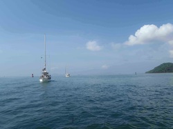
Resolute and Horizon leaving Panama
June 5, 2012 – July 24, 2012
Passage from Panama City, Panama to Honolulu, Hawaii
Passage Distance: 6,255.6 n.m.
Passage Time: 50 Days
As we started planning this long passage from Panama to Honolulu, it clearly broke down into three major segments. The first segment would be roughly 850 n.m. from Panama towards a point near the Galapagos Islands, where we could expect to find south to southeast winds. The second, and by far the longest, segment would be roughly 2,700 n.m. on a due-west course to a point where the Inter-Tropical Convergence Zone (ITCZ) tapers to a narrow band – estimated to be at approximately 135º W Longitude. The third, and final, segment would take us roughly 1,800 n.m. on a northwest heading straight toward the Hawaiian Islands, where we’d sail along the eastern coast around the “top” of Molokai before heading down the Kaiwi Channel, around Diamond Head and into the Hawaii Yacht Club at the Ala Wai Harbor. We set off on a sunny morning in the company of Jack and Daphne Garrett of s/v “Resolute”, also on their way to Honolulu.
1
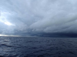
Early stages of Hurricane Carlotta
We knew the first leg of the voyage was going to be challenging. The geography of the Gulf of Panama is uniquely positioned to bring hot, steamy moisture from the Colombian rainforests together with cool(er) water down the coast from the North Pacific; add pulses of convection from the Caribbean squeezed between the North Pacific High and the South Pacific High, and you have the recipe for huge areas of low pressure and unsettled weather. The winds within these Lows are often light and variable … when you aren’t dealing with briefly strong gusts associated with thunderstorms. We encountered these light conditions – along with contrary currents – that gave us fits for several days. During the hurricane season, these Lows often deepen, collecting energy, and rotation begins, spawning “named” Tropical Rotating Storms or hurricanes. We found ourselves at the center of a massive Low that brought cell after cell of intense thunderstorms over an 18 hour period.
1
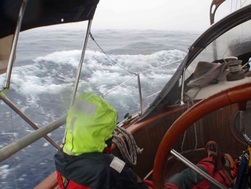
Marci "enjoying" wet weather in Carlotta
Lightning flashes with simultaneous rifle-shot thunder kept us on edge as we worked our way towards the southwest, opposite the normal track of these Lows. It turned out we were witnessing the birth of Hurricane Carlotta, a Tropical Rotating Storm that tracked up the Central American coastline to Mexico, reaching maximum sustained winds of 105 mph – making it a Category 2 storm. It is storms such as these that force sailors to take the long voyage out towards Hawaii, rather than the shorter, coastal route, and we were glad we elected not to run the risk of getting caught in such a storm.
1
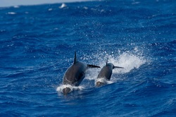
Pantropical Spotted Dolphins
We finally found favorable winds on Day 9 and were able to begin the long trek westward. Joseph planned our route to stay just north of the Equator, where a helpful west-setting current is often located, and sail in the steady southerly breeze historically found there. The route also keeps us safely below the ITCZ and the Lows that form in the Gulf of Panama that sometimes track westward. We had many good days of sailing, particularly when we picked up the favorable current, and achieved our all-time highest mileage in a 24-hour period of 177.6 n.m. on July 17th. But we also encountered some disappointing days when an annoying counter-current made “Horizon” feel as though she were sailing through Sludge. Jack and Daphne stopped at the Galapagos Islands to take on water and reported similar conditions behind us as their route took them south of the Equator. On June 25, 2012 we crossed 117º W Longitude, the longitude of San Diego, and had officially crossed all 360 degrees of longitude. At 2330 on July 4, 2012, “Horizon” and her crew crossed her outbound track and completed her circumnavigation, twenty-seven months and two days after leaving San Diego, California.
1

Squall at the tail end of Emelia
Every two or three days, Joseph downloaded weather faxes and GRIB files to monitor the position of the ITCZ, particularly as we approached 135º W Longitude. All along our westward leg, it looked as though the ITCZ would be only a couple of degrees wide (roughly 120 miles or so), and we’d have a straight shot for our third leg, once we made that “right” turn. So imagine our disappointment as the Cyclone Danger weather forecast predicted Hurricane Daniel to track westward, along roughly 16º N Latitude; the timing of which would put us on a collision course around 140º W Longitude. We managed to sail all the way around the world without being hit by a hurricane, and we were not about to start now. Understanding that Storms in the Northern Hemisphere do not venture south towards the Equator, we were in a position of safety, particularly as we were still below the ITCZ. All we needed to do was wait for Daniel to pass to our north and we’d catch the northeast Trade Winds that filled in behind the storm and continue on our way, right? Well, it was a good plan but for the development of Hurricane Emelia that sprang from a Low right behind “Daniel” that followed in the same path. These were both Category 2 Storms with maximum sustained winds of 105 m.p.h. Both of these storms affected the wind south of them and there was no way we could safely sail in the gap between them. So now we had to slow down and wait … for several days … as the storms moved westward and dissipated. In the end, we had a few impressive squalls at the tail end of Emelia and 24 hours being becalmed, before gradually finding the NE Trades that would finish this epic voyage. Unfortunately, the last couple of days were frustrating because we were tantalizingly close … and the wind got light and came more from the easterly direction which, you guessed it, came directly up our stern, with awkward rolling seas and slow sailing.
1
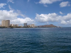
Diamond Head at Waikiki ... Aloha!
At 2025 UTC on July 23rd we shouted “Land Ho” as Haleakala peaked above the clouds on Maui. The Trade Winds got stronger later that afternoon and we literally rocketed down the Kaiwi Channel between Molokai and Oahu, sailed around Diamond Head and into the Ala Wai Harbor. This is “Horizon’s” third visit to Honolulu in the past ten years and we were thrilled to see space available on the dock at the Hawaii Yacht Club. Ron and the staff at the Hawaii Yacht Club secured a berth for us where we will be able to rest, relax and enjoy this wonderful facility. We have completed the necessary Customs/Immigration/Quarantine formalities and are now “officially” back in the United States of America. It is GOOD to be home.
1
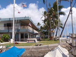
Hawaii Yacht Club, Ala Wai Harbor, Honolulu
July 25 – August 3, 2012
Hawaii Yacht Club, Honolulu, Hawaii
21º17 N / 157º50 W
We had a myriad of things to take care of, having been out of the country for over two years, and Honolulu is a great place to get started. Of course, there are the normal post-passage chores to take care of; “Horizon” needed a good cleaning, laundry, fuel/propane refills, etc. But we also needed to get a phone, secure a slip in Southern California … stuff like that. Oh, and we wanted to enjoy the Aloha of Hawaii. We didn’t have a monster list of broken stuff to repair … we had only one significant breakage during the passage … a stainless steel tube on our Monitor windvane broke (after nearly 40,000 miles of Tough Duty) but we had a spare and, after 90 minutes, all was right in the world. We planned to spend at least a week here. The nice folks at Scanmar still have record of our initial purchase and we received a replacement spare four days after giving them a call!
1
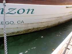
This sludge was a very stubborn stain.
“Horizon” looked worse for wear after that epic passage from Panama, despite Joseph having spent 90 minutes scrubbing the hull while we were stopped in the doldrums. He scraped a carpet of tubular barnacles that had grown several inches thick during our time in Equatorial waters but we still had a mess to clean up when we arrived in Honolulu. It took both of us, an entire day, to clean just one side of the hull with the toughest (yet environmentally approved) cleaning products we could find. We were completely out of “Elbow Grease” after the cleaning the starboard side first, so we allowed ourselves a rest day before turning the boat around and starting the port side. But “Horizon” is now clean, re-organized, re-provisioned and ready for the final leg of our circumnavigation.
1
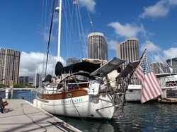
Horizon in Waikiki
August 4 – 28, 2012
Passage from Honolulu, Hawaii to Ventura, California
Passage Distance: 2,945.8 n.m.
Passage Time: 24 days
It would have been so easy to stay in Honolulu; we’ve always had such a nice time at the Hawaii Yacht Club. We are still weary after that epic, 50 day passage from Panama, but this last passage won’t get done if we don’t get started, so we pried ourselves off the dock as soon as a good weather window opened up. We left early under sunny skies with a forecast of steady breeze needed to sail due north as our route would take us around the North Pacific High.
1
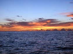
Sunset in calm seas
The first few days of the passage gave us some of the best sailing we’ve had in quite some time and we made excellent northeasterly progress. However, the position of the North Pacific High shifts north/south and east/west so planning your route around this moving target can be challenging. It is often simply a matter of luck whether or not the route you take will give you consistent wind. Our luck was good during the first week of the passage; we had steady easterlies, but then our luck changed. The High elongated and during a ten-day period, we spent the equivalent of three days being totally becalmed. This was our third passage from Hawaii to North America and we decided to give ourselves the challenge of seeing just how little we could run the engine. So when the wind died, rather than firing up the “iron jenny,” we just bobbed along, often drifting along less than 2 knots. We ended up putting only 8.8 hours on the engine and used 7 gallons of fuel, so we feel we met the challenge admirably.
1
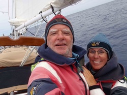
Still smiling after all these miles
We’ve been really looking forward to cooler weather, after spending so many months in the oppressive heat of the tropics, and were thrilled to have to put our cold-weather gear in use as we neared the California coast. We were two days from landfall when we saw our first piece of floating kelp, a sure sign we were getting close; and the North Pacific has a more “organic” smell than closer to the Equator. Joseph called “Land Ho” shortly before sunset on our final night out and we managed to get in the lee of Point Conception before the full force of a brewing gale churned up the seas. Unfortunately, once we got in the lee of Point Conception our wind finally failed and we had to motor the last 35 miles in to Ventura.
1
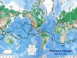
So, these are the boring statistics of our circumnavigation.
We departed San Diego, California on April 2, 2010 and arrived in Ventura, California on August 28, 2012 – 28 months later.
“Horizon” sailed a total of 37,545.3 nautical miles.
We visited three continents; Asia, Africa and South America, fifteen countries and 41 islands.
We departed San Diego, California on April 2, 2010 and arrived in Ventura, California on August 28, 2012 – 28 months later.
“Horizon” sailed a total of 37,545.3 nautical miles.
We visited three continents; Asia, Africa and South America, fifteen countries and 41 islands.