Where Have We Been in 2010?
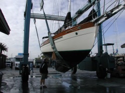
'Horizon' in travel-lift at Shelter Island boatyard
January, 2010
"Horizon" is currently at
Latitude 32.37.32 North
Longitude 117.06.12 West
in San Diego, California preparing for departure. Here she is at Shelter Island Boatyard, getting a new coat of bottom paint. It's the last "big" job before casting off!
"Horizon" is currently at
Latitude 32.37.32 North
Longitude 117.06.12 West
in San Diego, California preparing for departure. Here she is at Shelter Island Boatyard, getting a new coat of bottom paint. It's the last "big" job before casting off!
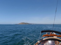
'Horizon' sailing away from Pt. Loma at San Diego
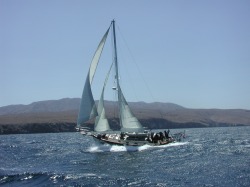
April 2, 2010 Passage to Guadalupe Island, off Baja California peninsula, Mexico
When we sailed to San Diego after our previous trip to New Zealand and the South Pacific, our intention was to return as quickly as we could. As it happened, nearly five years of planning and preparation passed before “Horizon” left San Diego Bay at 2020 UTC, bound once again for the South Pacific. What makes this voyage unique, however, is the addition of a third crew member, our son, Steven Paravia. We're sure he wondered what he got himself in for as the sea conditions got progressively worse the first 36 hours of the trip. The wind/wave situation was much higher than forecast so we decided to duck in at the anchorage known as Caleta Melpomene on Guadalupe Island and allow things to settle down a bit before continuing. This decision had the added benefit of allowing Steven time to get acclimated to life on a 38’ sailboat and turned out well. We were visited by local abalone fishermen and procured some of their catch one morning; and the local Armada stopped by to check in with us, kindly making sure that all was well on board and commiserating about the nasty weather conditions “outside.” They made it clear we were welcome to stay as long as we wanted but we were anxious to be on our way to the Marquesas and stayed only three days.
When we sailed to San Diego after our previous trip to New Zealand and the South Pacific, our intention was to return as quickly as we could. As it happened, nearly five years of planning and preparation passed before “Horizon” left San Diego Bay at 2020 UTC, bound once again for the South Pacific. What makes this voyage unique, however, is the addition of a third crew member, our son, Steven Paravia. We're sure he wondered what he got himself in for as the sea conditions got progressively worse the first 36 hours of the trip. The wind/wave situation was much higher than forecast so we decided to duck in at the anchorage known as Caleta Melpomene on Guadalupe Island and allow things to settle down a bit before continuing. This decision had the added benefit of allowing Steven time to get acclimated to life on a 38’ sailboat and turned out well. We were visited by local abalone fishermen and procured some of their catch one morning; and the local Armada stopped by to check in with us, kindly making sure that all was well on board and commiserating about the nasty weather conditions “outside.” They made it clear we were welcome to stay as long as we wanted but we were anxious to be on our way to the Marquesas and stayed only three days.
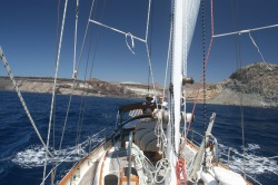
'Horizon' sailing away from Guadalupe Island, Mexico
April 7 – 29, 2010 Passage from Guadalupe Island, Mexico to Nuku Hiva, Marquesas, French Polynesia
Total Distance – 2,894.8 n.m.
Total Distance from San Diego Bay to Nuku Hiva – 3,178.8 n.m.
The howling winds had subsided and we could hear the Guadalupe Fur Seals bawling from the rocky shore as we weighed anchor and set sail. The first few nights of this voyage were bitter cold but got progressively warmer as we got further south. However, the entire passage will be best remembered for very rough seas and very fluky winds. Despite a forecast to the contrary, our first few days of this section of the passage were incredibly slow as a ridge of high pressure descended upon us, sucking our wind. The seas, however, remained rough and irregular due to a massive Low far to our north. It was very frustrating, clawing for every mile south, but we did manage to find Trade Wind conditions during Day 6. We reached squally conditions on Day 11 that kept us on our toes for the next five days before coming out of the “bottom” of the Inter-Tropical Convergence Zone (I.T.C.Z.) and an area of steady winds. We will remember April 24th as the day “Horizon” marked her fastest sailing in a 24-hour period … we covered 175.5 n.m. … in one day!
The following day, April 25, 2010 (Day 18 of our passage) was significant in that Steven Paravia crossed the Equator for the first time at 132º23.611 W – 0302 UTC – and is now able to declare himself a Shellback. We marked the occasion with a ceremony that included braiding his hair and feasting on Oreo cookies and ginger ale.
The remainder of the passage featured the ubiquitous 2-3 meter confused seas we’d had for the past weeks, along with steady, consistent trade winds and moonlit, starry nights. It was Steven who first announced Land Ho at 1520 UTC when the island of Ua Huka was sighted. Nuku Hiva came into view a short time later.
The jagged, vaulting peaks of the volcanic islands of the Marquesas are a welcome sight after weeks at sea and are generally the first stop for most sailors crossing the Pacific. Nuku Hiva (8 º56 S / 140 º09 W) is among the northern group of the islands and the village of Taiohae is the center of local government. It took us just a short time to learn how to walk on land again as we cleared customs and bought a few fresh provisions in town. Most of the anchorages are relatively exposed and rolling in the constant swells can be tiring. We investigated several different anchorages and found Anse Hakatea in Baie de Taioa (also known as “Daniel’s Bay”) to offer the best protection. An immense waterfall is located 7 km from shore along an often tortuous hike that includes fording a number of small streams, but we are here during the end of the dry season so the cascade was a mere trickle. (A short video of the rainforest hike is on our Video page!) The experience of hiking beneath a dense canopy of trees, hearing torrential rain yet feeling only a faint mist will be etched in our memory. Unfortunately, it took a number of weeks for the no-no bites to fade as well.
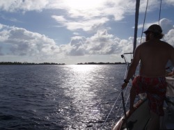
Steven on bow entering Manihi Lagoon
May 8-11, 2010 Manihi Atoll, Tuamotu Archipelago, French Polynesia
14'27 S / 146'02 W
Huge swells were rolling in as we left Daniel’s Bay which made for an intense beginning to our 3 ½ day voyage to Manihi Atoll in the Tuamotus. Massive waves were crashing against the rocks on our port side, pushing “Horizon” towards the vertical cliffs on our starboard, and we had to maintain a balance between going fast enough to power over the swells, but not so fast as to plough through them. The rough and confused sea conditions improved slightly once we passed the island of Ua-Pou (pronounced locally as “wah-pooh”) and the first couple of days of the trip were uneventful. The third day, however, brought torrential rain and steep, choppy seas that were particularly challenging because we were so close to the low-lying atolls. Squalls were all around us and, during one especially gusty event, sections of the leech line of our double-reefed main sail tore loose. We quickly doused the sail and finished the trip under headsail and staysail alone. Manihi, along with Ahe and Rangiroa, are the atolls most visited on the northern edge of the Tuamotu Archipelago. It was the fifth atoll “Horizon” would visit and the pass into the lagoon is by far the most challenging to enter. After standing off all night we were keen to get settled and entered during the ebb; the swirling water and overfalls reminiscent of similar narrow passes in Alaska and British Columbia. The difference, of course, is being the multitude of colorful fish visible beneath our bow as Marci and Steven watched for coral and fish traps. Joseph had his hands full at the helm, keeping our keel from getting sideways in the strong current but, before long, we were in the clear turquoise lagoon. Only one sailboat was anchored in the area near the village and her skipper, Sven, advised that it was fouled with coral and he would be moving later in the day. We continued to the eastern side of the lagoon and anchored near Tenukuparea Motu with three other sailboats. The calm, clear water was pure heaven after the cloudy, rolly anchorages of the Marquesas and we couldn’t wait to snorkel the nearby reefs. A deep tropical Low developed over the central Tuamotus bringing rain and unsettled conditions. We didn’t have any problems with fetch, but the shifting wind spun us around on our anchor and we (along with all of the other yachts) fouled on the rocky, coral bottom – despite being anchored in sand. It took Joseph less than 30 minutes to dive the anchor and clear the line; others were not so fortunate, needing to hire local professionals to break free.
.
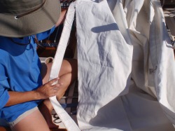
Marci inspecting damage to torn leech of main sail
But first we had some work to do. Given that our sails have 20,000 miles of hard sailing behind them it was not surprising that the leech area could separate and, once we got the sail down and inspected, we were pleased to see how limited the damage actually was. We dug out our Sailrite sewing machine and repaired the sail. The biggest challenge was doing the work on “Horizon’s” cabin top. We later took our headsail down and overstitched areas of the sun cover that were showing wear.
12
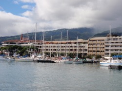
Busy quay in Papeete, Tahiti
May 22 - June 12, 2010 Papeete, Tahiti, French Polynesia
17'35 S / 149'36 W
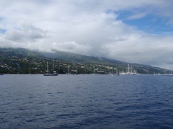
The absence of wind meant a longer sail to the island of Tahiti than we’d hoped but we had warm tropical days and starry skies so it wasn’t too bad. We timed our landfall for the morning; the pass into Papeete is very straightforward but the channel to Outumaouru must be done during the day. We got clearance from the airport to pass beneath the runway (both ends) and were shocked to see the forest of masts ahead. In the five years since our last visit, the marina has expanded several times its previous size and the dozens of mooring balls litter the once-free anchorage. Space was available beyond the marina and we found comfortable anchorage not far from one of the new dinghie landings. Steven was delighted to see the familiar Golden Arches of McDonalds after a several weeks fast-food “dry spell;” the scent of french fries wafted across the anchorage.
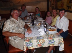
Joseph, Steven, Alan, Emily, Olivia, Ceri-Ann and Marci
We met up with the Dawson family; Alan, Ceri-Ann, Emily and Olivia of s/v “Stealaway” out of Cape Town, South Africa whom we’d met in Manihi and we went ashore to make a pilgrimage to Lou Pescadou’s – a steak and pizza restaurant esteemed by the locals. Dinner did not disappoint and we were saddened to learn that Mario, the colorful owner, had recently passed away but the baton was handed to the competent hands of his son and we wish them the best for continued success. If you’re in Papeete, ask for directions to Lou Pescadou’s – everyone knows where it is.
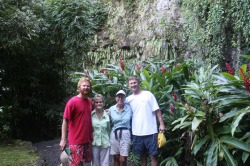
Steven, Charla, Marci and Jim
May 28, 2010
Steven’s “other parents,” Charla and Jim Palmer, arrived May 28th for a highly anticipated rendezvous and stay at the nearby Hotel Sofitel. We were thrilled to spend a few days catching up and sharing our cruising experience with them. Our circle-island drive of the Island of Tahiti was a highlight of their visit … along with hours lounging poolside at the Hotel Sofitel.
Steven’s “other parents,” Charla and Jim Palmer, arrived May 28th for a highly anticipated rendezvous and stay at the nearby Hotel Sofitel. We were thrilled to spend a few days catching up and sharing our cruising experience with them. Our circle-island drive of the Island of Tahiti was a highlight of their visit … along with hours lounging poolside at the Hotel Sofitel.
1..
Approaching Marina Taina
The expanded Marina Taina now has self-serve laundry facilities available so (at considerable expense) we could wash all of our cold-weather gear and put it in deep storage. We’ll be in the tropics for quite some time. We also located the proper facilities to discard our used oil so we were able to give “Horizon” a quick oil/filter change while we’re here. As far as maintenance goes, aside from a pesky tri-color light fixture that keeps wiggling loose and, of course, the sail repair, the trip has been remarkably trouble-free. This is due to Joseph’s efforts in inspecting and upgrading many of “Horizon’s” systems while in San Diego which gives us more time to spend snorkeling the nearby reefs instead of chasing down parts.
Steven on bow entering Opunohu Bay, Moorea
June 12-17, 2010 Opunohu Bay, Moorea, French Polynesia
17'29 S / 149'51 W
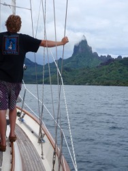
The anchorage filled up as members of this years’ Puddle Jump arrived and at last our long-awaited mail arrived and we could pull up the hook and cross the channel to the lovely island of Moorea. This was our third visit to Opunohu Bay (long considered our favorite anchorage in French Polynesia) and we managed to squeeze in amongst the boats already anchored there. The snorkeling was excellent and it would have been easy to linger but the Leeward Islands beckoned and it was time to go.
View from anchorage in Huahine
June 17-24, 2010 Baie de Avea, Huahine, Leeward Islands, French Polynesia
16'48 S / 150'59 W
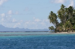
We had a “lumpy” passage from Moorea to Huahine – the large, rolly seas courtesy of a major weather system located hundreds of miles to our south. The visibility was terrible as we crept up to the narrow passage leading into the channel between the reef and the mountainous island; Steven and Marci stood at the bow in the pouring rain, peering through binoculars in search of the channel markers between the thundering waves breaking on the reef. We were less than ½ mile from the entrance when it finally came into view and we all breathed a sigh of relief. The channel down to Avea Bay is pretty straightforward and we were only the third boat to anchor. The weather during the next three days was the worst we’ve ever seen in French Polynesia with winds gusting up to 43 kts for hours at a time; we were confident in the set of our 55 lb. Delta anchor and it didn’t let us down. Finally, the clouds parted and we were able to go out and snorkel the coral gardens near the reef. (Feel free to visit the French Polynesia section of the photo gallery for annotated images of this area).
Peaks of Bora Bora from Raiatea/Tahaa
June 24-30, 2010
Various anchorages, Raiatea-Tahaa, Leeward Islands,
French Polynesia
16'31 S / 151'46 W
Our day sail from Huahine to Raiatea-Tahaa was the BEST sailing we’ve had since arriving in French Polynesia. We had a 12-15 kt steady breeze with flat sea conditions that allowed us to (finally) fly “Bob The Big Sail” (our 165% asymmetrical). We got some excellent video footage which is up on our Video page!
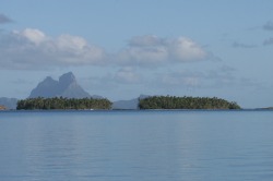
Raiatea-Tahaa has the distinction of being the only place on earth where two separate islands share one single fringing reef. We didn’t have much time to explore during our last visit so we made a point to check out as many new spots as we could. We found anchorages with views of the lush mountainsides and some with views of nearby Bora Bora. We needed to fill our propane tank while we were here; this created a fair bit of drama as the tank we installed just a couple of years ago is no longer compatible with any of the filling stations in Raiatea-Tahaa. We were lucky to find someone with a machine shop who could switch out the filling valve on our tank so we could get cooking fuel before heading off to Bora Bora.
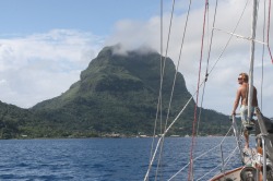
Steven on the bow entering Bora Bora lagoon
June 30 – July 7, 2010
Various anchorages, Bora Bora, Leeward Islands, French Polynesia
16'31S / 151'44 W
We had a “boisterous” passage from Raiatea-Tahaa to Bora Bora; the wind that whips between the two islands gave us a major push. The sudden cloudburst that occurred shortly before we reached Bora Bora washed much of the sea-spray off “Horizon” so she gleamed as we entered the narrow pass. We anchored near one of the many over-the-water bungalows that dot the lagoon; this one was nearly empty and we had the anchorage all to ourselves for several days before we set off to explore other parts of the lagoon. Many of the anchorages are specifically “day use” only (either because they are not well protected or have poor holding) but we were able to see more of the island than on our previous visit. We anchored near the iconic Bloody Mary’s restaurant, located on the southern end of the lagoon, and proprietor, Rick, kindly offered the use of one of their mooring balls for the remainder of our visit. Of course, we couldn’t miss the opportunity to celebrate Steven’s birthday here; how often do you get to have a gourmet seafood meal in a place with sand floors where bare feet are “required” footwear? Needless to say, their Bloody Mary drinks are excellent, as was the complimentary chocolate cake and vanilla ice cream that were presented Steven at the end of the meal. It ended our visit to French Polynesia on a high note and, once we’d updated our provisions and cleared out with the Gendarmes in Customs, it was time once again to hit the high seas.
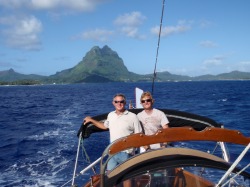
Joseph and Steven at the helm leaving Bora Bora
July 7 – 16, 2010 Passage from Bora Bora, French Polynesia to Pago Pago, American Samoa.
Total distance: 1373.1 n.m.
The weather in this section of the South Pacific has a dangerous history but we watched the conditions carefully and had a good forecast for our departure. We had originally planned to sail from Bora Bora to the Cook Island of Suwarrow but, after two days decided to change course and head straight for Pago Pago in American Samoa. It turned out to be a good decision. The weather in our area was, for the most part, not too bad; we had few squalls to contend with. But, to our north and south, high winds and violent weather prevailed, creating high, rough seas that played havoc with our sailing.
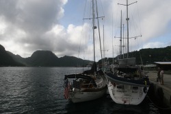
Horizon and Compass Rose at dock in Pago Pago
July 16, 2010 to August 2, 2010
Pago Pago, American Samoa
14◦16S / 170◦41 W
We arrived in Pago Pago (pronounced "Pahngo-Pahngo") American Samoa just as the sun was sinking behind the steep, lush peaks – which were invisible as we entered the harbor in steady showers – and we tied up at the Customs dock, happy to be still after so many days of constant motion. We had just enough time to change into dry clothes before being swept over to a nearby birthday celebration of a woman crewing on one of the other boats rafted onto the dock. Since clearing Customs, we’ve already investigated a Cost-U-Less warehouse store (for reprovisioning), located an Ace Hardware, and have taken care of a couple of minor boat jobs. We cannot overstate the difference in the attitude of the the people here, versus that found in French Polynesia. Folks have been down to the dock to visit and have all been very kind. When we were unable to locate a pay telephone, one of the cashiers at a local market offered the use of the store phone so Marci could call her Grandma (Virginia Gill) back in Michigan to wish her a happy 93rd birthday! The legendary Samoan hospitality was evident everywhere.
The weather during our stay was not wonderful. We've had rain (often torrential) nearly every day of our visit and this has seriously limited progress on our "to do" list. Internet access, however, has been outstanding (once we got past some of their technical problems) and we've been able to update our photo galleries and get three new videos uploaded. The McDonalds located near the dock provides the best Internet access and was (coincidently) a great place to spend those rainy days.
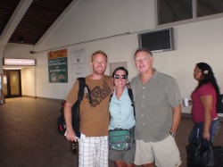
Tearful goodbye as Steven ends his 4 month voyage
We were up before dawn to make the 30-minute bus ride to the airport so Steven could catch his 8 a.m. flight to Apia, Western Samoa with connections to Auckland, New Zealand and on to Sydney, Australia. It didn’t sink in until his plane taxied up to the gate that his 4-month stay on board “Horizon” was coming to an end – it seems as though he only just arrived. We talked about the incredible sailing (and, some not-so-incredible), learning the constellations during the starry nights at sea, and how much we’ve all learned along the way. We are so glad he could take the time to share this leg of our voyage and he is missed.
Nasty fishing boats rafted on commercial dock
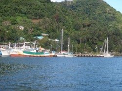
We wanted to be able to report that Pago Pago is a great place for cruisers to visit but, sadly, we cannot. The anchorage does not provide good holding, there are only 3 mooring buoys and yachts are required to raft up along a commercial fishing dock. The management responsibility of the fishing dock is being contested between two government agencies and, as a result, yachties are often given conflicting information regarding available services. Marine services are not available; there are no chandleries so all parts must be ordered and shipped in (often at great expense). We have also been locked behind a chain-link gate every evening at sunset, been subjected to the toxic fumes of foreign fishing vessels rafted 4-deep on the dock, and have been asked to pay $.50 per Gallon for fresh water that is piped to this commercial dock funded by the U.S. Government (U.S. taxpayers). When we checked out of the country, we were charged $50.00 to check in and $50.00 to check out by the U.S. Customs office, and we were charged $25.00 to check in and $25.00 to check out by the Harbormaster's office, in addition to the $12.50 fee we paid to the harbor to be tied to the dock, for a total of $162.50. They all required cash!
A more complete discussion about our stay in Pago Pago are in the Ship's Journal
Our stay in Pago Pago lasted 19 days and we were relieved to push away from the awful dock and set sail to Savusavu, Vanua Levu, Fiji.
A more complete discussion about our stay in Pago Pago are in the Ship's Journal
Our stay in Pago Pago lasted 19 days and we were relieved to push away from the awful dock and set sail to Savusavu, Vanua Levu, Fiji.
August 3 – 10, 2010
Passage from Pago Pago, American Samoa to
Savusavu, Vanua Levu, Fiji
Total Distance: 679.9 nm
5 days
Our passage from Pago Pago to the port of Savusavu, Fiji was one of the best passages we’ve had. The sailing was excellent; favorable seas and starry nights and we had only a few hours of squally conditions to contend with.
Horizon on mooring at Copra Shed Marina - Savusavu
August 10 - 17, 2010
Copra Shed Marina
Savusavu Bay, Vanua Levu, Fiji
16º46 S / 179º20 E
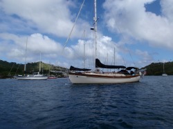
We arrived early August 10th (we crossed the International Date Line and jumped ahead a day) and took a mooring at the Copra Shed Marina, kindly arranged by our friends, Tom and Vicky Jackson of s/v “Sunstone.” We are thrilled that our paths should meet once again after all these years since both boats spent the winter at the marina in Sidney, British Columbia in 2002/2003. We can’t speak highly enough about the courtesy and professionalism of the folks at the Copra Shed Marina; from their assistance in locating the assigned mooring ball, to ferrying the officials to “Horizon” for clearing Customs and Immigration, to arranging our cruising permit for Fiji waters. It is a welcome change from our unfortunate experience in Pago Pago. We look forward to using this as our base as we cruise the waters surrounding the island of Vanua Levu in the coming weeks.
Horizon threading through the Fawn Harbour entrance
Fiji is a group of 332 islands and islets with hundreds of miles of reefs and coral bays to explore. The larger of the two volcanic islands is the southern island of Viti Levu, and the northern island of Vanua Levu. Savusavu is the only Port of Entry on the northern island of Vanua Levu and is a great launching point for cruising this area.
August 17, 2010
Fawn Harbour, Vanua Levu, Fiji
16º44S / 179º42E
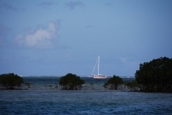
The entry to Fawn Harbour is a small gap between the reef that fringes the island but a small mangrove barrier island provided good protection for the evening.
August 17, 2010
Fawn Harbour, Vanua Levu, Fiji
16º44S / 179º42E
The entry to Fawn Harbour is a small gap between the reef that fringes the island but a small mangrove barrier island provided good protection for the evening.
123
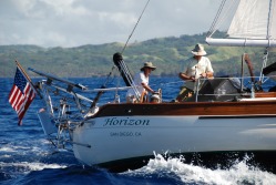
August 17-23, 2010 Cruising Vanua Levu, Fiji
We received our cruising permit and left our mooring early in the morning to sail northeasterly along the coast to our first destination, Fawn Harbour with our friends, Tom and Vicky Jackson of s/v “Sunstone.” The breeze was lovely and we had several opportunities to take still and video photography of their boat sailing alongside as we made our way up the coast. Check out the video we captured of this lovely 1965 mahogany-planked, Sparkman & Stephens designed classic yacht.
We received our cruising permit and left our mooring early in the morning to sail northeasterly along the coast to our first destination, Fawn Harbour with our friends, Tom and Vicky Jackson of s/v “Sunstone.” The breeze was lovely and we had several opportunities to take still and video photography of their boat sailing alongside as we made our way up the coast. Check out the video we captured of this lovely 1965 mahogany-planked, Sparkman & Stephens designed classic yacht.
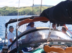
Vicky Jackson, Jack Fisher, Joseph and Tom Jackson
Viani Bay, Vanua Levu, Fiji
16º45S / 179º53E
The following morning we retraced our path back out into the Koro Sea and continued up the coast to Viani Bay. Viani Bay is located on the south side of the eastern tip of a small peninsula on Vanua Levu in the Somosomo Strait and is the home of the famous “Rainbow Reef.” The legendary underwater explorer, Jacques Cousteau, has visited this area numerous times. We paused before entering the Viani Pass to watch a juvenile Humpback Whale swim in the depths along the outside of the reef.
Once we reached the head of Viani Bay, we took a mooring kindly provided by Jack Fisher, a local entrepreneur who rowed out to visit us, once we’d gotten settled in. Marci and Vicky went ashore to visit his wife, Sophie, who gave us a tour of their gardens and school. Jack loves to share his local knowledge of Rainbow Reef and we arranged for him to “pilot” Horizon out to his special day anchorage out at the reef. Since the reef is submerged, his local knowledge was invaluable. Once in the water, he followed us in our dinghy, pointing out all of the special attractions of the area, including the Cabbage Patch, where a huge field of green cabbage coral grows near one of the passes. It is impossible to describe the staggering varieties of leather corals, finger corals, soft corals and various “leaf” corals. Vertical coral columns stood like small high-rises with shields, fans and finger corals protruding like “balconies” and each layer had its own residential school of brilliantly colored tropical fish ducking between the crevasses. The sunlight filtered through the warm water and the effect was dazzling. It was easy to lose track of time but before we knew it, it was time to take “Horizon” back to the protection of the anchorage and we bid Jack a fond farewell.
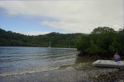
Vicky on dinghy at Naqaiqai Creek beach
August 21 - 23, 2010
Naqaiqai Creek Bay, Vanua Levu, Fiji
16º43S / 179º53E
Our journey from Viani Bay over to Naqaiqai Creek Bay was fortunately uneventful. As is always the case in the waters of Fiji, many of the reefs and shoals are imprecisely charted and a watchful eye must be maintained to be sure to keep Horizon clear of these dangers. We carefully entered the narrow opening into Naqaiqai Creek Bay (pronounced oong-guy-guy) and found a safe anchorage near the center of the bay with good holding for our anchor in the thick, soft mud.
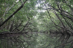
Mangrove canopy over Naqaiqai Creek swamp
The shores are lined with mangrove trees which are home to numerous land and seabirds whose calls filled the air. During low tide, Marci and Vicky went ashore to do some “fossicking” (a British term meaning ‘to beachcomb’) and found many interesting shells, bits of coral and some delicate starfish in the pools. During high tide, the four of us traveled up the Naqaiqai Creek into a primeval mangrove swamp, following the creek as far as we could. The tops of the trees grew together creating a canopy through which little of the afternoon light filtered. The men silently paddled the dinghy up the creek and it was as though time stood still.
UPDATED ANNOTATED PHOTOS ARE IN THE MELANESIA - FIJI GALLERY
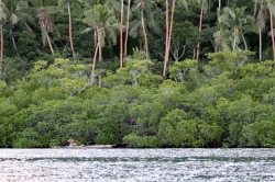
Fisherman on bamboo raft - Naqaiqai Creek
Fijian fishermen still using rafts of bamboo logs lashed together, poled alongside the mangrove shores, just as they have for generations.
We were up early to take advantage of the calm seas as we again retraced our patch out of the reefs along the shoreline, through Viani Pass and into the Koro Sea. The wind didn’t pick up until we were just an hour away from the Passage Reef into Savusavu Bay so we took advantage of the time spent motoring to fully charge the batteries in our cameras and computers. We arrived back at the Copra Shed Marina Mooring area and picked up a mooring nearer the entrance, which gives us (we think) a better view of Savusavu Bay.
We were up early to take advantage of the calm seas as we again retraced our patch out of the reefs along the shoreline, through Viani Pass and into the Koro Sea. The wind didn’t pick up until we were just an hour away from the Passage Reef into Savusavu Bay so we took advantage of the time spent motoring to fully charge the batteries in our cameras and computers. We arrived back at the Copra Shed Marina Mooring area and picked up a mooring nearer the entrance, which gives us (we think) a better view of Savusavu Bay.
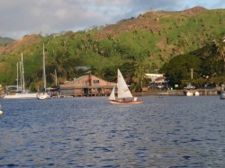
Day sailing near Copra Shed Marina
August 23 - 31, 2010
Copra Shed Marina, Savusavu, Vanua Levu, Fiji
16º46 S / 179º20 E
We have had a wonderful time in Savusavu; it’s the kind of place you can envision yourself falling into comfortably. While we were moored on a Copra Shed Marina mooring, there are also moorings available from Waitui Marina operated by Michael and Kendra (former American cruisers who’ve anchored here). Michael operates a company called “Bebi Electronics” where we purchased an excellent LED hanging anchor light. For more information check out our Links Page.
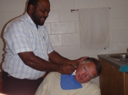
Dr. Ishaque fixing Joseph's ear
All of our snorkeling (and boat cleaning) caused Joseph’s right ear to develop a painful case of “swimmers’ ear,” and we were referred to the nearby Savusavu Medical Centre. Dr. Mohammed Ishaque cheerfully cleaned Joseph’s ear and gave him some eardrops to correct the inflammation. He also provided a cortico-steroid and anti-inflammatories for Joseph’s knee (old sports injury) with great results. Dr. Ishaque shared his story of being born and raised in a very poor nearby province by illiterate parents, yet he and his two brothers are educated professionals (his brothers are both dentists). He was recently recruited from his management position at the hospital by an American to operate this clinic to provide services on this end of town. He and his staff are competent, warm and professional.
,
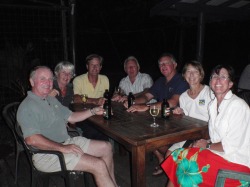
Duncan, Ria, Tom, Ian, Joseph, Vicky & Marci
We’ve also had plenty of time to socialize with our friends and fellow OCC members, Tom and Vicky Jackson of s/v “Sunstone,” who helped explain the finer points of rugby during the broadcast of a match between South Africa and Australia. Being die-hard All Black fans (Team New Zealand) the most important thing to remember is that we are to root for anyone playing AGAINST Australia (who are apparently arch-rivals of New Zealand). We’ve enjoyed several “meetings” of other OCC members during our stay here as well (Duncan and Ria of s/v “Sea Topaz” and Ed and Ellen of s/v “Entr' Acte”) over Fiji Bitters, wine and some of the Best Pizza we found outside the States. We look forward to reading of their adventures as we sadly sail off in different directions.
123
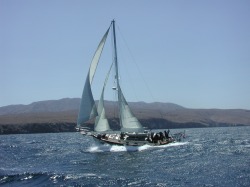
September 1-2, 2010
“Horizon” is currently on her way from Savusavu on the island of Vanua Levu, through the Bligh Waters to the Yasawa Group of Islands located west of the island of Vanua Levu. We expect to cruise these remote islands for 7-10 days before arriving in Malololailai in the Mamanuca Group and the resort of Musket Cove, where we hope to find Internet again. We’ll be staying at Musket Cove during “Race Week” and then going on to Lautoka for last minute provisioning and clearing Customs for our voyage to Vanuatu.
“Horizon” is currently on her way from Savusavu on the island of Vanua Levu, through the Bligh Waters to the Yasawa Group of Islands located west of the island of Vanua Levu. We expect to cruise these remote islands for 7-10 days before arriving in Malololailai in the Mamanuca Group and the resort of Musket Cove, where we hope to find Internet again. We’ll be staying at Musket Cove during “Race Week” and then going on to Lautoka for last minute provisioning and clearing Customs for our voyage to Vanuatu.
1
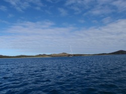
Horizon alone at Namataya Bay
September 2-9, 2010
Yasawa Island Group, Fiji
We left Savusavu under a heavy gray sky early on September 1st and motored briefly in the Koro Sea before heading through Nasonisoni Pass and into Wainunu Bay, protected by the Namena Barrier Reef. The clouds burst off and on all morning but the wind improved once we got into Wainunu Bay and we sailed through the Nambouwala Point Passage into the area between Vanua Levu and Viti Levu known as the Bligh Water. Timing the remainder of the trip was critical because we needed good light to leave the Bligh Water approaching Yasawa Island, so we had to sail slowly all night. Of course, the wind picked up and we were going too fast so, rather than let “Horizon” kick up her heels a little, we took in all but the staysail and plodded along in the darkness. We arrived at Yasawa Island shortly after sunrise and transited Tamasua Passage with good light. Namataya Bay anchorage was lovely but the reef extended from shore out several hundred yards and it wasn’t possible to get ashore, nor was there a village to visit, but the snorkeling was excellent with a huge variety of corals surrounded by schools of brilliant little fish.
123
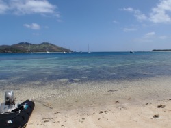
The 'Comet' on the beach at Nanuya Resort
After a couple of days, in increasingly gusty wind, we motored 13 miles down the Yasawa Group to a well-protected anchorage nestled behind Nanuyalailai Island, where the movie “The Blue Lagoon” was filmed so many years ago. Fiji has done a nice job of enforcing a low-impact development philosophy for the resorts out here and the folks at the Nanuya Island Resort kindly welcome visiting yachts to come ashore for the “coldest beer in Fiji.”
123
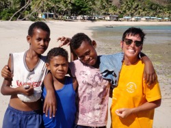
Marci with Rosi, Drua and Lena at Yalombi Bay
We spent a couple of days at Nanuyalailai waiting for the weather to moderate before setting off to sail down to Yalombi Bay on the south end of Waya Island. The sailing was lovely and we arrived at the empty anchorage in time to present the Kava root to “Seru,” the village elder who greeted us when we first came ashore. He took us to his home where we sat on a fine woven mat and he conducted the “sevu-sevu” ceremony; recognizing us as guests of the village under the protection of the elders. We were then welcome to go where we wanted and stay as long as we wished. We were out “fossicking” one afternoon when we were greeted by Rosie (age 14), Lena (age 12) and Drua (age 10), cousins who were one their way home from collecting “kirikiri” from the nearby reef at low tide. The shells are boiled and the meat seasoned with coconut milk, citrus and onion (South Pacific escargot) and Drua reckoned she could eat “at least 10.” The girls attend the nearby school where they study English, math and social sciences, but the girls were more keen to discuss Miley Cyrus and Lady Gaga (whom they hear on “FM96.”)
1
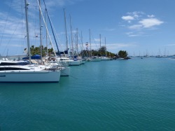
Musket Cove Marina
September 9-15, 2010
Musket Cove Yacht Club, Malololailai Island, Fiji
17º46.21S / 177º11.40E
We left Waya Island and the Yasawa Group to make our way through the reef-strewn area known as the Mamanuca Group of small islands before arriving at Malololailai Island, home of the legendary Musket Cove Yacht Club. Our arrival coincided with the 27th Annual Fiji Regatta week, although the term “regatta” is somewhat loosely applied. Cruisers from all over the world (OK, mostly annual visitors from New Zealand) make this part of their itinerary in order to partake of the lighthearted merriment. From here we will go to Lautoka, on the larger island of Viti Levu, where we’ll top off our fuel and propane tanks, pick up a few fresh provisions and then get our exit clearance from Customs. We hope this will take only a day or two and will then be off to Vanuatu. We’re not sure if we’ll find a good Internet connection while we’re in Lautoka so, if we don’t we should be in Vanuatu by September 25th or so. We’ll update the website whenever we can.
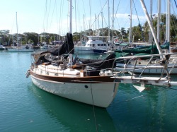
Horizon in the Vuda Vortex!
September 15-20, 2010
Vuda Point Marina, Lautoka, Viti Levu, Fiji
While the merriment and frivolity (not to mention Aussies and Kiwis parading around in drag as Island Princess contestants) was good fun, we need to keep moving so we left the Musket Cove Yacht Club mooring and motored 15 miles in calm conditions to the Vuda (pronounced “voonda”) Point Marina near the city of Lautoka on the island of Viti Levu. They have a rather complicated system of mooring which manages to squeeze the maximum number of boats into a very tight, circular area but we got parked without drama. You really get to know your neighbors – but we were fortunate that Fiona and Ray (Aussies) on s/v “Willow” were parked next to us – they’re a lovely couple. The marina facilities were excellent and we topped off our fuel and propane tanks in anticipation of the next leg of our adventure. Clearing in and out of Customs was, once again, very straightforward and we were cleared to leave.
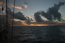
Sunset during passage from Fiji to Port Vila
September 21-25, 2010
Passage to Port Vila, Efate Island, Vanuatu
568 n.m. – 4 days
We could have easily stayed longer in Fiji; this is truly a cruiser's dream with secure anchorages and excellent snorkeling … but we have to keep going. We successfully extracted ourselves from the “Vuda Vortex” (so named both because of its circular design and the fact that, once you’re in here, it’s difficult to leave) early in the morning of September 21st and out into deep water, and pointed “Horizon” due west. It was a straight downwind passage with the seas generally coming astern, so it was a rolly slog – but with puffy trade wind clouds and full moon nights – and it was a short trip. On September 24th we reached 18º35 S – the furthest distance south of the Equator we will go in 2010. We are now working our way north, towards the Equator for the onset of the Southern Hemisphere summer and its cyclone season.
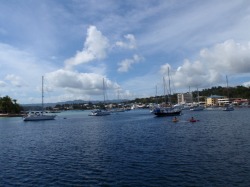
Mooring field at Port Vila, Vanuatu
September 26 – 30, 2010
Yachting World Mooring #8, Port Vila, Efate Island, Vanuatu
17º44 S / 168º18 E
We arrived in the clean, bustling harbor of Port Vila on Efate Island in Vanuatu on a Saturday afternoon so we had to remain on the boat until Monday morning in order to clear in with Customs and Immigration. We were delighted to see other boats we’d met along the way. The officials were all courteous, helpful and professional. We are now ready to explore Port Vila and prepare to visit as many of these lovely islands as possible within our allotted 30-day cruising permit.
Vanuatu consists of over 80 large and small islands covering approximately 5,700 square miles. Captain Cook named these mountainous islands "New Hebrides" during his visit in 1774 (ostensibly because they reminded him of Scotland at the time), but indiginous peoples have called these islands home for several thousand years. Formerly under "shared" French and British government rule, Vanuatu has been independent since July, 1980. Port Vila on Efate Island is the capitol city and it's a vibrant waterfront community.
..
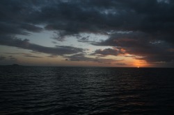
Sunset leaving Efate Island
We had an easy voyage from Port Vila to Havannah Harbour, up on the north coast of Efate Island, sailing the entire distance in excellent conditions. The next leg of our trip was too far to complete in one day and still arrive with enough daylight to anchor safely, so we planned to leave Havannah just before sunset the following day and sail overnight. We were relaxing on the boat at 1:54 local time (0254 UTC) when an Earthquake vibrated through “Horizon’s” hull. It was an unforgettable experience.
Our passage from Havannah was unremarkable, except for having too much wind which gave us the challenge of keeping our speed down in sloppy seas. We arrived at Epi at sunrise and napped briefly before going ashore and paying respects to the village elder.
Our passage from Havannah was unremarkable, except for having too much wind which gave us the challenge of keeping our speed down in sloppy seas. We arrived at Epi at sunrise and napped briefly before going ashore and paying respects to the village elder.
..
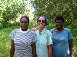
Olivia, Marci and Lucy at Epi Island
October 2-4, 2010
Reveliu Bay, Epi Island, Vanuatu
16 º43S / 168 º08 E
We met “Lucy,” a lovely, well-spoken woman who kindly gave us a tour of her village and some history of the area. The following day a copra barge came in to be loaded, and Lucy introduced us to one of the copra buyers.
Reveliu Bay, Epi Island, Vanuatu
16 º43S / 168 º08 E
We met “Lucy,” a lovely, well-spoken woman who kindly gave us a tour of her village and some history of the area. The following day a copra barge came in to be loaded, and Lucy introduced us to one of the copra buyers.
..
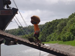
Loading copra onto the barge
Copra is dried coconut husks which are the basic ingredient for cocoa butter, coconut oil, etc. and one of the main exports of Epi, and its production is backbreaking labor. The coconut trees must be planted and maintained, the coconuts are harvested and broken, the husks peeled, dried (often by smoking) and stored in burlap bags. These bags weigh between 60-75 kilos and it takes three men to lift each bag onto a mans shoulders, who then carries them up the ramp onto the barge. The men are paid roughly $280.00 per ton of copra as it is loaded onto the barge. The elders of Epi Island would like to build a refinery on the island; the refined copra fetches $600.00 per ton, thereby minimizing the shipping costs. It was very educational to learn how this industry generates income for the community. Check out the photos of this process in the Vanuatu gallery!
...
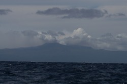
Ambrym Island volcano venting steam and ash
Our sail from Epi Island to Malekula Island took us alongside Ambrym Island, which is currently in the midst of a volcanic eruption. From as far as 20 miles away plumes of smoke and ash billowed high into the sky and, once we were between the islands, we saw flames from lava coming down a slope amid the smoke. It was awe inspiring to see raw volcanic activity in action.
12.
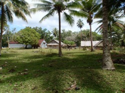
Housing compound and coconut trees at Port Sandwich
October 5-7, 2010
Port Sandwich, Malekula Island, Vanuatu
16 º26S / 167 º47E
We saw an ad for an “Island Nights Festival” taking place at Port Sandwich in Lamap Village while we were in Port Vila and the anchorage is one of the best in the islands so we wanted to get there a day or so ahead of time – in case it was crowded. Unfortunately, it’s also late in the winter season here so most cruisers are already to the south, and we were the only boat in the anchorage. Ordinarily this wouldn’t be a problem but the festival includes a pig roast and we didn’t want to be solely responsible for the slaughter of a pig, so the festival was postponed until more boats arrived. We met the organizers of the festival; Stephanie, a Peace Corps volunteer from the D.C. area, and Tito, Christian and Amae who are all members of the Malekula Tourism Board under her tutelage. She is providing training on English, computer and business skills and the men are enthusiastic about their future plans. We spent a lovely couple of days in peace and quiet but one of the downsides of this anchorage is the fact that there used to be an abattoir nearby that dumped steer carcasses into the bay, which created a veritable shark buffet. Two fatal attacks occurred several years ago and we didn’t want to risk a third so there was no swimming while we were here and we didn’t feel like waiting indefinitely for more boats to arrive, so we said goodbye.
..
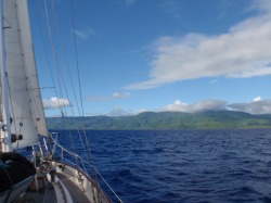
Landfall at Pentacost Island
October 8, 2010
Melsisi (Waterfall) Bay, Pentacost Island
15 º47 S / 168 º09E
We had an excellent day of sailing leaving Malekula Island but the ash falling from the volcano on Ambrym Island was blowing right over our intended anchorage, so we continued on to Pentacost Island. Waterfall Bay is lovely but the anchorage is exposed and we didn’t get any rest because the incoming swells and reverberations from the beach created a miserable “belly roll” that rocked “Horizon” from side-to-side, all night long. We didn’t even feel like staying long enough to go ashore and see the waterfall.
1
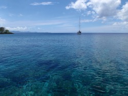
Horizon anchored at Asanvari Bay, Maewo Island
October 9-15, 2010
Asanvari Bay, Maewo Island
15 º22S / 168 º07E
It was a short, sloppy trip up the coast of Pentacost Island and across a 5-mile channel to Asanvari Bay, located on the southern end of one of the least habited islands in the group. The anchorage was mirror calm and the scenery spectacular; a waterfall cascades down the eastern slope on one side of the bay and a rocky knoll over a coral reef extends northward on the other, and the Asanvari Yacht club sits nestled in between.
1
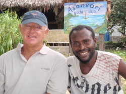
Joseph and Nixon at Asanvari Yacht Club
We were worn out from lack of sleep at our last anchorage but immediately went ashore to pay our respects to Chief Nelson. He’s off island so his son, Nixon, accepted our regards on his father’s behalf and then spent the next two hours guiding us on a tour of his village and the “sister” village located on the southern coast of Maewo. There are four villages in this area which contain nearly 500 people. Nixon shared the colorful history of the island, including rampant cannibalism which finally ended in 1814 with the arrival of Protestant missionaries.
1
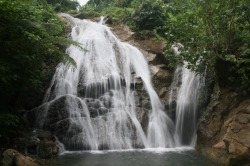
Waterfall at Asanvari Bay
We were welcome to go anywhere we wished so we did a video tour of the island the following day (Check out our Vanuatu Video!) We were invited to visit the school (funded by the Vanuatu government) which provides grades 1-6 for nearly 100 students and saw, once again, that children are the same everywhere. Once the children overcame their initial shyness, we fielded questions about our travels and America. We took a group photograph of the students at the end of the day and presented a printed copy to Charity, the Headmaster, as well as a photo of the five faculty members, as a small thank-you for allowing us a visit. But this is springtime in the Southern Hemisphere topics which means more frequent unsettled, squally weather, two days of which kept us cooped up inside the boat, and a break in the weather signaled our time to move on.
..
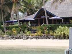
Aore Island Resort near Luganville
October 15-20, 2010
Aore Island Resort, Luganville, Espiritu Santo
15º32S / 167º10E
The distance between Maewo Island and Espiritu Santo is roughly 60 miles, which is normally too far to travel during daylight hours, so some creativity is needed to accomplish our goal. In this case, we set an alarm (!) for 3:00 a.m. and were off our anchor by 3:20 a.m., and followed our G.P.S. path out of the anchorage into safe water. There is plenty of sea-room between the islands so we navigated safely between them until sunrise – the important part is arriving at your destination with enough light to navigate through potential obstacles and anchor safely. In this case, a favorable current added considerably to our speed and we reached the Segond Channel off Luganville and the Aore Island Resort shortly after 2:00 p.m. The staff here welcomes yachties with a dinghy dock, use of their swimming pool, Internet access and, of course, cold beers, and we used this as our base before heading north to the Banks Island Group, and then off to the Solomon Islands.
123
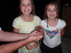
Darcy and Lana with 'Pinky' the hermit crab
Luganville does not have a lot to offer cruisers in the way of a good anchorage, interesting activities or even particularly decent stores. It is, however, a Port of Entry and, as such, is a mandatory stop before heading to the Banks Islands. We stayed at the anchorage in front of the Aore Island Resort; the location was sheltered, has a good dinghie dock and excellent restaurant. We met several nice people while we were there, including a group of women from San Diego – of all places – as well as an Australian couple, John and Robin, with their daughters, Darcy and Lana. The girls were fascinated by hermit crabs and their ongoing quest found a giant (named “Pinky”) who made his home in the fragments of a pink plastic drinking cup. Sadly, Australian quarantine restrictions ruled out taking him home as a pet, so the girls put him back on the beach where they found him.
..
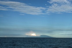
Ambae volcano venting steam and ash
October 21-23, 2010
Losolava, Gaua, Vanuatu
14º12S / 167º34E
We got all our boat work done and cleared Customs onward to the Banks, and left Aore Island Resort mid-afternoon for an overnight sail up to the island of Santa Maria (locally known as Gaua). The clear weather gave us an excellent view of the steam and ash venting from nearby Ambae Island (not to be confused with Ambrym, which is also in an active phase). We arrived at the anchorage in Losolava Bay early the following morning, just ahead of the unsettled weather that brought a deluge of rain over the next two days. We were surprised by the large number of people we saw in the village when we went ashore to pay our respects to the chief, and we later learned that the western side of the island had been evacuated by the Red Cross due to a dangerous volcanic eruption on Gaua! The Ring of Fire is very busy this month.
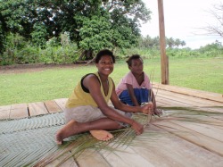
Lucy and Caroline weaving at school
October 23 - 27, 2010
Port Pattison, Vanua Lavu
13º52’S / 167º33E
We had a boisterous trip to the island of Vanua Lavu (locally known as Sola) where we planned a short stay before our cruising permit expired and we would sail to the Solomons. The anchorage at Sola Village was exposed and rolly so we motored to the anchorage at the north end of the bay near an Anglican school whose emphasis is vocational training (carpentry, masonry, etc). Marci got to chat with the women while they were weaving floor mats while Joseph discussed management concerns with Arthur, the Headmaster. The only downside to this anchorage was the reported residence of over a dozen saltwater crocodiles – animals known for being grouchy. Once again, Joseph’s time in the water was restricted.
123
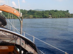
Entrance to anchorage at Twin Waterfall Bay
October 27 - November 1, 2010
Sasara Twin Waterfall Bay, Vanua Lava
13º49S / 167º22 E
We planned to set sail October 27th for the Solomons, but the weather gods had other ideas, or they just needed the wind somewhere else, so we were granted permission to stay as long as was necessary. The Customs agent, Harold, suggested we might like Sasara Twin Waterfall Bay, on the western coast of the island, so we took him up on his suggestion and left Sola Bay. Dolphins leapt out of the water as we sailed around Mousoumes Point and saw the twin cascades that give this spectacular anchorage its name, and the dolphins followed us into the bay, clearly visible in the turquoise water. Words cannot begin to describe this pristine, remote bay where vertical, vine-covered rocky cliffs, dense jungle and the ragged coastline all blend perfectly together with the bird calls and waves crashing on shore. The charcoal gray volcanic sand gave the water a vivid cobalt blue color and “Horizon” appeared to float suspended over the dark sea bed. Schools of squid and various small fish used the boat as protection from larger predators – not always successfully.
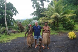
Joseph with Chief Kerely, Elizabeth and Dudley
We arranged to visit Chief Kerely and his wife, Elizabeth, early the morning following our arrival, but we were not prepared for the ceremony he arranged. His three daughters and 2 year-old son, Dudley, greeted us at the Long House, sang a “welcome” song, and Kerely explained the customary traditional ways his people greet visitors. A hibiscus flower was placed behind our left ear to remind us that, according to Kastom, our lives here on earth are like the life of the hibiscus; it is born in the morning (when the flower opens), it turns its face to the sun all day, and closes and dies at the end of the day – as we must all do. Kastom dictates the important value each day we are given and the hibiscus symbolizes that. He also prepared a small meal because, in Kastom tradition, the food provided by the earth must be shared, and we were granted permission to explore the waterfall area and do laundry or swim in the fresh water as we wished. As it turned out, afternoon and overnight showers caused the falls to become a dangerous torrent, so swimming was out of the question. We had an opportunity to help his village by creating and printing a couple dozen Family Tree forms so Chief Kerely can establish a written record of the relationships of this community recognized by its matrilineal line. We also created a Certificate of Matrimony that was designed to recognize the event both in a church, as well as by the Tribe. He also let us know that he would appreciate having a photo of himself and his wife in traditional garb – if we wouldn’t mind doing so. Mind? We were flattered and the photos in the gallery speak for themselves. While this family may live in what westerners consider to be primitive conditions, their society is rich in tradition and their lives diffused with ritual and symbolism. It was a privilege to take the photos and a small thing to print copies for them. Other villagers paddled out in their dugout canoes to trade fresh produce for items often difficult for them to obtain (Sola, the nearest village, is a half-day walk through the jungle – each way). We traded fishing line and hooks, matches, D-batteries (for flashlights because none of the homes have electricity), soap, pencils and T-shirts for pineapples, grapefruit, green onions and cherry tomatoes. It is important to note that, with exception of the children, to whom the pencils were given for school, these people came to trade – not ask for handouts. What we would have liked to have been able to offer in trade were gently used children’s T-shirts, ladies T-shirts and tank tops, and small hand tools such as hammers, wood chisels, carpenters squares, etc., but we were unaware of the specific need. Chief Kerely hopes to revive some of the old wood carving traditions so a set of carving tools would be most welcome – such things are not available in Vanuatu outside of Port Vila. We would have loved to stay in this tranquil spot much longer; Chief Kerely offered to take us on walking tours of the village garden and nearby caves, but we had already stayed long beyond our permitted time so when a possible weather window opened up, we had to bid farewell to these fine people and move on.
Title. Click here to e
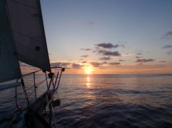
Sunset and calm seas
Passage from Vanuatu to Honiara Harbor, Guadalcanal Island, Solomon Islands - 6 days
When you stop to consider it, it’s pretty cool to think that people still harness the wind to sail a 16-ton boat across vast expanses of water in the 21st century. The key word being “wind.” The data we had when we left Sasara Twin Waterfall Bay was that we’d have light wind for the first 18-24 hours or so, and then we’d have the prevailing 15 knots out of the east (a nearly perfect forecast). What we got, however, were light and variable winds (meaning coming from any which way) and, for nearly 36 hours, we had no wind with which to fill our sails. This is a huge disadvantage to sailboats and we really didn’t feel like motoring the entire distance … so we found a compromise. When the wind blew at all, we used “Bob,” the big light air sail – often only covering 3 miles an hour – if there was no wind at night (which was often the case) we’d just stop and sleep. The Coral Sea between Vanuatu and the Solomons are far from major shipping lanes – we didn’t see another vessel the entire passage – and we decided not to spend fuel unnecessarily. The breeze finally freshened early on our 4th day and we were able to knock out a major portion of the distance –but then it died again and the final 150 miles were agonizingly slow. We arrived at the capitol city of Honiara late on Saturday afternoon, finally, glad to be north of 10ºS and (theoretically) out of danger of cyclones during the Southern Hemisphere summer.
When you stop to consider it, it’s pretty cool to think that people still harness the wind to sail a 16-ton boat across vast expanses of water in the 21st century. The key word being “wind.” The data we had when we left Sasara Twin Waterfall Bay was that we’d have light wind for the first 18-24 hours or so, and then we’d have the prevailing 15 knots out of the east (a nearly perfect forecast). What we got, however, were light and variable winds (meaning coming from any which way) and, for nearly 36 hours, we had no wind with which to fill our sails. This is a huge disadvantage to sailboats and we really didn’t feel like motoring the entire distance … so we found a compromise. When the wind blew at all, we used “Bob,” the big light air sail – often only covering 3 miles an hour – if there was no wind at night (which was often the case) we’d just stop and sleep. The Coral Sea between Vanuatu and the Solomons are far from major shipping lanes – we didn’t see another vessel the entire passage – and we decided not to spend fuel unnecessarily. The breeze finally freshened early on our 4th day and we were able to knock out a major portion of the distance –but then it died again and the final 150 miles were agonizingly slow. We arrived at the capitol city of Honiara late on Saturday afternoon, finally, glad to be north of 10ºS and (theoretically) out of danger of cyclones during the Southern Hemisphere summer.
Tit
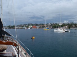
Busy harbor at Honiara, Guadalcanal
November 7-18, 2010
Honiara Harbor, Guadalcanal Island
9º25S / 159º57E
The Solomon Islands consist of over 900 tropical islands of which nearly 350 are currently inhabited. People originally arrived here over 4,000 years ago, but the first European contact came in 1568 when the Spanish explorer, Alvaro de Medaña , named the islands “Isle de Solomon” after discovering gold believed to have belonged to King Solomon. Honiara became the capital after World War II with the construction of government buildings, wharves and Henderson Airfield, which is currently the country’s only international airport. The harbor is not great from a cruiser’s standpoint; it’s open, exposed, rolly and positioned next to a busy container ship wharf. What we’ve seen of the city, so far, is a busy, energetic, dusty town with a lot of activity. Scores of small colorful “longboats” (so called because of their long, narrow shape which is quite useful for transporting goods and people between the islands) whiz by “Horizon” each day, going about their business. We didn’t spend as much time as we’d like exploring Guadalcanal before moving north to Gizo because the anchorage was just too uncomfortable. Once we received our mail and the weather was right, we set out for Gizo Harbor in the New Georgia group of islands in the Western Province for a little more remote cruising.
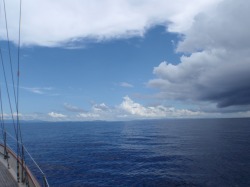
Storm clouds gathering on horizon.
November 18-20, 2010
Passage to Gizo Harbor, Gizo Island
277.2 n.m.
This is the transition season in the South Pacific and the Solomon Islands are known for having periods of calm weather with little or variable wind. We knew this when we left the rough and rolly anchorage at Honiara but the weather forecast was favorable for at least 10 kts of breeze to propel “Horizon” slowly towards her destination, so we left Honiara. We had several hours of good conditions before a massive thunderstorm developed, completely taking our wind and forcing us to motor several hours in some of the most intense lightning either of us can recall ever witnessing. It was not fun. Sunrise brought very light breeze; just enough to keep the sails full for several hours before it went completely calm. We had a choice: we could either fire up the engine and motor towards our destination, or wait and make this a casual passage and sail when we could and rest when the breeze failed, and get there when we got there. We chose the latter.
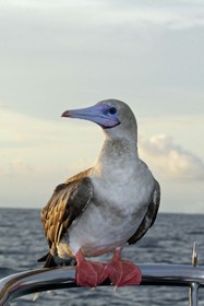
It was occasionally frustrating, when a thunderstorm would brew up nearby and pull the wind, causing us to bob along on the glassy seas. But there were rewards as well, such as when the Red Footed Booby landed on our bow pulpit, allowed Marci to approach very closely for some photos, and then spent the night on “Horizon” before flying off shortly after sunrise the following morning. We were pleased to provide some respite for the lovely bird and watched him soar off in search of breakfast, just as we enjoyed our morning brew.
Red Footed Booby
Sula sula
These are the smallest of the Booby group but their wing spans are up to 5 ft in width. They are pantropical, gregarious birds known for approaching ships and perching on rigging.
Red Footed Booby
Sula sula
These are the smallest of the Booby group but their wing spans are up to 5 ft in width. They are pantropical, gregarious birds known for approaching ships and perching on rigging.
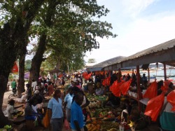
Crowded public market in Gizo
November 21-30, 2010
Gizo Harbor, Gizo Island, 8º05S / 156º50 E
New Georgia Group, Solomon Islands
Gizo is the capital of the Western Province of the New Georgia group of islands. It is a dusty frontier town, but the people here seem quite industrious and friendly. It has a small Chinatown, several markets and the renowned Gizo Hotel, along with the PT-109 Yacht Club. Gizo is also notable because several miles to the north is Blackett Strait, made famous by President John F. Kennedy who, while serving in the U.S. Navy during WWII, his PT-109 was rammed (and sunk) by a Japanese ship. He and his crew swam to Plum Pudding Island (recently renamed “Kennedy Island”) where they were rescued. This is also the one of the locations of the famed Coast Watchers; they consisted of Allied Forces and Solomon Islanders who kept watch on the movement of the Japanese ships. The sweltering conditions here during summer in the jungle must have been almost unbearable.
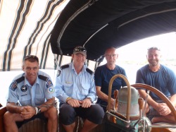
Graham Adams, Steve Knight, Peter 'Wiff' Howarth, Mark Greenhill
We invited several members of the RAMSI Force (Regional Assistance Mission Solomon Islands) on board “Horizon." They are serving as security and development advisors to the government of the Solomon Islands and are from New Zealand and Australia. They were gracious and open to us and advised us as visitors regarding safety issues in the Solomon Islands, which made our traveling easier. We hope the lovely people of the Solomon Islands appreciate the hard work and sacrifice of the men and women of RAMSI. The RAMSI force consists of individuals from 15 different countries in the South Pacific (Australia, Cook Islands, Federated States of Micronesia, Fiji, Gilbert Islands [Kiribati], Marshall Islands, Nauru, New Zealand, Niue, Palau, Papua New Guinea, Samoa, Tonga, Tuvalu, and Vanuatu) who are stationed here anywhere from 6-24 months. For more information on the important work they do, please see their website at www.ramsi.org.
.
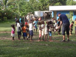
Steve Knight teaching Gizo children Aussie football
Steve invited us to join him during a weekly “Aus Rules” football practice he leads every Tuesday afternoon at the nearby school. The children here do not have access to organized sports as they do in other countries and eagerly look forward to this each week. Steve donates his time and energy in an attempt to give the children a chance to participate in team sports, something they rarely have an opportunity to do. These children behaved as children do everywhere; racing to catch the ball, competing with their age-mates and “smack” talking amongst each other as kids often do. We wish Steve the best for the remainder of his tour as he looks forward to returning to his wife and two children back in Australia.
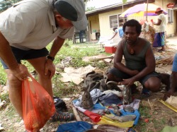
Joseph and Selwyn discussing carving
The Western Province is known for its wood and stone carvers to be among the best in the South Pacific. Their stone and wood carving traditions have not been lost, as in other island groups, and we had several artisans approach the boat when we arrived. We met Selwyn at the market from whom we purchased a nousa-nousa (a figurehead used by the headhunters on their war canoes) and a carving known as The Spirit of Solomon (a figure known to rise out of the depths of the sea when a man or woman committed adultery). These carvings are made from stones taken from a specific river on Ranonga Island which are known for the unique grain, and they are inlaid with fragments of nautilus shells.
Our visit to Gizo has been interesting to say the least. People gather here from remote villages throughout the western province and their ethnic backgrounds range from the very-dark people from Choisul Island to those with Polynesian features whose parents and grandparents came from Kiribati (Gilbert) Islands as part of a relocation program. There have been ethnic tensions in the past and the Government is working hard to encourage unity among the different groups. Time will tell if they are able to move forward after the RAMSI force leaves in the coming years.
We met our RAMSI friends at the Gizo Hotel for a Friday night “croc and chips” feast but, sadly, no crocs were available – so we had kingfish and chips instead. Saltwater crocodiles are fairly common to this area and, once they get to be a certain size, are dangerous for the children who spend hours playing in the shallows, so the locals look to the RAMSI force to “remove” the crocs, which are then eaten. During supper, a local band performed; the dreadlocked lead singer is known as “Rambo” due to his penchant for wearing US Army clothes and stopping in the middle of songs to perform his “other” job as bouncer for the nightclub. Rambo warbled a unique interpretation of John Denver’s “Country Road,” while the rhythm was provided by an instrument created by shaking a plastic water bottle partially filled with rice. Once their set was complete, several young women performed Polynesian style dances before the DJ arrived and the place really took off.
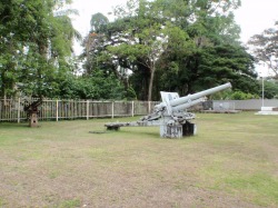
Old World War II guns in Honiara
A more poignant moment for us was sailing across Iron Bottom Sound north of Guadalcanal where hundreds of huge Japanese ships lie on the bottom, entombing thousands of Japanese sailors. The loss of humanity is staggering regardless of nationality. Throughout these islands you can find gun batteries, reinforcements, artillery, machinery, and other artifacts of the war. It goes without saying, thousands of Americans lost their lives here, along with Allied Forces and their sacrifice must never be forgotten.
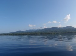
Steamy jungle on Kolombangara Island
December 1 – 17, 2010 Passage from Gizo Island, Solomon Islands to Malakal Harbor, Koror, Republic of Palau, Federated States of Micronesia
This passage began differently than most because we were not able to obtain the proper Customs outward clearance from the Solomon Islands – but we left anyway. We had spent the past eight days unsuccessfully trying to reach the officials who, despite being assigned to Gizo as a Port of Entry, were spending most of their time in Noro and elsewhere. We felt this was a reasonable effort and our weather window would not wait for the officials to show up for work. We had a leisurely sail up the New Georgia Sound between the dense jungle of Kolombangara Island and Choisul and approached the Bougainville Strait shortly after sunrise.
This passage began differently than most because we were not able to obtain the proper Customs outward clearance from the Solomon Islands – but we left anyway. We had spent the past eight days unsuccessfully trying to reach the officials who, despite being assigned to Gizo as a Port of Entry, were spending most of their time in Noro and elsewhere. We felt this was a reasonable effort and our weather window would not wait for the officials to show up for work. We had a leisurely sail up the New Georgia Sound between the dense jungle of Kolombangara Island and Choisul and approached the Bougainville Strait shortly after sunrise.
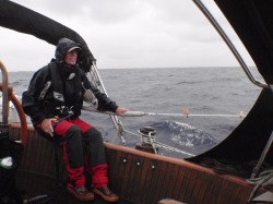
Marci infull foulies during squall
We found excellent sailing conditions as we sailed essentially due north to clear a couple of small island groups east of Papua New Guinea before our course curved west around Lyra Reef and northwest towards Palau. We hoped to find the prevailing northeast trade winds in this area of the North Pacific but we did not. We had light easterly and southeasterly winds … right on our stern … making for a dead downwind run. This is “Horizon’s” worst point of sail and she struggled to cover even 100 miles a day in these conditions. Then there came the thunderstorms which brought hours of flashing lightning and a deluge of rain – but little wind.
.
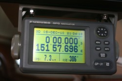
Crossing the Equator back into the North Pacific
The passage began with such great days; we covered 170.1 n.m. on the day we crossed the Equator, our second highest daily mileage, and we really thought we’d planned this one well. Then we lost our wind altogether and it was a struggle to cover even 100 miles a day for several days in a row. It was torture, looking up at several thousand dollars worth of canvas sails flagging in the feeble breeze; the swells tipping the mast from side to side, the swinging boom backfilling the sails causing the boat to violently shudder. And here is where we found the counter-current. The last 600 miles of the passage were an absolute slog. We were 225 miles from the entrance to Koror; no wind and not enough fuel to motor the entire distance in a 1.5 knot foul current (for each 5.5 kts of speed through the water, we only traveled 4.0 kts over the bottom). So we made the decision to drop the mainsail and stop the boat for a few hours at sunset. We had a nice supper, took a cool, refreshing shower and watched “Galaxy Quest” on DVD on the laptop in the cockpit under the stars. It felt good to laugh away some of the tension accumulated during the past few days. During our stop, we actually drifted 12 miles away from Palau, but the rest we got more than made up for it.
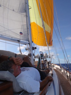
Joseph relaxing while Bob pulls the boat in light wind
Sunrise on Day 15 brought the long-awaited light northeasterlies and we were able to use “Bob,” our Big Sail to chip away at the remaining miles. The foul current gradually diminished so we began to get a greater return for our efforts. But the decent conditions lasted only a short time and the next 36 hours were awful. Finally, with only 99 miles to the entrance to Malakal Harbor, we fired up the motor and “drove” straight to our destination. The entrance to Malakal Harbor was not as straightforward as it appears on the charts; the channel markers are ambiguous and not where they are supposed to be and traveling the short distance to the safe anchorage seemed to take forever. But we successfully completed our voyage after 16 ½ days, traveling 1941.4 n.m. and are safely in Palau. We were waived over to the commercial wharf shortly after our first cup of coffee the following morning and met with officials from Transportation, Quarantine, Customs, Immigration and the Port (all of whom had fees and paperwork) who were friendly and professional.
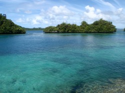
Clear water and reef in Koror
December 18, 2010 to February 1, 2011 Malakal Hamlet (Koror),
Republic of Palau, Federated States of Micronesia
7º19.75N / 134º27.55 E
We were then free to move “Horizon” over to the anchorage on the other side of Malakal Island (which is connected to the hamlet of Koror on Babelthuap Island by a bridge). There are nearly 20 yachts anchored at the location referred to as “Sam’s” anchorage as the dinghy dock is attached to Sam’s Dive Shop. The folks at Sam’s have made this a cruiser’s haven with the Bottom Time Bar and Grill, a fuel dock, showers and an Internet café. Laundry facilities are a short distance away, as are groceries and hardware stores. We will be here probably until the latter part of January. After being in the Solomon Islands; we were immediately struck by the cleanliness of Palau with streets free of filth and litter. Small rock islands surround the larger islands with dense jungle foliage that grows to the waterline. Seabirds such as White-Tailed Tropicbirds, Black-naped Terns and Black Noddies dive into the clean, clear water in the anchorage and fruit bats soar overhead in the evenings. We have thoroughly enjoyed learning more about these lovely islands.
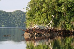
Sunken fishing boat at Malakal anchorage
The Republic of Palau is composed of over 300 islands/islets divided into 16 states. Three islands (Arakabesang, Malakal and Koror) are connected by bridges and causeways to make up Koror State, within which 90% of the nearly 25,000 inhabitants reside. Babeldoab (Babelthaup) Island covers 128 square miles, which comprises over 70% of the area of the country. Much of the island is undeveloped; the coastal mangrove stands and dense jungle forests inland inhibit development. Palau played a significant role in World War II with pitched battles at Peleliu, Anguar, Kongauru and Ngesebus Islands, and wreck dives are hugely popular attractions for divers from around the world. Other tourist activities include snorkeling, kayaking and visiting ancient archaeological and World War II sites.
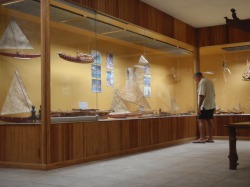
Joseph at the maritime exhibit at the Etpison Museum
Archaeological evidence indicates human settlements dating back to 1,000 BC. and the original inhabitants are thought to have come from Malaysia and Indonesia. There is no oral or written history that addresses where the ancestors came from, other than "out of the sea." Palauans have always had a close connection with the ocean. The first western contact was made by Ferdinand Magellan in 1521. We visited the Etpison Museum in Koror and were impressed with the collection of artifacts from throughout Micronesia, as well as models of the traditional watercraft the islanders used to travel between the islands.
...
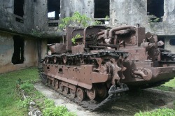
Old Japanese tank at former headquarters
On January 13th we took a guided land tour with our friend (and taxi driver extraordinaire) John Kloulubak. Our tour began with a stop at the ruins of the old headquarters building used by the Japanese during World War II, located in Airai state. The bullet holes in the buildings and rusty equipment are lasting reminders of the devastation of war. Our tour continued up to Palau’s capitol building which incorporates design elements from the U.S. Capitol building in Washington with traditional motifs and the Palauan people are understandably proud of this building. We drove along the Compact Road past rolling hills of dense, virgin forests containing diverse stands of old-growth trees and wide open savannahs which receive less rainfall. Annotated photos are in our updated Palau Gallery!
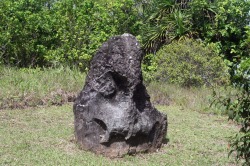
Not sure if this face is supposed to be scary or not
We made our way up to Ngarchelong (pronounced nnarelong) State where a collection of stone heads stand near monoliths. What makes these heads so remarkable is that the stone on which they are carved did not come from Babeldoab Island. There is no oral record of why the stones are here, nor are there any stories about their purpose. Some of the expressions on the faces attempt to be frightening, while others appear to be silly. John suggests perhaps they may be guardians of some sort of burial ground, but further archaeological studies would be necessary. We drove past agricultural terraces in Ngchesar State that were used between 491 AD and 1150 AD. before being abandoned.
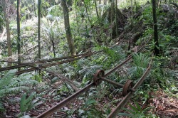
Rails left behind from Japanese bauxite mining operation
Our final stop was at the Ngardmau Falls where we hiked down a partially-improved path through thick clay mud beneath the rainforest canopy to the river. It was worth the effort when we reached our destination and let the pulsating falls massage our tired shoulders and wallow in the clear fresh pool. Unfortunately, we still had to make the return trip back UP the hill and we didn’t have the refreshing waterfall to look forward to! We made the best of it by stopping by the Bottom Time Bar at Sam’s for an icy cold beverage and one of their legendary burgers. It was an excellent day.
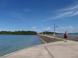
Joseph walking along a causeway in Koror
Koror is an easy place in which to become comfortable and was perfect for purposes of resting and restoring our energy for the next leg of our adventure. Our days blended together with a simple ritual: up early with a cup of coffee before it got too hot, tidy up the cabin and head ashore for a walk into town. Stop at the Rock Island Café for a bottle of water and an hour on the Internet, then on finish our walk to one of the several excellent grocery stores to pick up a back-pack full of provisions. As our conditioning improved, we were then able to walk the 1 ½ mile or so trip back to Sam’s in the sweltering heat and get a cold iced tea from the Bottom Time Bar and socialize with other cruisers. If fresh fish was on the menu (as it often was) we’d have some amazing fish for an early dinner, spend a little more time on the Internet, and head back to the boat before sunset. The mosquitoes are quite fierce here; dengue fever is an occasional problem but (thankfully) no malaria, so we like to be home in time to get a mossie coil burning to keep the winged devils out of the cabin. After our “cooling-off” shower, we spend the remainder of the evenings downstairs with fans blowing directly on us, listening to Australia Public Radio while we read or write. It inevitably starts to rain between 1-3am, so one of us has to get up and close the hatches and ports, but by then, it’s cooled off to the point where the ventilation isn’t absolutely necessary. A few hours later, we awake and start the process all over again.
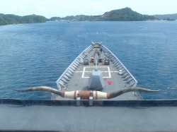
View from the Bridge of the USS Cowpens
The U.S.S. Cowpens CG-63 pulled into Malakal Harbor and anchored near the mooring field where “Horizon” and other cruisers are resting. During her brief stay, Joseph struck up a conversation with Lt. DeVere Crooks (with San Diego connections) who kindly invited us out for a tour of his ship! The U.S.S. Cowpens is a Guided Missile Cruiser named for the Battle at Cowpens, South Carolina on January 17, 1781 and was built by the Bath Iron Works in Bath, Maine. She was commissioned March 9, 1991 and is the second ship to bear the name “Cowpens.” The first ship participated in the Pacific Theater in WWII. Lt. Crooks proudly gave us an extended tour of the ship and we learned a great deal about how she provides support to her battle group.