Where Have We Been in 2011?
t.
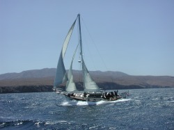
Horizon charging along the Santa Cruz coastline
February 2, 2011
“Horizon” is currently on her way from Koror, Palau, Micronesia to the Philippine Islands. While this passage should only take 4 or 5 days, it may be several additional days before we have access to an Internet cafe. From the Philippines, we will continue our westward push onward to the province of Sabah, on the northeast corner of Malaysian Borneo.
“Horizon” is currently on her way from Koror, Palau, Micronesia to the Philippine Islands. While this passage should only take 4 or 5 days, it may be several additional days before we have access to an Internet cafe. From the Philippines, we will continue our westward push onward to the province of Sabah, on the northeast corner of Malaysian Borneo.
..
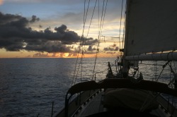
Calm sailing (no wind) at sunset
February 2 – 9, 2011
Passage from Koror, Palau to Port Surigao, Mindinao Island, Philippines
668 n.m. – 7 days, 7 hours
The weather in the Philippine Sea had been fraught with high winds and big seas for the past couple of weeks so we waited for the North Pacific winter storms to abate before setting off. What we did not expect, nor was it forecast, that the wind would stop completely, but that’s exactly what happened. We said goodbye to our new friends at Sam’s, cleared Customs and Immigration and set off expecting a steady 10-12 knots of wind for the next several days. What we got, instead, was a sporadic 3-7 knots – often barely enough to keep the sails full. The daily weather forecast continued to tell us we should have wind … but we did not. So we struggled to sail as much as we could until we got close enough to motor the final distance into Port Surigao. It was very frustrating. We had the engine running over 36 hours – by far the longest time we’ve ever motored in this boat. Fortunately, Joseph’s efforts to keep the hull and propeller clean meant we got good mileage and made good speed; small consolation when we wanted to sail.
123
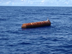
Scary FAD floating far off shore
There was another issue that will make this passage stand out among the rest. They are called F.A.D.’s: Fish Attraction Devices, and they are located as far as 300 miles offshore. These objects are often built from 55-gallon drums welded together and, apparently, small fish like to congregate in the shadow of these devices, which are then eaten by larger fish, which attract fish large enough to be commercially viable to fishermen. Some of them were lit; many were not. Needless to say, hitting one with our boat would have been a serious disappointment, so we had to be particularly vigilant as we neared Mindinao. As the sun rose after a night of enumerable fish boats and lit FAD’s, we approached Whale Rock a mile off the coast of Mindinao, where we altered our course to the north to transit the Hinatuan Pass to Port Surigao. It is important to time the trip through this passage to coincide with the flood tide, as going against the tide would have been nearly impossible due to the vast amount of water that comes and goes twice a day.
.
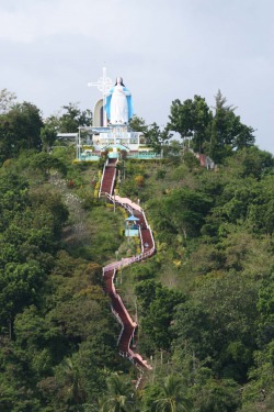
Stairs leading up to Mother Mary Shrine - Maasin
February 9, 10, and 11, 2011
Leyte and Cebu Islands, Philippines
We reached Port Surigao (Lat: 9º 47.07N / Lon: 125º 30.23E) late in the afternoon and as soon as we anchored, were immediately descended upon by people in outrigger kayaks wishing to sell us pearl or coral jewelry. The kayaks that visited us at sunrise the following morning were simply hungry, so we gave them some canned goods as we prepared to depart. Since there is still no wind, we motored over to Maasin anchorage on Leyte Island. As we motored between these lovely islands, we passed some of the most unusual fishing kayaks we’ve ever encountered. Check out the photos in the Philippines Gallery. Our anchorage in Maasin
(Lat: 10º07N / Lon: 124º50 E) was interesting as well as we were located at the base of the massive Shrine of Our Lady of the Assumption and Precious Blood of Christ (locally referred to as the Mother Mary Shrine). It was not simply the sheer size of the monument that attracted our attention (although it is quite enormous), but the fact that massive loudspeakers broadcast “Hail Mary’s” and the Lord’s Prayer continuously throughout the day – and night. The same few messages were broadcast over, and over … and then it was time to pull up anchor and motor to Port Carmen on Cebu Island. Sadly, despite our efforts early in the day to use “Bob the Big Sail,” we ended up motoring all but 2 miles of the 60 mile journey to Port Carmen, which we will use as a base for most of our stay in the Philippines. Our anchorage at Lat: 10º34.976 N / Lon: 124º01.678 E will be as far north of the Equator as we will get – until we round the Cape of Good Hope and reach the Atlantic in the months to come. From here on, we’ll be heading southwest.
Ti1232
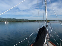
View of calm anchorage from Horizon's bow
February 12 – 18, 2011
Port Carmen, Cebu Island, Philippines
10º34.976 N /124º01.678 E
We had initially resisted the idea of visiting the Philippines because of reports of dangerous political issues, particularly in the Mindinao area, but waited until arriving in Palau to make our decision. We expected we could get more accurate information from people who regularly visit this archipelago, and we were not disappointed. In fact, we got such excellent reports, it was difficult to narrow our choices, based on the limited time we had. Cebu City is the second largest city in the Philippines and the oldest city established by the Spaniards in 1565.
.
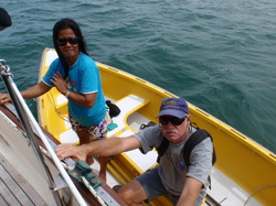
Naneth and Claus Nilssen of s/v 'Papillion'
The anchorage at Port Carmen was recommended by our friends, Claus and Naneth of s/v “Papillion III,” as being a good, out-of-the way alternative to the Big City atmosphere of Cebu City. “Horizon” is very safely anchored in thick mud behind mangroves, nestled among floating huts over fish traps, so we are comfortable leaving her when we go into town. The trip into town, however, is another story! First we hail a “tricycle,” which is a motorcycle with a customized carriage attached, which takes us to the nearest city of Dinao. We then have a choice of riding in a special van that goes directly to the SM Mall (a massive 4-storey mega-mall containing everything a person could want/need) or catching one of the many open-air busses going into town. The ride into town is a harrowing experience; vehicles sometimes crowd 2 to 3 to a lane, speed limits are non-existent, and crashes are commonplace. The opulence of the SM Mall stands in stark contrast to the corrugated shantytown perched upon the river across the six-lane highway from the mall.
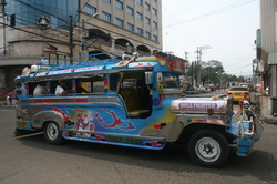
Colorful mass transit Jeepney - Cebu City
With trepidation, we traveled to the Philippines, making landfall on Mindinao Island’s Port Surigao on the north coast. There is some political unrest in the south and in the Sulu Archipelago, but none was apparent in northern Mindinao. What we found were a people and a culture that are as colorful and different as the Jeepneys that people ride for 7 pesos each way. The country is growing and dynamic with the biggest modern mall that would rival that found in any country in the world, along with crystal clear water and remote anchorages. There were the poorest fishermen in shanty-towns with Spanish colonial villages and high-rise condos, and everything in between. After all, it is Southeast Asia.
.
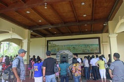
Joseph amid the tourists at Magellan
February 18 – March 7, 2011
Cebu Yacht Club, Lapulapu City, Mactan Island, Philippines
10º17.76N /123º58.57E
It’s time to embrace the hustle and activity of the Big City so we pulled our anchor out of the thick, sticky mud and began working our way back towards the Equator by motoring 17 miles down the coast of Cebu Island to the Cebu Yacht Club, which is actually in the city of Lapulapu, on Mactan Island. This location is legendary as it is here that Ferdinand Magellan met his demise at the hands of Chief Lapulapu and his warriors. We just finished reading the fascinating biography of Magellan by Lawrence Bergreen entitled, “Over the Edge of the World: Magellan’s Terrifying Voyage Around the World,” so it was interesting to visit the location firsthand. What is also interesting is the fact that Chief Lapulapu is considered a Philippine National Hero and an annual celebration takes place every year re-enacting the battle in which Magellan died. We highly recommend the book if you are interested in the history surrounding the early Age of Discovery.
.
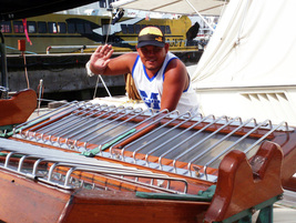
Boatman - Bernard Auditor
Every year “Horizon” gets some cosmetic attention: we update her varnish, polish the stainless, and make sure the hull and cabin top are waxed and shiny. We had initially planned to do this work in Palau, but the heat, humidity and daily rain showers made it impossible. We really got lucky when we were introduced to Bernard Auditor, a young boatman who is responsible for caring for a powerboat in the Cebu Yacht Club. Bernard contracted to help us with “Horizon’s” facelift and, within a few short days, our girl looks better than ever.
More photos in About the Yacht; Keeping Her Afloat
More photos in About the Yacht; Keeping Her Afloat
.
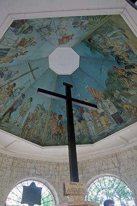
Magellan's Cross
Bernard also kindly offered to show us some of the cultural attractions of Cebu City and his presence added a great deal to the experience. Our tour began with a visit to the Basilica and Convent of Santo Nino; the original structure was built in 1565 and the existing structure built in 1737, and it is clearly a source of pride and comfort to the predominately Catholic population.
Adjacent to the Basilica is a small chapel which holds Magellan’s Cross. The actual cross, which is reputed to have been planted by Ferdinand Magellan when he arrived in 1521, is encased in a tindalo wood shell, to prevent devotees from chipping away at the monument. The Magellan’s Cross is a symbol of Christianity in the Philippines. Local women sell votive candles to pilgrims, who lay the unlit candles at the feet of the cross, pay their respects and then leave. The women then collect the candles and re-sell them to the next wave of people as they enter the chapel.
From the Basilica, we walked a short distance to Plaza del Independencia which is at the site of the Fortress of San Pedro, the original Spanish fortress built in 1565. Bernard pointed out the statue of Miguel Lopez de Legazpi with one hand extended, the other holding a scroll of parchment. Bernard explained that Sr. Legazpi is credited with bringing education to the Philippine people and is held in very high regard. While much of the plaza is under renovation, we still marveled at the thick stone walls, canon and architecture that must have made quite an impression on the indigenous Filipinos living here at that time. Complete photos in our updated Philippine gallery!
.
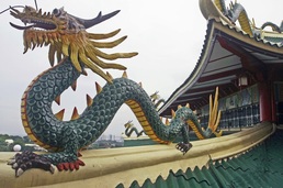
Rooftop of Daoist Temple overlooking Cebu City
Our final stop took us up through the opulent Beverly Hills neighborhood to the Daoist Temple of the Philippines perched on the hillside overlooking Cebu City. It’s a lovely structure; colorful and elegant and rich in traditional Buddhist icons. Daoism places heavy emphasis on meditation and reflection, so photography inside the shrine is strictly forbidden. The hapless security guard had a heck of a time trying to maintain order among a group of young tourists as they giggled their way through the various photo-ops.
123
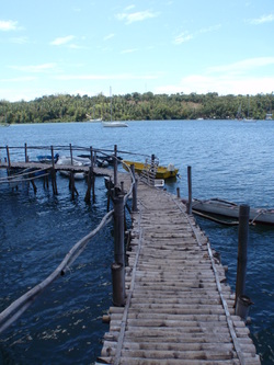
Bamboo dock at Pt. Bonbonon, Negros Island
March 7 – 14, 2011
Port Bonbonon, Negros Island, Philippines
9º03.41N / 123º07.56 E
We pulled away from the Cebu Yacht Club shortly after 8am and motored between Cebu Island and Mactan Island in mirror-calm conditions, dreading the prospect of having to motor the entire distance to our intended anchorage at the south end of Negros Island. But, as luck would have it, the breeze filled in nicely after a couple of hours and we had a lovely overnight passage; our arrival at the narrow, shallow entrance to Port Bonbonon was perfectly timed for an hour past sun-up. The anchorage is well protected and our stay here gave Joseph a chance to recover from a lingering head cold.
123
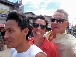
James, Marci & Joseph on habal-habal
We weren’t entirely idle during our stay here; we took a habal-habal (also known as a 125cc motor scooter) into the nearby village of Saitan. James, our habal-habal driver, insisted his ride was capable of carrying all three of us – and we were dubious – until we noted one such scooter carrying six people! The motor vehicles in the Philippines are an experience of themselves. We also visited the city of Dumaguette, which required a habal-habal ride up to the main highway, where we caught a van into town, and a bus back.
hhh123
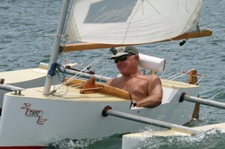
Joseph toughing it out on a Marpol trimaran
Joseph also was “coerced” into spending a few hours sailing around the anchorage in a Bruce Marpol-designed trimaran built by Bruce, a former cruiser who made this place his home back in 1994. Bruce had put the finishing touches on a two-man tri that he’d fashioned out of the original Marpol design and suggested he’d like some photos to send to Mr. Marpol. So, while the boys played in the tri’s, Marci played photographer, trying to set up shots of the two tri’s, while “Horizon” swung in the stiff breeze. A good time was had by all. We met a couple of boats whom we’ve crossed paths with earlier this year who plan to spend a considerable amount of time here, as well as a couple of folks who have been here 10 years or more. We can see how it could be easy to put down roots; the anchorage is secure, the environment is very safe, the people are lovely and Negros is a rich, diverse island with incredible scenery.
.
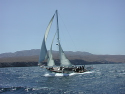
March 14 – 18, 2011
Passage from Negros Island, Philippines to Kota Kinabalu, Malaysian Borneo 588.8 n.m. – 4 Days
We’ve been carefully watching the weather in the Sulu Sea and the conditions appeared to be about perfect for a short passage from Negros to Borneo. We said goodbye to our new friends and motored out of Port Bonbonon shortly after sunrise. Imagine our surprise when we got past the mbankas (local fishing craft) into deeper water and were met with Westerly winds … on the nose! This was not in the forecast … the winds were set to come from the East/Northeast! What a disappointment. But, rather than turn back, we decided to continue on and hope for an improvement – and we’re very glad we did. After motoring a little over 10 hours, the breeze filled in, gradually at first, and then in full force, and we had plenty of wind to keep the sails full in the building seas. The chop occasionally got obnoxious (as opposed to dangerous) but “Horizon” held her own and made the most of the challenging conditions. We sailed through the Balabac Strait and all the way down the northeast coast of Malaysian Borneo to within 30 miles of our destination, before the steep, rugged mountains of Borneo blocked the wind and we were forced to start the engine. We reached the Sutera Harbour Marina (a 5-Star resort) and were quickly checked in and advised on clearing customs. We can't wait to explore Borneo!
..
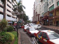
Bustling downtown Kota Kinabalu
March 18 – 28, 2011
Sutera Yacht Harbour
Kota Kinabalu, Sabah Province, Malaysian Borneo
5º58.01 N / 116º03.41 E
At 74,000 square kilometers, Borneo is the third largest island in the world after Greenland and New Guinea. Evidence of human settlement dates back 40,000 years, with regular migrations from mainland Asia dating back 4,000 years. The island was a key stop for Chinese and Indian traders, and has played a pivotal role in commerce throughout the region. Borneo boasts a wide cultural mix of indigenous Malays, Indian and Chinese, as well as European influences. Borneo is an island divided by three countries; two provinces of Malaysia (Sabah and Sarawak), the Sultanate of Brunei, and Indonesian Kalimantan. While it is predominately Islamic, religious freedom is constitutionally guaranteed in Malaysia and Christian churches and various Chinese temples exist amongst the Mosques throughout the region. Kota Kinabalu is clean, well managed and very friendly. As Westerners, we feel very safe walking throughout the streets and alleys of this Islamic country. This could well be a blueprint for other Muslim countries who wish to encourage visitors who hold differing viewpoints. We are struck by the size of the city of Kota Kinabalu, and how westernized it is with popular shops including Starbucks, Kentucky Fried Chicken, and Pizza Hut among the local haunts. The island of Borneo is rich in natural resources with an incredibly long growing season and much of the northern end of the Sabah province is developed with terraces of fruits and vegetables which are shipped to markets throughout Malaysia. Numerous oil wells dot the coastline and a thriving palm oil industry has lead to massive palm tree plantations supplanting the old-growth jungle vegetation in much of the country.
..
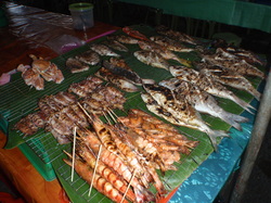
Tempting array of barbequed seafood at Night Market
Rather than bring us back to the Marina, we asked our driver to drop us off near Kota Kinabalu’s waterfront, home of the colorful Central Market. The Market was highly praised by the authors of the Lonely Planet Guides and rightly so. Stall after stall of fresh produce, seafood and dried goods are available – and at a good price – and the Night Market features local cuisine at its finest. On our first visit, we had fried soba noodles from one stall, barbequed corn from another, an amazing barbequed red snapper from a third, and so on. It was a feast for the senses, as well as the palate, and we’ve been back several times, particularly for the noodles. This is where the locals dine (one young man claims he eats supper at “our” noodle stand every night after his shift at a local Quicksilver boutique), and tourists are eagerly accommodated. One barbeque stall features various parts of the chicken; in Australia, it’s called the “Parson’s Nose,” while here it is referred to as the “buttocks,” as well as wing portions and the heart. Given the predominately Muslim population, it is not surprising there are no pork offerings here. Check out our updated photos in the Borneo Gallery!
Of course, no stop would be complete without spending some quality time working on the boat, and this is no exception. We noticed a tear in our headsail during our voyage from the Philippines; in fact, we sailed the entire distance without the headsail because we didn’t want to risk blowing the sail completely, so fixing it was foremost on our agenda. And, as usual, the set screws on the foils on our furling system had come just loose enough that the sail would not slide down without Joseph going up the mast to “help,” so a 15 minute task took nearly an hour. We discovered several additional problem areas which needed immediate attention so, what we anticipated would take a morning to resolve, ended up taking nearly 4 days. But the sail is fixed, the foils are correct (again) and “Horizon” is ready to sail down the coast.
Of course, no stop would be complete without spending some quality time working on the boat, and this is no exception. We noticed a tear in our headsail during our voyage from the Philippines; in fact, we sailed the entire distance without the headsail because we didn’t want to risk blowing the sail completely, so fixing it was foremost on our agenda. And, as usual, the set screws on the foils on our furling system had come just loose enough that the sail would not slide down without Joseph going up the mast to “help,” so a 15 minute task took nearly an hour. We discovered several additional problem areas which needed immediate attention so, what we anticipated would take a morning to resolve, ended up taking nearly 4 days. But the sail is fixed, the foils are correct (again) and “Horizon” is ready to sail down the coast.
.
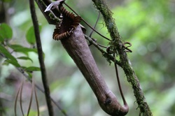
Giant pitcher plant
There is so much to see and our season is running short, so we’ll need to pace ourselves carefully to allow time to visit each distinct area of Malaysia and Borneo. For our Sabah province visit, we chose a tour of Mt. Kinabalu which left early from the nearby hotel for a 2-hour drive up a winding mountain road through dense jungle rainforests dotted with cultivated fields. Our destination was a botanical tour at the base of the 4,095 meter granite peaks where we walked among orchids, pitcher plants and huge rhododendrons. Clouds obscured the peaks for most of the day, but provided welcome protection from the scorching tropical sun.
.1
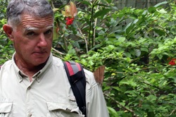
Joseph with massive moth resting on his shoulder
Our tour continued along the winding road to the nearby Poring Hot Springs (poring being an indigenous word for “bamboo.”) We walked along a 41 meter high treetop canopy over the forest floor, serenaded by the whir of cicadas, punctuated by tropical birdsong, and the shrieks of the odd tourist as the swinging canopy walkway caught them unawares. But rather than soak in the rather crowded baths, we decided to visit the Butterfly Farm, a small enclosure dedicated to the conservation and preservation of the thousands of moth and butterfly species found in Borneo. This was a highlight of our day as butterflies ranging from the size of a quarter, to that of small birds, flitted about our heads, occasionally landing on our shoulders!
1.
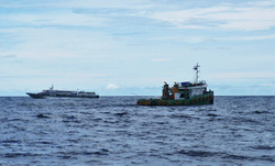
Fast ferry and working tug off Borneo coast
March 29, 2011
Trip to Pulau (island) Tiga
5º42.87N / 115º38.78E 32.1 n.m.
The Sutera Harbour Marina is sandwiched between two 5-star resorts and the combination of luxury amenities and the Night Barbeque downtown made this a difficult place to leave. But there is much more to see and the forecast looked good for sailing down the coast. Our first destination was just over 30 miles away so we had plenty of time to sail in the light morning breeze. Along the coast, you’ll find navigational hazards to avoid with names like Hanin Reef, Scout Patches, Tanmen Reef, Blunt Rock and Brunei Patches, and the South China Sea is much shallower than the vast depths we are accustomed to in the Pacific Islands. It is not unusual, along this stretch of coastline, to be sailing four miles offshore, in 45 feet of water, and it can be disconcerting, so close attention to the charts is required. Rivers winding through the dense jungles empty into the Sea, creating alluvial deltas and murky water as you approach the coast. The breeze filled in as the day progressed and “Horizon” finally got to enjoy some good reaching across the flat South China Sea. Pulau Tiga has the distinction of being the location for the first Survivor reality show filmed in 2001 and is promoted by the local tourism industry as “Survivor Island.” We sailed into the empty anchorage near the resort pier and put the hook down as ominous afternoon thunderclouds built up against the Borneo hills. The resulting lightning was too far away to be of concern, this time.
1.
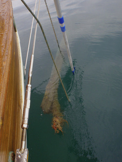
Using a boat hook to release the log on our anchor
March 30, 2011
Trip to Pulau Labuan
5º16.33N / 115º14.94 E 39.9 n.m.
Joseph initially thought our anchor must have collected a great deal of mud overnight because, when that happens, it behaves differently as it is being pulled up by the windlass, as it did this morning. But, curiously, there wasn’t any mud on the chain so he was not overly surprised to see the seven-foot log come up along with our 55 pound anchor! Fortunately, he had rigged an anchor float with trip line last night, so getting the log off the anchor was a relatively simple matter. We had hoped for another excellent day of sailing but, sadly, it was not the case. Apparently this coast is known for having little wind and today was no exception, so we ended up motoring the entire distance along with the myriad of other vessels that ply this coastline. We were on our toes as we navigated among tugs towing barges, fishing boats of all sizes, commercial ferries and those moving oil rig personnel to and from the platforms that dot this section of coastline. The anchorage outside of Victoria City, the main town on Pulau Labuan, is crowded with oil tankers, oil rig rescue vessels, and cargo vessels from around the world, and we were happy to find a vacancy at the Public Marina located near the center of town.
1.
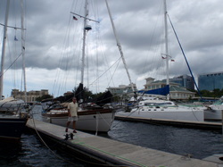
Joseph and Horizon at Labuan Public Marina
March 30 – April 7, 2011
Labuan Public Marina
5º16.33N / 115º14.94 E
The Public Marina is a much more “utilitarian” marina than the one we left in Kota Kinabalu, but serviceable as we waited for the low pressure system that formed in the South China Sea north of us to dissipate – something that eventually took several days. The weather off the north Borneo coast does not get “dangerous” from a sailors perspective, i.e. tropical storms can originate here but there are no typhoons, but the combination of strong tides and gusty winds in the shallow water create steep, choppy seas. Logs washing out from the rivers add additional navigational concerns, particularly in lumpy conditions, when they are harder to see and avoid. There is no reason to be pounding against those conditions so the prudent choice is to wait for them to improve. It was easy to learn our way around the safe streets of Victoria City and we met several cruisers who have spent years exploring these waters and keen to share their favorite restaurants with us. Chinese and Indian influences are strong here, particularly in the restaurant sector and we quickly found our favorites, so cooking on the boat in the steamy tropics is even less attractive, particularly given the high quality and inexpensive menus we discovered. We also spent a little time taking in some of the local tourist attractions.
.
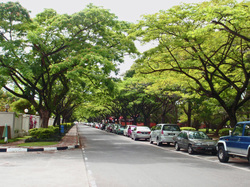
One of many tree-lined streets in Victoria
Pulau Labuan is located just off the southern coast of Sabah, adjacent to the border of Brunei. Historically, it was part of the Sultanate of Brunei until it was ceded to the British in 1846 and operated under colonial rule until World War II. Petroleum is the main economic force here and it is a hub for oil services and rescue vessels. Labuan is also an Offshore Banking Center and scores of duty-free shops line the main streets of Victoria selling alcohol, chocolate and tobacco products to visitors from Brunei and elsewhere.
1
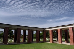
Labuan War Memorial
The Labuan War Memorial is dedicated to the nearly 4,000 Commonwealth servicemen (mostly Australian and British) who died in Borneo during World War II. The well-tended expanse of lawn houses row upon row of headstones as well as several monuments in an effort to honor those sacrifices with dignity. It is heartbreaking to read the plaque on several rows of headstones which read simply “A Soldier,” because their identities could not be determined. A red brick monument comprised of columns bearing plaques lists the names of those 2,400 servicemen who died during the Sandakan Death Marches, but whose bodies were never recovered. Another monument is dedicated to the soldiers from the Indian Army “whose remains were committed to fire.”
1.
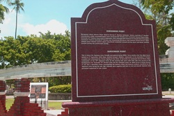
Entrance to monument at Surrender Point
Surrender Point is the site where the Japanese army forces in North Borneo formally surrendered to Major General George F. Wooten, Commander of the Australian 9th Division on September 9, 1945. The site became the command center for allied forces in British Borneo where war tribunals were held and punishment meted out for the atrocities committed by Japanese forces against Australian, British and New Zealand soldiers, including the Sandakan Death Marches, as well as civilian islanders during the Japanese occupation. The Peace Park (located adjacent to Surrender Point) was built by the Japanese government in 1983 and its gazebos, shaded ponds, bougainvillea covered archways and well-tended gardens are designed to inspire tranquility. Various plaques have been erected to renounce violence and preserve the memories of those who suffered and died during World War II.
1.
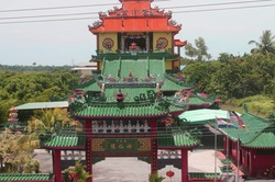
Entrance to Ba San Miao Chinese Temple
We also visited the Ba San Miao Chinese Temple, often called the “Heaven and Earth” Temple or the “Turtle” Temple because children love to feed the turtles kept near the entrance. This elaborate structure is designed with layers; the walls of the basement feature graphic carvings depicting the horrors of hell, the central floor represents earth, and the top floor symbolizes the heights of heaven according to their philosophy. A tremendous amount of work went into the artistic carvings, paintings and gold-leaf designs throughout the Temple.
Check out the photos in our updated Gallery!
Check out the photos in our updated Gallery!
123
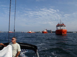
Leaving Labuan - rescue vessels at anchorage
April 7 – 13, 2011
Passage from Pulau Labuan to Singpore
7.25 days – 789.8 n.m.
Each time we take “Horizon” off the dock, whether it’s for a one-day sail or a passage spanning several days (or weeks), we always identify a goal or plan of what we hope to accomplish, and how we want to achieve that objective. Our passage from Pulau Labuan, just north of Brunei in Malaysian Borneo’s Sabah Province, to Singapore is no exception. We had two choices for our route: one would be to simply follow the northern Borneo coastline down to Kuching and then sail across the South China Sea to Singapore, or we could sail offshore straight from Labuan. Each route had its pros and cons. The trip down the coast would give us a chance to see more of Borneo (a pro) but the chances of sailing would be practically nil because the breeze along the coastline is historically fluky. The offshore choice would give us a greater likelihood of sailing, plus reduce our exposure to the shoals, reefs, petroleum wells and inshore shipping traffic, but we wouldn’t get to stop in the Sarawak Province. It is ironic that an oil-rich region, such as this, with oil platforms sprouting like trees along the coastline, would be such a difficult place to find diesel fuel, but such is the case. Getting fuel on board would require hiring a taxi for a several-mile journey to fill the jerry cans, and then have to haul the full cans back out to the boat – a huge hassle that, in the end, tipped our decision to take the offshore route. We also had a favorable forecast that looked to give us steady wind in the right direction. So we motored away from Pulau Labuan on a bright, clear morning – smack into headwinds coming from the exact opposite direction of the forecast! Not Good! Our course took us past a possible stop just 40 miles away so, if the conditions didn’t change, we had the option of stopping and waiting for better weather. But, as luck would have it, the wind shifted around and we sailed alongside fishing boats of all sizes, tugs towing barges, and massive commercial freighters, between reefs and shallows in search of a steady breeze. We found it – but it was light and, in some cases, not enough to keep “Horizon” moving when the tides and currents went foul. We had to start the engine after sunset on our first night to navigate between a cluster of oil wells, and it was just around midnight when Joseph noticed fresh water on the floor near the nav station … again, Not Good! A water hose connection had come loose and one of our fresh water tanks emptied itself into the bilge. So, in addition to the “routine” drama of sailing around massive oil platforms (mostly lit) we had to identify the source of the leak, and stop it. Fortunately it was a simple fix and we refilled the water tank with our watermaker when we ran the engine over the course of the next few days.
123
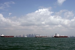
City of Singapore - huge shipping center
The breeze filled in at sunrise and we sailed – slowly – towards Singapore on what became a pattern of sailing 18-20 hours at a stretch before losing our wind and having to motor up to 6 hours (our longest “drive”). In the end, however, we were able to sail to within 10 miles of the Singapore coastline … it took us 7 days to travel 770 miles (we added some miles putting the boat in the best point of sail when the wind came directly behind us) and we motored less than 20 hours in total (using less than 20 gallons of fuel!) There were several periods when it was a struggle just to keep the sails quiet; the breeze was strong enough to keep the boat moving, but not enough to keep the boom from swinging and the sail from snapping, that were frustrating beyond measure. Whose idea was this anyway? Sailing is stupid. What were we thinking? But then the wind would shift or the seas would flatten or the breeze filled in and “Horizon” would return to her graceful motion, quietly slicing through the waves. The last three nights were clear and cool and a half moon dominated the sky during much of the night. And then we remembered why we are out here and it was worth the effort of clawing each mile of this voyage. The clear conditions were helpful as we approached the Singapore coastline and got back into the heavier ship traffic. We expected to see a huge number of commercial freighters because Singapore is one of the busiest shipping areas in the world. Those vessels all operated with the universally accepted navigation lights, so it is fairly straightforward to immediately tell which way they are going. However, the local fishing boats tended to towards a more “creative” approach to their navigation lights – sometimes not even turning them on until they saw us draw near! It was disconcerting to see an array of red, green, white and yellow lights suddenly appear in front of us; the unique positioning of the lights made it impossible to judge the direction they were headed. More than once did we have the key in the ignition in anticipation of having to take emergency evasive action but the fishing boats moved off before it was necessary to do so. At sunrise on our final day, we sailed into what appeared to be a staging area where dozens of massive freighters and supertankers lingered outside the shipping lane, where traffic is governed by strict codes of speed and separation. The traffic separation zone is roughly four miles across and the ships were spaced roughly a mile apart, traveling at roughly 25 miles per hour – often two abreast – going in both directions. “Horizon” can only motor about 6-7 miles per hour and the seas were choppy and chaotic, which slowed us down even further. But we managed to time our movement between the lanes and breathed a huge sigh of relief when we came out the other side – until the engine suddenly died. We had our mainsail up so it was a simple matter of rolling out the headsail and sailing in the gusty 15-18 knots of wind while Joseph replaced a fuel filter and got the engine running again. The breeze was strong enough, however that we continued sailing the remaining 15 miles through the anchorage filled with scores of ships towards our intended anchorage. Ominous clouds brewed ahead of us and thunder boomed as we conned our way towards shallower water near shore, and Joseph just managed to get the mainsail safely stowed when the “cold nose” of the squall blew in. The wind was gusting to 30 knots and the seas suddenly got a steep, nasty chop as we anchored near an oil platform, both soaked to the skin from the driving rain. Yes, it was a miserable as it sounds and we were NOT having a good time, but the squall blew itself out, we were safely anchored for the night and the passage was successfully complete.
123
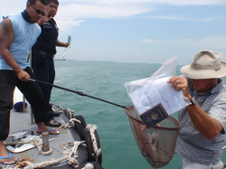
Customs/Immigration formalities - Singapore style!
We awoke the following morning and found ourselves surrounded by fishing nets that had been placed during the night and we hurried to pull up anchor as another small craft was placing nets even closer to the boat. We motored the remaining 20 miles down the coast, past the impressive city of Singapore, to the area designated as the Western Anchorage where Customs officials met us and clearance formalities were quickly and efficiently taken care of. Our intended destination, Oneº15 Marina, was within sight and their friendly staff pointed us to our slip, where we’ll stay during the duration of our visit here.
123
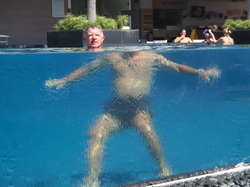
Joseph cooling off in posh pool
April 14 - 22, 2011
Oneº15 Marina – Sentosa Cove, Singapore
1º14.55 N / 130º50.47 E
The facilities at Oneº15 Marina are VERY nice (and that's an understatement!) and we have enjoyed the brief time we’ve been here so far. We take care of a few minor boat projects in the morning and then cool off in the lovely swimming pool before setting off to explore. We went with a group of cruisers for lunch in Chinatown at Yum Cha, a restaurant that specializes in dim sum – and stuffed ourselves silly with sesame-mango-prawn, spinach shrimp, chicken, fish roe siu mai, and sweet potato dim sum, scallops in filo, chicken wings in paper, fried soft-shell crab, and tender ginger-marinated steamed fish. We were only able to stroll halfway through Chinatown before the heat drove us into another restaurant for a lemon ice-tea break, and then caught the MRT subway back to the Vivocity Mall and the free shuttle bus that brings us back out to Sentosa Cove. Then, it’s back to the pool to cool off before whatever evening festivities develop on the dock. We have a “wish list” of things we’d like to do in the short time we’ve allotted so the next few days should be packed.
li23
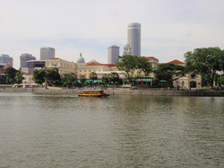
Empress Place Building on Waterfront - Singapore
Singapore is a fascinating urban center with several excellent museums and we chose to visit the Asian Civilizations Museum located inside the old Empress Place building in the revitalized Waterfront District. Maritime traders have been meeting in this region for thousands of years with European influences the relative newcomers, having arrived in the early 1800’s. Several bronze statues along the Waterfront mark the confluence of the various cultures which were based on trade of goods such as rice, tea, silk and spices, rather than colonization. The Asian Civilizations Museum highlights the religious beliefs of the Arabian, Indian, Chinese and Malays, along with the agricultural and commercial development of the region.
1.
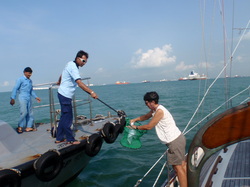
Marci getting our paperwork back
April 23 – 26, 2011
Passage from Singapore to Pulau (island) Penang
off western Peninsular Malaysia
371.2 n.m.
We understood why several of our neighbors at the Oneº15 Marina had been there for months and sometimes years, but we want to press onward, so we cleared out with the Port Authority and left the Marina shortly after 9 a.m. on April 23rd. Many on-line cruising forums discuss the difficulties associated with clearing in and out of Customs and Immigration in Singapore, but we found the process to be very straightforward and relatively painless. We motored into the “Western Anchorage” area and contacted the officials via the VHF radio and, within a few minutes, they pulled alongside “Horizon” to collect our passports and paperwork using the time-honored, high-tech Fishnet Transfer System. Within 10 minutes we were free to leave the country with farewells and best wishes.
..
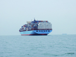
'Standard' loaded container ship - Malacca Strait
The first 8 hours or so of our passage from Singapore was spent navigating through the myriad of cargo vessels that ply these waters. There are several anchorages along the coastline where ships lay waiting to be offloaded, and these are often only a few miles away from Malacca Strait, one of the busiest shipping lanes in the world. Imagine our little 38-foot sailboat motoring along at 6 knots alongside massive cargo behemoths moving at 20 knots as we all made our way north. As darkness fell, it was easy for us to spot the commercial vessels who utilize standard navigation lights (a red light on the port [left] side and a green light on the starboard [right] side) and they weren’t difficult to avoid. It was the local fishermen who use creative lighting schemes who gave us fits as we could not tell from the multicolored lights which direction they were heading, and whether or not we needed to take evasive action. As the first night wore on, however, local fishing boats became the least of our worries as the afternoon thunderstorms brewed up and we braced ourselves for a few hours of lightning and rain. We had no idea what we were in for.
Around 2:00 a.m., a massive thunderstorm descended upon us and we spent the next three hours enduring brilliant flashes of lightning nearly every 60 seconds, with the associated ear-splitting thunder, but very little wind or rain. When would this end? These things normally blow themselves out and we kept waiting – but the cell apparently kept re-forming and we had no choice but to keep going north. The most frightening moment of all came when a northbound cargo vessel about a mile off our port beam was struck by a bolt of lightning; the rifle-shot thunder shook us to the core and we saw echos of the lightning for several moments after the bolt knocked the decklights off the ship. And there was nothing we could do but hold on and keep going. But, as with all bad weather, the sun came up and the storm blew itself out and we did our best to get as much rest as we could. It was not easy as our nerves were frayed, but we knew we were traveling in one of the most lightning-prone regions of the world and all we could do was hope that, as we put more distance between ourselves and the Equator, the intensity of the thunderstorms might lessen. And we were rewarded because the second night brought only a few hours of “cloud” lightning and low rumbles of distant thunder, and the third night actually graced us with stars and a minimal light show. During the day, we actually got enough wind to sail nearly a third of the total distance; something most people apparently don’t get to do, so we felt pretty lucky in that regard, and in the fact that we didn’t get hit by lightning. We reached Penang at dawn at the end of our third day and made the straightforward entrance to the Tanjong City Marina in Georgetown on Pulau Penang. It’s centrally located in an historic city that has been recognized as a World Heritage Site, so we are looking forward to spending some quality time exploring.
Around 2:00 a.m., a massive thunderstorm descended upon us and we spent the next three hours enduring brilliant flashes of lightning nearly every 60 seconds, with the associated ear-splitting thunder, but very little wind or rain. When would this end? These things normally blow themselves out and we kept waiting – but the cell apparently kept re-forming and we had no choice but to keep going north. The most frightening moment of all came when a northbound cargo vessel about a mile off our port beam was struck by a bolt of lightning; the rifle-shot thunder shook us to the core and we saw echos of the lightning for several moments after the bolt knocked the decklights off the ship. And there was nothing we could do but hold on and keep going. But, as with all bad weather, the sun came up and the storm blew itself out and we did our best to get as much rest as we could. It was not easy as our nerves were frayed, but we knew we were traveling in one of the most lightning-prone regions of the world and all we could do was hope that, as we put more distance between ourselves and the Equator, the intensity of the thunderstorms might lessen. And we were rewarded because the second night brought only a few hours of “cloud” lightning and low rumbles of distant thunder, and the third night actually graced us with stars and a minimal light show. During the day, we actually got enough wind to sail nearly a third of the total distance; something most people apparently don’t get to do, so we felt pretty lucky in that regard, and in the fact that we didn’t get hit by lightning. We reached Penang at dawn at the end of our third day and made the straightforward entrance to the Tanjong City Marina in Georgetown on Pulau Penang. It’s centrally located in an historic city that has been recognized as a World Heritage Site, so we are looking forward to spending some quality time exploring.
..K
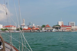
Entrance to marina in Georgetown
April 26 – May 24, 2011
Pulau Penang, Peninsular Malaysia
5º24.74N / 100º20.64E
As usual, the first order of business was to take care of the Customs/Immigration/Port Clearance formalities that are associated with entering a new country. Our marina is not far from the government offices, the biggest challenge is dealing with Malaysian drivers who are, to say the least, very assertive in their opinion that roads are meant for motorized vehicles – not pedestrians. Malaysia is a “yacht friendly” country and the process was quick, and we simply followed our noses past old colonial buildings into Little India where we were lured by the sign over the Restoran Kapitan boasting the “World’s Best Tandoori.” The tandoori and butter chicken, dhal and naan were pure nirvana and we barely made it back to the boat before collapsing beneath the weight of such an excellent meal. There are several seasoned cruisers here who have been happy to share their favorite eateries; food is an integral part of society here and only the highest quality restaurants survive. But there are things to do here, besides eat, and we look forward to learning more about the rich history of Penang and her people.
123
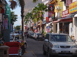
Bustling street in Little India
The island of Penang has been inhabited for thousands of years, but within the last millennia has become an important hub for maritime trade between China and India, and more recently, Europe. The colonial British were the latest to insinuate themselves among the existing population of Malay, Chinese, Thai, Burmese, Japanese, Arab, Sumatran, Indonesian and Indian traders who lived here, and the island was under British rule until WWII, when it fell to the Japanese. It was briefly governed by the British after the end of WWII, but gained independence as part of the Federation of Malaya in 1957 and the subsequent development of Malaysia in 1963. Located at the top of the Malacca Strait (between peninsular Malaysia and the island of Sumatra), Penang enjoys a yearlong warm and sunny tropical rainforest climate without significant typhoon or difficult weather hazards and, despite being close to the Equator, is generally comfortable, although fairly humid. Thunderstorms are something we will have to get used to because they are quite frequent.
1.
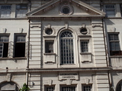
Historic Georgetown Chambers building
On 7 July 2008, Georgetown, which is the historic capital of Penang, was formally inscribed as a UNESCOWorld Heritage Site, alongside Malacca. It is officially recognized as having "a unique architectural and cultural townscape without parallel anywhere in East and Southeast Asia". In the early days of our stay at the Tanjung City Marina in Georgetown, we purchased a book called “Streets of Georgetown Penang: an Illustrated Guide to Penang’s City Streets & Historic Attractions” by Khoo Su Nin. Ms. Khoo is a fourth-generation resident of Penang who painstakingly gathered information regarding a majority of the historic structures in Georgetown, many of which are in varying stages of blight or restoration, some of which have sadly decayed beyond repair. The book features excellent photography and concise information regarding the treasures of Georgetown, as well as some historic locations such as the Penang Botanical Gardens located outside of Georgetown.
1.
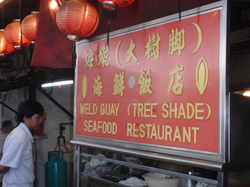
It’s difficult to believe we spent nearly a month in Penang, particularly when we had initially planned on staying just a few days, and we’ve accomplished a lot during our stay. Most importantly, Joseph sorted out a nagging fuel-supply problem (clogged fuel line) and we took care of some other boat tasks (listed in the Keeping Her Afloat page in About the Yacht) while we had access to parts and supplies. This should free us up to enjoy our upcoming time at anchor in more remote locations. We also had an unplanned opportunity to participate in the Malaysian health care system when Joseph suddenly spiked a high (103º) fever and received excellent treatment at the Penang General Hospital. The doctors were initially concerned about the possibility Joseph contracted dengue and it took several days for the fever to subside, but subsequent blood tests confirmed a more benign diagnosis of a bacterial infection which responded well to antibiotics. However, having a high fever in the tropics takes a lot out of a person and it was over a week before Joseph felt like himself again. We knew he was back to normal when he got bored with the rice/broth menu set by the doctors and wanted to go back to The Tree Shade seafood restaurant.
1.
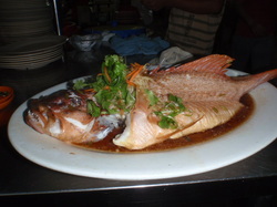
Standard fare at the Shade Tree
Dining is one of the main attractions to Penang in general and Georgetown in particular and the wide variety of ethnic foods meant we had plenty of choices – and all at very reasonable prices. We quickly found our favorites; Restoran Kapitan for tandoori, the Tree Shade seafood restaurant for fish and excellent quick-wok veggies (Malay), hawker stalls for noodles, and several dim sum restaurants where we’d stop for a quick nibble. Our meals generally cost anywhere from $3.00 to $6.00 U.S. per person, except for an extravagant pizza supper at the QEII restaurant at the marina which cost $50.00 because we had alcohol along with the food. It became a quest to find the best meals at the lowest price, and we had a great time doing it! Aside from a few pots of rice (particularly when Joseph was ill) Marci hasn’t had to cook the entire time we’ve been in Penang, since dining out is a better value than cooking in – and we don’t have to heat up the galley or tidy up afterward!
1.
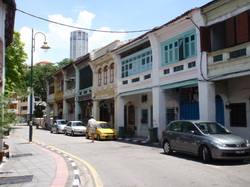
Joseph walking on Armenian Street in Georgetown
We took a long bus ride around to the north end of the island to visit the Penang Butterfly farm, a site known for its spectacular collection of butterflies living in their native environment, but were disappointed to find the place closed for renovation! Fortunately, the National Park was a short ride away and we ended up seeing not only butterflies, but Crab-eating Macaques and a massive Monitor Lizard as well! We try to make it a practice to utilize local bus services whenever possible because we find we get a broader view of the community that way. We’ll take a taxi when we’re lugging provisions back to the boat; Malaysian taxi drivers are always keen to ask where we’re from and share opinions about their communities, while weaving in and out of incomprehensible traffic schemes. Otherwise, we prefer to walk.
1.
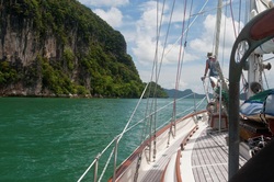
Marci on bow approaching anchorage
May 25, 2011
Pulau Payar Marine Reserve
6º03.84N / 100º02.66E
45.2 n.m.
We said goodbye to our fellow cruisers and slipped the docklines early in the morning and motored back into the glassy Malacca Strait. We had hoped to be able to sail some of the distance between Pulau Penang and Pulau Langkawi, but it was not the case on this day. But, we were able to take advantage of the considerable tidal flow that runs between Peninsular Malaysia and Sumatra to our west, and we got nearly 2 knots boost to our speed over the ground. The absence of wind made it easier to spot the cluster of fish traps located 10-15 miles south of the marine reserve so we were able to avoid fouling our propeller in the nets, and the trip was uneventful. We collected one of the mooring buoys made available to visiting yachts and passed a quiet evening.
1,
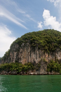
Steep cliffs and dense foliage on small island
May 26 – 29, 2011
“Fiords” anchorage between Pulau Dayang Bunting and Pulau Gubang Darat
6º11.47N / 99º47.25E
18.9 n.m.
We began the day with a “cloud failure” and what looked to be a freshening westerly that would have made for a great sail over towards Langkawi, so we hoist the main as soon as we were off the mooring at Pulau Payar. Sadly, the breeze was deceptive and, by the time we got out away from the effects of the small island, there was barely enough to keep the sail from flogging as we motored along. We’ve noticed, however, the further north we’ve gone from Singapore, the less “hazy” the atmospheric conditions have been and, today, we had quite clear views of the islands as we approached. We carefully navigated between the small outer islands, through the shallow channels, and into the anchorage locally known as “Fiords,” which took our breath away. Vertical granite cliffs rose straight from shore and dense virgin jungle foliage erupted with the calls of tropical birds and scolding Macaques as we anchored with only one other yacht in sight. THIS is what we were looking forward to and our time here was spent alternating between exploring the shorelines and idling in the cool breeze beneath the shade of our awning. We spent a few hours cleaning the residue built up on the waterline from the, uhm, “un-clean” water of Penang, and “Horizon” is back to her fabulous self. The steep hills blocked the sun after around 4:30 every afternoon and the breeze that funneled between the islands was refreshing. But what makes this anchorage so special is the dawn; when the air is filled with the calls of sea eagles, kites, hornbills, kingfishers, herons and oystercatchers greeting the new day.
1.
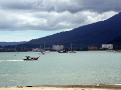
Horizon at anchor in Kuah
May 30 – June 8, 2011
Bass Harbour, Kuah Town, Pulau Langkawi
6º18.66N / 99º50.83E
11.9 n.m.
It would have been so easy to spend a week (or more) at the Fiords, but the officials require notification when moving from port-to-port and it would have been bad form to delay beyond the weekend. The trip from this anchorage to Kuah was lovely and we were able to investigate several possible future anchorages along the way. The prevailing opinion amongst cruisers is that the anchorage here is “pretty terrible,” largely due to the poor holding and high-speed ferries, tour boats, and long-tail fishing boats that speed through the area throughout the day. And these are valid opinions, but we did find decent holding off to one side of the anchorage, away from the main ferry landing, as well as a good place to land the dinghy for excursions to shore. Yes, boats have been dragging when the afternoon squalls blow in, so we’ve made it a point to be home, just in case we’ve needed to fend off (which has not [yet] been the case).
1.
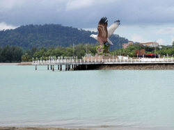
Massive Sea Eagle greeting visitors at ferry landing
Pulau Langkawi is the largest of the 99 islands in the Langkawi archipelago located in the Andaman Sea, thirty kilometers from the mainland coast of Northwest Malaysia. Only four of the islands are inhabited. It is the administrative seat of the Kedah Province, adjacent to the southern Thailand border. The name “Langkawi” is derived from the Malay words for “eagle” and “reddish brown” and these birds have become an icon for the archipelago. The limestone cliffs surrounded by dense, unspoiled jungle house numerous birds (including the majestic sea eagles), macaques and monitor lizards and there are dozens of anchorages to explore. Tourism is a major economic force with visitors from throughout Malaysia and Thailand coming to splash along the pristine northern beaches, visit places made famous in local lore (such as Pregnant Maiden Lake where a dip in the waters are said to enhance fertility), or splurge in the duty-free markets. Our plan is to remain here just a few more days before heading back out to the peace and quiet of the outer anchorages.
1.
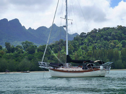
Horizon resting at anchor in Tulaga, Langkawi
June 8 – 18, 2011
Telaga Harbour, Pulau Langkawi
6º21.73N / 99º40.58E
18.2 n.m.
We were feeling entirely too comfortable in Kuah (despite the rolly anchorage) so it was time to investigate the other side of Langkawi. Joseph spent nearly 45 minutes cleaning the slimy mud that was caked on each link of the anchor chain (all 100 feet of it) and covering the anchor, before we could motor freely towards Telaga. It was a hot, sticky job, but we were pleased to know how well our anchor was set! There wasn't any wind so we had a pleasant "drive" around the island to Telaga Harbour, where an anchorage has been created out of two breakwalls that have been converted to small islands. It's a shallow anchorage but generally well protected, which is nice when the daily (and nightly) squalls bring brief, gusty winds and heavy rains, so we haven't had big swells to contend with. But, with the rain comes a break in the humidity and it's very nice here. We are also very near a 3G cell-tower, so we have amazing Internet access - which has been a real treat because we have been able to get a much better handle on the weather here and up towards Thailand.
1.
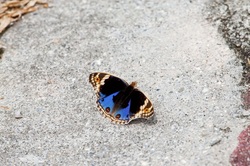
One of the many brilliant residents of Langkawi
The nearby marina is home to a fuel station (with mini-mart), an overpriced Indian restaurant, and (gasp) a Kentucky Fried Chicken restaurant with Pepsi on tap. So we’ve been treating ourselves to our daily allotment of “empty calories” in the form of a cold soda as we finish walking around the marina each day. Marci has been working on her skills photographing the brilliant butterflies that grace a vacant field while Joseph keeps a sharp eye out for suitable subjects. She’s had several shots accepted by stock photography websites. But a weather window opened up for us to head north to Thailand, so we had our last cold soda for a while and took off.
1.
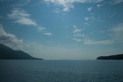
Butang Group of Islands, Thailand
June 19 – 20, 2011
Ko Lipe Island, The Batang Group, Thailand
6º29.60N / 99º17.73E
29.1 n.m.
Luckily Joseph didn’t have such a chore getting the mud off the anchor once he got it free from the thick mud, and it was a simple matter to exit the harbour and point towards Ko Lipe (pronounced “ko lee-pay”) Island. Unfortunately, the wind was not in our favor and we ended up motoring the entire distance up to the group; our headsail gave us a little boost but there wasn’t enough to keep the main full. The Butang Group of islands is part of the larger Ko Tarutao Marine National Park located on Thailand’s southern boundary with Malaysia, in the Andaman Sea. These are the 10 westernmost islands of the Park of which Ko Lipe is the most developed and most often visited. However, during the off-season (May – October) the otherwise crowded beaches and anchorages become deserted and cruisers can often find themselves alone in paradise, as we did. Joseph took full advantage of this visibility (the best we’ve had since Palau) to thoroughly clean the hull and scrape baby barnacles and coral from the propeller. It’s an ongoing battle (something he needs to do every 3 or 4 weeks – at least) made more difficult when the water is murky or the anchorage is rolly. Here we had several hours of calm water where he could really focus on the prop and rudder, in particular, so “Horizon’s” hull is smooth once again. See the photos in the Thailand Gallery
1.
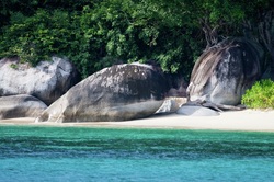
Clear water and rocky shore at Ko Adang
June 21, 2011
Ko Adang Island, The Batang Group, Thailand
6º32.57N / 99º16.67E
3.9 n.m.
Our next stop was an anchorage between Ko Adang and Ko Yang island and we anchored in 70 feet in the crystal clear water. Our first order of business was to go snorkeling. The coral along the shoreline did not have much variety but the 4 or 5 different types we saw appear to be fairly healthy. There were, however, a large number of giant clams and, what they lacked in the brilliant colors of those we found in the Tuamotus, they more than made up for in sheer size. There were large schools of fish in the deeper edges of the reef; not the brightly colored “aquarium” fish we’ve seen in Fiji and French Polynesia, but more anchovies and slightly larger fish. We saw unfamiliar species of small fish darting between the corals, along with the more familiar tangs and parrotfish. What we did not see was much litter in the water, nor evidence of humanity other than a couple of small mooring buoys (which we believe were probably used by snorkel tour operators in the high season).
1.
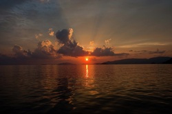
Sunset over the Butang Islands - Thailand
We walked along the beach and discovered several interesting shells as nearly transparent sand-crabs darted to safety. Impressive sea eagles soared overhead, often in pairs calling each other, and we heard hornbills and finches singing in the nearby tree branches. The shrill hum of cicadas added to the soundtrack over the rhythmic waves hitting the beach and lapping against the hull of the boat. Only one tour boat and an occasional long-tail fishing boat interrupted the sounds of nature and we ended the day by toasting the sunset beyond Ko Rawi. If you wanted to “plan” a perfect day at anchor, this would pretty much have fit the bill.
1.
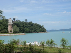
Ornamental lighthouse at Telaga Harbour
June 22 – 29, 2011
Telaga Harbour, Pulau Langkawi, Malaysia
6º21.75N / 99º40.59E
45.0 n.m.
But clouds rolled in to obscure the brilliant stars around 3 a.m. the following morning and, by 7:30 a.m. the whitecaps were building up in the channel between Ko Adang and Ko Rawi. Our anchorage had become untenable. We motored over to another possible anchorage located on Ko Rawi but found it crowded with fishing boats hunkered down against the freshening breeze. We lashed the dinghie securely in the chocks, raised the mainsail, rolled out the headsail and took advantage of the westerly wind to sail back to Langkawi. There was a northwesterly groundswell that made the boisterous trip a bit uncomfortable, but we enjoyed the sensation of feeling the boat powered up under sail (at long last!) The biggest down-side of the trip was the strain of having to look out for the hundreds of fishing floats scattered throughout the area. The fishermen tend to use black flags (for some obscure reason) which are difficult to see on a calm day – and about impossible to see on a day like today until you’re nearly on top of them. Then there’s the question of the function of the float: are they for fishing nets, lines, pots? Any of these choices could snag our rudder or propeller and be a serious disappointment to ourselves and the fishermen. So we were relieved to see the Telaga lighthouse as we approached the anchorage and, as luck would have it, we got the hook set and sails covered just a few minutes before the afternoon squall blew in.
1.
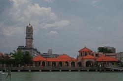
Tanjong City Marina - Georgetown Penang
Southbound Voyage down Malacca Strait
June 29 - July 10, 2011
Aside from enduring an epic 3-hour lightning storm, dodging tug-tows and fleets of local fishermen trailing nets and lines, our northbound trip up the Malacca Strait from Singapore to Penang was uneventful. We carefully monitored the weather forecasts and felt confident our southbound trip would be even less stressful, given our increased familiarity with the local vessels. We left Telaga Harbour on Langkawi on June 29th under a clear sky in calm conditions and, before long, were actually sailing towards our intended destination; Johor Bahru on the southern tip of Peninsular Malaysia. We planned to sail around the outside of Pulau Penang in order to avoid the fishing fleet and straight down the Malacca Strait with no plans to stop along the way.
But the conditions deteriorated as the breeze, forecast to be less than 10 knots from the southwest, built to 20 knots from the southeast and heaped up steep, choppy swells that we had to pound against. How had we gotten the forecast so wrong? After 7 hours with little progress to show for our efforts, we decided to duck into Georgetown on Penang and try and get a handle on the weather. The gusty conditions followed us into the harbour and, later in the day, blew 25 knots into the channel. We had whitecaps in the marina. However, the local forecast called for 5-10 knots during this time. We made the best of the situation by visiting our favorite tandoori restaurant (Kapitan) and Chinese seafood spot (Tree Shade).
..
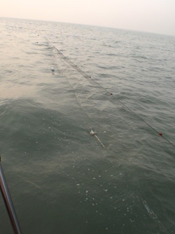
Fishing net trailing alongside Horizon at anchor
We left Penang in calm conditions with a forecast of light and variable breeze for the next 48 hours. But, four hours later, we were bashing into steep chop and 15 knot southerly wind, so we turned around and ducked behind Pulau Rima – along with several local fishing boats. We waited a few hours and went back out and tried again, only to find the same conditions, so we backtracked to the anchorage and settled down for the night.
A small fishing boat came alongside early the next morning, as we were getting ready to leave, and indicated he wanted to put out his nets. Joseph said, “no problem, we are leaving soon,” and the man motored away. Moments later, Joseph saw him set his nets close to the shoreline, and we started our motor. Within moments, however, the swift current moved the drift nets towards us and “Horizon” was encircled by the floating mesh. There was no way to recover our anchor – we were stuck. We got the attention of the fisherman and he and his wife came back to “Horizon.” His English was limited and our Bahasa Malay is non-existent, and we could not explain our suggestion of moving the shorter end of the net around the bow. After a few harsh words and angry gestures, the man produced a cleaver, collected the nets at the bowsprit and cut them in one clean sweep. Now free, the two net pieces drifted safely away from “Horizon.” We were mortified because these nets are this man’s livelihood so we offered him some money in hopes of compensation for this misunderstanding. He didn’t ask and we weren’t sure if the amount of the payment was adequate; but his wife’s eyes lit up at the sight of the ringgits and, after several nods, bows and apologies, they motored off to collect the nets. We pulled up anchor and went back out into Malacca Strait.
A small fishing boat came alongside early the next morning, as we were getting ready to leave, and indicated he wanted to put out his nets. Joseph said, “no problem, we are leaving soon,” and the man motored away. Moments later, Joseph saw him set his nets close to the shoreline, and we started our motor. Within moments, however, the swift current moved the drift nets towards us and “Horizon” was encircled by the floating mesh. There was no way to recover our anchor – we were stuck. We got the attention of the fisherman and he and his wife came back to “Horizon.” His English was limited and our Bahasa Malay is non-existent, and we could not explain our suggestion of moving the shorter end of the net around the bow. After a few harsh words and angry gestures, the man produced a cleaver, collected the nets at the bowsprit and cut them in one clean sweep. Now free, the two net pieces drifted safely away from “Horizon.” We were mortified because these nets are this man’s livelihood so we offered him some money in hopes of compensation for this misunderstanding. He didn’t ask and we weren’t sure if the amount of the payment was adequate; but his wife’s eyes lit up at the sight of the ringgits and, after several nods, bows and apologies, they motored off to collect the nets. We pulled up anchor and went back out into Malacca Strait.
1.
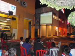
Soccer match being broadcast at Nadi Kasar
We got considerably further south before the conditions deteriorated again to where we decided to duck into a reportedly “safe” anchorage in Teluk Balanga on the western side of Pangkor, a small island off the coast of Lumut. We normally don’t enter unfamiliar anchorages at night but made an exception in this case, and it was calm and serene when we dropped anchor at 1:00 a.m. The wind shifted to the west and quickly built as a squall blew in and, by sunrise, there were 3-5 foot swells rocking “Horizon” like a child’s hobbyhorse. Joseph somehow managed to recover the anchor without getting hurt in the violent chop and we quickly got the boat into deeper water. We passed the conspicuous shipwreck in the shallows as we followed the channel markers into Sungei Dindings to the mainland town of Lumut. On July 3, 2011 at 0800 UTC, we set foot on the continent of Asia, exactly 457 days after leaving the continent of North America (surpassing our earlier record of 432 days set in 2004/2005). Our SE Asia Cruising Guide (Vol. II, Davies/Morgan) suggested diesel might be available on the dock at the Lumut International Yacht Club, but such is no longer the case. Several rivers empty into Sungei Dindings and the holding here was very good. Lumut was a pleasant little town and we were able to take on 80 liters of diesel fuel (since we’d done so much motoring so far) with a helpful Yacht Club staff member volunteering to carry our jerry cans via scooter from the nearest fuel station. We also treated ourselves to an excellent dinner at Nadi Kasar of tandoori and Malay noodles (called “mee”) and watched Malaysia’s soccer team compete against Chinese Tai-Pei.
..
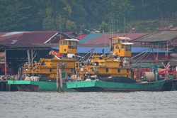
Boatyard on Pangkor
It’s always odd to celebrate American Independence Day outside of the United States; apparently July 4th is just another day! The Stars and Strips proudly fluttered in the breeze as we motored past the Malaysian Naval base and into the channel between the mainland and Pangkor. Nearly the entire eastern coast of Pangkor is occupied by a water village/boat yard which serves as a base for the fishing fleet in this area. These wooden boats are built on the shore combining traditional designs with 21st century additions such as long-range radios and GPS. See more photos in the Voyage Around the World Gallery. We actually made decent progress as the miles ticked by in relatively benign conditions and we entered the narrowest area of the Malacca Strait known as One Fathom Bank. This is the area where shallows extend east from the Indonesian island of Sumatra, creating a "choke point" with limited space for the heavy cargo vessels to pass. One Fathom Bank shallows to 3 meters, extends on a NW/SE axis for several miles, and is littered with numerous wrecks and fishing stakes from old "farms" long since abandonded. Malacca Strait is one of the most important shipping lanes in the world with over 50,000 commercial vessels transiting annually. One Fathom Bank is divided by a Traffic Separation Scheme so commercial traffic flows smoothly within the deep channel. But within the inner boundary of the Bank and the Malaysian shoreline lie several smaller banks, including the Pematang Katam bank, that are often just 1 or 2 meters deep and create turbulence based on the strong tides. There is plenty of deep water between One Fathom Bank and the shore for tug-tow traffic … with fishing boats working in the shallows on either side. Not a big deal … unless your engine dies four miles from the south boundary of One Fathom Bank … at 4:30 a.m. … with a two-knot foul current ... and then it gets interesting. We caught a break because the wind was more west of south – at 20 knots – so we were able to sail slowly under just the headsail and stay out of traffic. The rough seas had churned up our fuel and whatever is in the tanks is clogging our fuel line. This was not good news. We’d cleaned the tanks in November, how could they have collected so much sludge in such a short time? We decided to stop in nearby Port Klang to rest and maybe let the tanks settle down, and check the forecast again. We sailed slowly to the entrance of the anchorage up in the river estuary at Selat Lumut. Once we got settled, we checked the weather and, once again, it called for light and variable conditions for the next several days. We hoped eventually they’d get it right.
..
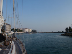
Entrance to Admiral Marina in Port Dickson
But, as soon as we left the estuary early the next morning, we met the lumpy confused seas indicative of several hours of windy conditions. We powered into deeper water away from shore, into flatter conditions, and Joseph had to clean the fuel elbow, which clogged again after two hours, and replace our primary fuel filter which only had five hours on it (they generally last at least 100 hours). We arrived at the Admiral Marina in Port Dickson shortly before 6 p.m. and it’s probably the nicest marina we’ve seen throughout all of Malaysia. We had planned to power through a couple of boat chores and leave the next day, but the facilities were so nice we decided to slow down and stay an extra day. One of the wires was loose on our bow-lights so Joseph had to crawl up into the anchor locker to reconnect it. The light bulb had burned out on the steaming light mid-mast, so Joseph had to go up in the bosn’s chair to replace it. He cleaned the fuel elbow – it was only partially clogged – and we both scrubbed the brown film of crud from the waterline that comes from being in Malaysia. Monika and Armin of s/v “Slamat” shared their favorite Chinese seafood restaurant shortly after we arrived and we had a great supper at the marina restaurant the second night. We also got acquainted with Ian, Jo, Gillen and Keely on s/v “Chaotic Harmony,” and we hope to reconnect with them in Cocos Keeling in the weeks ahead.
1.
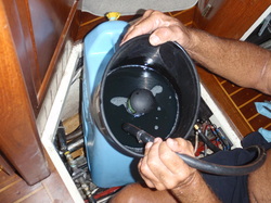
Joseph using the Baja filter to polish the bad fuel
We left Port Dickson with roughly 160 miles to go – and a forecast of light and variable wind. We got 10-15 knots on the nose as soon as we got out away from shore near Cape Rachado but things gradually got better and we managed to go a whole eight hours before we had to stop the engine, clean the fuel elbow and change the primary filter. We motored on and were a couple of miles south of the Water Islands when the fuel coming into the fuel bowl became too cloudy to use. The main sail was already up so we rolled out the headsail and Marci sailed the boat back and forth between the boundary of the traffic lane on the west and the fishing fleet to the east – roughly two miles of “empty” water. She only had two tug-tows to contend with. Meanwhile, Joseph rigged a fuel “polishing” system where he could pull the fuel from the tank, strain it through a “Baja” filter and into a clean jerry can. It worked great – until the sludge clogged the Baja filter. The next solution was a piece of old T-shirt fabric which ended up doing a fine job of straining the crud out of the fuel. It took nearly four hours but he polished over 70 liters of diesel fuel so we could continue down the Strait. Because this all took place during an ebb tide, we actually gave up just over a mile of ground while Marci sailed back and forth, the current pushed us backwards!
..
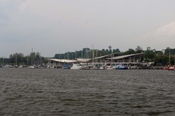
Entrance to Danga Bay Marina
We rotated 90-minute naps throughout the night as we neared the southern tip of the Malaysian Peninsula and the channel around the north side of Singapore. We passed scores of anchored commercial ships from around the world and, finally, into calm protected water up to the Danga Bay Marina in Johor Bahru. The trip took us twelve days to travel 585.2 miles, and we were delighted to see Pam and Doug Winkler of s/v “Helly” (our friends from Langkawi) there to catch our docklines at the marina. They were keen to commiserate on the obnoxious weather conditions (apparently their forecasters were equally clueless) and help us knock back a few cold ones in celebration that we could all put the Malacca Strait voyage behind us.
1..
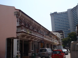
Busy Singapore city street
July 11 - August 1st or 2nd, 2011
Danga Bay Marina, Johor Bahru, Peninsular Malaysia
Our first order of business, after giving “Horizon” a well-deserved bath to remove the salt that accumulated from taking so much spray over the bow, was to track down more fuel filters. As is customary on docks worldwide, folks are eager to share information regarding parts and provisions and we got a line on a filter supplier in Singapore. Doug was already planning a trip “across the Causeway” so he helped guide us through the maze that is Malaysian/Singapore Customs and Immigration (it’s easier the second time through) and into beautiful Downtown Singapore. We found a fuel additive (which we hope will limit the future growth of whatever “bloomed” in our tanks) along with a few other toys at MarineTech and then over to a store that specializes in all manner of filters. We came away with primary filters, engine filters and oil filters – hopefully we’ll still have most of them when this trip is through!
..1
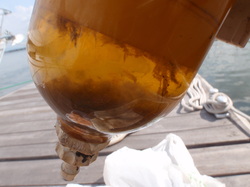
Fuel bowl with chunks floating in contaminated fuel
Then it was time to get to work. We changed the engine oil (a routine task that was already on the “list”) and the two fuel filters, as well as installing a new alternator belt. The following day, Joseph polished the remaining fuel (again) and was up to his shoulders (literally) wiping out the accumulated sludge that had grown inside both of our tanks. It’s an awkward, messy job that, sadly, he’s gotten all too good at. Once the tanks were clean, we put the polished fuel back in, along with the biocide, and the engine once again purrs like a kitten. More photos available in Keeping Her Afloat! The next job on the “to-do” list was rebuild the “head,” (toilet) which was also a routine, scheduled task. Being routine doesn’t make it any less obnoxious; the biggest challenge here being the fact that our bathroom has little maneuvering room and getting all the hoses and fittings aligned properly (so they don’t leak) is very difficult. But, it’s done for another couple of years, we checked that off the “list” and could finally give the interior a thorough cleaning with a vinegar-water solution that breaks down the residue of sea air (and petroleum products) that collect on the teak. Our Girl sparkles inside and out, and we can finally relax. All we have to do now are a few normal “pre-passage” type chores; Joseph likes to go up the mast and inspect the rigging and Marci likes to stock the boat with enough provisions for a years worth of space travel, we have a couple of small sail repairs to accomplish and need to get the dinghy deflated and stowed. We also have some local sightseeing we’d like to do. Johor Bahru is centrally located and we are looking forward to maybe having some “downtime” before setting off on the next leg of our voyage.
..
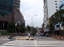
Downtown Johor Bahru
On July 25th, we got another “early start” and met up with our friends, Pam and Doug Winkler of s/v “Helly” to catch a taxi (teksi) to the Larkin Interstate Bus Terminal. Bus travel is very popular throughout Malaysia and a 2 ½ hour trip to Malacca aboard a fairly new clean, air conditioned coach cost around $6.50 (U.S.) per person, each way. We prefer to use public transportation whenever possible, mainly because it frees us from the responsibility of navigating in unfamiliar traffic schemes and allows us the chance to relax and enjoy the scenery. Our coach took a circuitous route through the suburbs of Johor Bahru where we saw colorful, older structures with character wedged between modern malls and hi-rise apartments.
Once out of town, the new Interstate Highway carried us past miles and miles of palm oil plantations which cover the rolling hills of south peninsular Malaysia. Palm oil is a controversial industry and Malaysia, which had over 17,400 sq. miles of land planted in coconut palms in 2008, is the world’s second largest exporter of palm oil (behind Indonesia). The country has several prestigious universities dedicated to the development of the crop as well as its uses, and the palm oil industry is a major economic force here. The downsides, unfortunately, can be irreversible as virgin rainforests are cleared in order to make way for the coconut palms, causing habitat loss to orangutans and tigers (which are having a tough enough time fighting extinction). We were surprised to learn that the rainforests sit on top of ancient bogs which contain carbon and, when the rainforest is cleared, the bogs dry and the carbon is released, adding greenhouse gasses to the atmosphere. So the question of whether the benefits of using palm oil as a biodiesel (to help reduce greenhouse gas) outweighs the damage caused by the release of carbon resulting from the clearing of the rainforest, rages on. The palm oil plantations continued right to the edge of the town of Malacca and another bus terminal. We managed to find our way through the chaos to the city bus and were hustled aboard by a conductor who assured us we were on the right one (in the absence of signage). Fortunately, the hot, dusty, loud, scary trip on the ancient bus was brief.
Once out of town, the new Interstate Highway carried us past miles and miles of palm oil plantations which cover the rolling hills of south peninsular Malaysia. Palm oil is a controversial industry and Malaysia, which had over 17,400 sq. miles of land planted in coconut palms in 2008, is the world’s second largest exporter of palm oil (behind Indonesia). The country has several prestigious universities dedicated to the development of the crop as well as its uses, and the palm oil industry is a major economic force here. The downsides, unfortunately, can be irreversible as virgin rainforests are cleared in order to make way for the coconut palms, causing habitat loss to orangutans and tigers (which are having a tough enough time fighting extinction). We were surprised to learn that the rainforests sit on top of ancient bogs which contain carbon and, when the rainforest is cleared, the bogs dry and the carbon is released, adding greenhouse gasses to the atmosphere. So the question of whether the benefits of using palm oil as a biodiesel (to help reduce greenhouse gas) outweighs the damage caused by the release of carbon resulting from the clearing of the rainforest, rages on. The palm oil plantations continued right to the edge of the town of Malacca and another bus terminal. We managed to find our way through the chaos to the city bus and were hustled aboard by a conductor who assured us we were on the right one (in the absence of signage). Fortunately, the hot, dusty, loud, scary trip on the ancient bus was brief.
1.
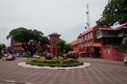
The roundabout in the center of Old Malacca
Malacca has been recognized as a World Heritage Site because of the historic buildings in the center of town, but it seemed to us they are struggling to find a balance between preserving the essence of the town against the lure of tourist dollars. The entrance to the sanctuary in the Christ Church contains several rows of folding tables selling tacky bookmarks and cheap religious icons, yet has the temerity to insist that no photos be taken! A large building houses a museum that captures much of the history of this area over the course of the past 600 years and we found much of it quite interesting as it relates to the maritime importance of this area. The museum emphasized the British, Chinese, Dutch, Indonesian, Indian and Portuguese influences that have shaped the economic and political developments of the region and we particularly liked the Admiral Zheng Ho Gallery that highlights the massive Chinese fleet that set sail in 1421 which led the way for Europe’s Age of Discovery. Check out the photos in the Peninsular Malaysia Gallery!
..
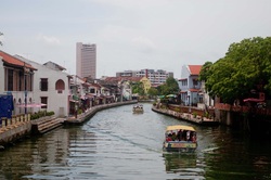
Malacca River with tour boats
We wandered along a developing riverwalk along the Malacca river (which was the initial magnet for shipping and trading) area to Jonker Street and found an excellent bronze statue of Buddha in the Thai style; Joseph and the antiques dealer “negotiated” a price that made everyone happy and we now have a good souvenir of Southeast Asia. Of course, we had a wonderful lunch and stopped for coffee, strolled among old sultan palaces and gardens and generally had a great day of exploring. We endured another frightening rickety bus ride driven by a frustrated Nascar driver back to the terminal and then on to a tranquil, clean coach for the $6.50 ride home. But we must say goodbye to Malaysia and continue our westward voyage. Our exact departure date is unclear because no one is certain whether or not Customs/Immigration Clearance will be possible on August 1st, which is the first day of Ramadan, but we are assuming we can clear out and are cancelling our broadband Internet access (sadly) based on that assumption. We may not leave the marina until August 2nd.
1.
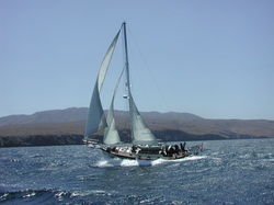
August 1st or 2nd, 2011
“Horizon” is currently en route on her voyage across the Indian Ocean. But first we must leave Southeast Asia – which is easier said than done! This will require us to travel down the eastern coast of Sumatra. We must first transit the Johor Strait between the island of Singapore and mainland Malaysia and cross the busy “Main Strait” (the strait that connects Singapore Strait with Malacca Strait) and entering Indonesian waters. Our route will take us down Selat (Strait) Durian which separates the Riau Islands and Sumatra, through Selat Berhala and briefly into the South China Sea, through Selat Bangka (a 120-mile stretch in itself) and finally entering the busy Java Sea. We will then sail to the pass that separates Sumatra to the north from Java to our south in what is known as the Sunda Strait. One of our last land sightings as we leave Southeast Asia will be Anak Krakatau (or Child of Krakatoa), the remainder of the catastrophic Krakatoa eruption of 1883. We will shape our course west to Cocos Keeling, Rodriguez, Mauritius and, finally, Richards Bay, South Africa. We hope to arrive in South Africa some time in November – but will update our progress at each available Internet connection.
“Horizon” is currently en route on her voyage across the Indian Ocean. But first we must leave Southeast Asia – which is easier said than done! This will require us to travel down the eastern coast of Sumatra. We must first transit the Johor Strait between the island of Singapore and mainland Malaysia and cross the busy “Main Strait” (the strait that connects Singapore Strait with Malacca Strait) and entering Indonesian waters. Our route will take us down Selat (Strait) Durian which separates the Riau Islands and Sumatra, through Selat Berhala and briefly into the South China Sea, through Selat Bangka (a 120-mile stretch in itself) and finally entering the busy Java Sea. We will then sail to the pass that separates Sumatra to the north from Java to our south in what is known as the Sunda Strait. One of our last land sightings as we leave Southeast Asia will be Anak Krakatau (or Child of Krakatoa), the remainder of the catastrophic Krakatoa eruption of 1883. We will shape our course west to Cocos Keeling, Rodriguez, Mauritius and, finally, Richards Bay, South Africa. We hope to arrive in South Africa some time in November – but will update our progress at each available Internet connection.
1
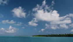
Direction Island (view from Horizon at anchor)
August 3-12, 2011
Passage from Johor Bahru, Malaysia to Cocos (Keeling) Islands, Australia
1307.5 n.m
It was not easy, saying goodbye to our friends in Danga Bay, particularly Pam and Doug Winkler of s/v “Helly”, but we bid them farewell as we left on the outgoing tide. Our trip out Johor Strait was straightforward, as was crossing the Main Strait into Selat Durian, and our first night was gentle and pleasant. After a few hours of pounding into headwinds, we reached Selat Berhala and the ITCZ, where we found suitable wind to sail over 60 miles of our southbound leg. Sadly, we lost our favorable conditions when we entered Selat Bangka and had to endure 30 hours of headwind and steep, choppy seas that sent spray over the bow which covered the boat. It quickly lost its considerable charm. We wove our way past scores of fishing boats (and nets and floats and lines) into the Java Sea where we were graced once again with favorable winds and current. We lost our wind as we approached the Sunda Strait, which we transited early in the morning, and we entered the Indian Ocean in flat conditions. The northwest wind coming off the coast of Sumatra gradually shifted to southeast Trade Winds as we passed Anak Krakatau (which looked like a classic cone volcano in the hazy distance) and we got into deep water. It was such a relief to be back in Trade Wind sailing in Blue Water and a favorable current gave us an excellent push towards Cocos (Keeling). We encountered a few periods of really boisterous conditions and occasionally confused seas but, for the most part, the deep water section of the trip was wonderful. We didn’t lose our wind until we were within 30 miles of the entrance to Cocos (Keeling) and decided to just fire up the Yanmar and finish the trip. The well-lit entrance to Refuge Harbour can be safely entered at night and we did so beneath a full moon, after contacting Customs to advise them of our arrival. Arrangements were made for proper clearance later on the morning of August 12th and were completed quickly, and we are free to enjoy our time here. Cocos (Keeling) is a lovely atoll with white sand beaches and crystal clear water. There are currently eight yachts here representing Europe, Australia and another American yacht as well. We are all heading in the same direction and will be keeping in touch with each other as we continue westward. Internet access may be difficult because of the distance from the yacht anchorage to the nearby town, so it is unlikely we will be able to update the website much until we reach Rodrigues/Mauritius (sometime in September).
123
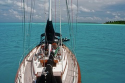
Horizon at anchor off Direction Island
August 13-22, 2011
Anchored Direction Island, Cocos (Keeling) Islands, Australia
12º05.58 S / 96º52.86 E
Cocos (Keeling) Islands are located in the Indian Ocean approximately 600 miles SW of the southern tip of the Indonesian island of Sumatra. The islands were reported by British sea Captain William Keeling in 1609, but was not inhabited until 1826 when partners John Hare and John Clunies-Ross arrived and developed a copra plantation. The island was declared a British dominion in 1857 but it wasn’t on anybody’s radar until World War I, when a German ship (Emden) destroyed a cable station on Direction Island and was subsequently wrecked by Australian forces on North Keeling Island nearby. It was made an Australian dependency in 1955 and many of its inhabitants descend from the Malaysian laborers imported by the Clunies-Ross family during the 1800’s. The dazzling white sand, crystal clear water and healthy coral housing a huge variety of fish make this a memorable place for yachts to stop along the westward trek across the Indian Ocean. “Horizon” is anchored off Direction Island with 7 other yachts from around the world and we’ve whiled away the days snorkeling the “Rip” (a pass between Direction Island and Pulu Pasir) and sightseeing on Home Island and West Island. The anchorage is protected from the prevailing winds and seas and we have really enjoyed the cooler Trade Wind temperatures after the sultry heat of Malaysia. We could easily stay another several weeks but must continue on to Rodrigues, Mauritius and So. Africa.
1.
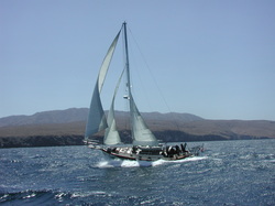
August 22, 2011
“Horizon” is currently sailing from Cocos (Keeling) Islands across the Indian Ocean to the island of Rodrigues. We anticipate the passage will last 15-21 days, depending upon the weather conditions we find. We hope to find good enough Internet access to be able to update the website and upload the excellent photos we have of Cocos at that time.
“Horizon” is currently sailing from Cocos (Keeling) Islands across the Indian Ocean to the island of Rodrigues. We anticipate the passage will last 15-21 days, depending upon the weather conditions we find. We hope to find good enough Internet access to be able to update the website and upload the excellent photos we have of Cocos at that time.
1.
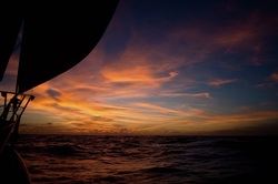
Sunset on the Indian Ocean
August 26 – September 10, 2011
Passage from Direction Island, Cocos (Keeling) Islands, Australia to Port Mathurin, Rodrigues Island, Indian Ocean
15 days - 2124.4 n.m.
The cruising guides and sailor’s websites all refer to this passage across the Indian Ocean as being “boisterous” with frequent references to a “heavy southern cross-swell.” A strong west-going current also helps make this a fast passage, as we soon found out when we departed the Direction Island anchorage and turned “Horizon” towards deep water. A strong high pressure system had just passed to our south so we dealt with the remaining 3-4.5 meter seas during the first 18 hours or so, and then they moderated to a more comfortable 2 meters. We had consistent Trade Winds (albeit reinforced) for the first couple of days as well, which was more than our tired mainsail (“Patches”) could handle. We repaired a couple of small tears during the first 48 hours but, during a particularly robust squall, we blew a sizeable hole in the sail between the first and second reef, so we kept the mainsail on the second reef for the remainder of the voyage. Lucky for us, the wind blew so hard during most of the trip we were able to maintain good speed and boat control for all but one brief (3-hours) stretch where we needed to start the engine and motor. We had fairly good weather during the majority of the voyage with starry skies and waxing moon, but the seas got progressively larger, rougher and more chaotic the further west we traveled, which made for exhausting work as the boat was often tossed violently off the large swells. It quickly lost its allure, to be sure. As luck would have it, we made such good speed that we made landfall several hours before sunrise, and the harbor entrance to Port Mathurin is one best done during daylight, so we spent several hours tucked in the lee of the island, sailing back and forth until we had enough light to enter safely. We were greeted by the courteous and professional officials of the Quarantine, Customs, Coast Guard, Police and Immigration departments; each man seemed most concerned that we be able to complete the formalities quickly enough to enjoy the nearby Saturday produce market before it closed! What little we’ve seen of this charming and colorful community has been a feast for the senses after 15 days at sea and we look forward to exploring the island further in the days to come.
12
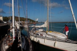
Horizon rafted against "Sogno d'Azul" of Holland.
September 10 - 16, 2011
Port Mathurin, Rodrigues, Mascarene Islands, Indian Ocean
“Horizon” spent the first couple of days in Rodrigues tied to the commercial wharf at Port Mathurin along with sailors from around the world; “Sogno d’Azul” (Netherlands) is rafted alongside “Horizon,” “Conversations” (Canada) is directly behind us with “Empire” (Norway) rafted alongside, “Hokus Pokus” (Sweden) is tied behind “Conversations … and “Chaotic Harmony” (Australia), “Rhythm” (England), “Wombat of Sydney” (American), “Blue Callalou” (Germany) and “Whiskers” (South Africa) are in the anchorage basin … a veritable United Nations of cruisers! Most of us shared the anchorage in Cocos and are all planning to sail to Mauritius in the next few days. We have repaired “Patches” adequately for the trip to Mauritius (where we expect to dress “Horizon” is a new set of sails) and have moved away from the hustle of the wharf and out into the anchorage for a little quiet.
1.
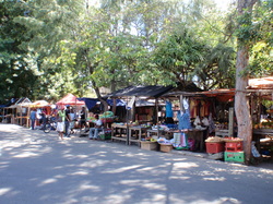
Fresh produce at sidewalk stalls in Port Mathurin in Rodrigues.
We took a guided circle-island tour with several friends that proved to be most informative. Most of the 37,000 people living on this island are descendants of African slaves and Indian/Indonesian indentured workers and they are rightfully proud of how peacefully people with such a diverse ethnic background can coexist. The colorful, well-kept homes are adorned with brilliant bougainvillea vines, along with the ubiquitous goats and cattle picketed nearby and chickens scratching in the yards. The narrow two lane highway wound its way around the coastline surrounded by the ever-present reef and small boats used for subsistence fishing were everywhere.
1.
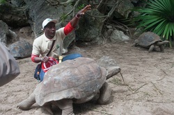
Our guide with one of the elder tortoises.
We bounced our way up a short unpaved road to visit the Francois Leguat Giant Tortoise and Cave Reserve. Opened in 1985, it is a 19-hectare nature reserve dedicated to preserving and restoring some of the islands’ native vegetation and wildlife. There are currently over 1,000 giant tortoise (Aldabran and Radiated) as a product of the captive breeding program based on animals imported from Madagascar, and many have been released (or escaped) back into the wild. The Golden Fruit Bat was rescued from the brink of extinction in the 1970’s when the numbers dropped to fewer than 100 individuals, and there are now thousands of the small animals in the wild. There are eleven limestone caves in this location and the largest gallery is open to visitors for guided tours. We were impressed with how well the government designed the unobtrusive walkway for visitors to enjoy the raw beauty of the geologic features without excessive lighting and signage. Our tour ended around 4:30 p.m. and we had just enough time to go back to the boat and relax briefly before going to one of the many of the restaurants offering a dinner/show combination. We gathered with several yachts to enjoy a passable meal but spectacular local accordion/percussion band and dance troupe. The African musical influence was strong and the dancers thrilled the crowd with traditional dances and European polkas and waltzes. Then the 21st century kicked in; the DJ raised the decibels and the air was filled with the throbbing beat of techno-pop and the dance floor filled with locals and cruisers alike.
1.
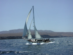
September 16 – 19, 2011
Passage from Rodrigues Island to
Port Louis, Mauritius, Indian Ocean
380.0 n.m.
We had a good weather window for the short passage from Rodrigues to Mauritius so, once the exit clearance formalities were completed and we made a final visit to the fresh produce market, we pulled up anchor and headed back out into the Indian Ocean. A large high pressure system to our southeast created a robust swell that was a little un-nerving when we met it coming out of the harbor, but it propelled us nicely once we got around the fringing reef and pointed due west towards our destination. And, at 1724 hours (UTC) on September 16th, “Horizon” crossed longitude 62º54 E – which is the longitudinal antipodes of San Diego. What does this mean? It means we are no longer sailing away from our home port, we are now sailing towards it. We had plenty of wind and kept “Patches” reefed during the entire voyage, but a tear developed between the first and second reef late on the second day of the trip so we completed the trip with two reefs. The wind was steady throughout the voyage and we sailed up to the entrance of Port Louis and put the bow into the wind to bring the mainsail down … and the poor sail had had enough. The wind caught the earlier tear and the fabric split nearly to the top of the sail. Since leaving Sunda Strait and all the way across the Indian Ocean, we’ve looked up at the sail and silently asked, “please hold up until Mauritius, please hold up … “ and it did as we asked. We arrived in Port Louis around 2 p.m., completed Customs/Immigration and Port formalities and were free to go to the Caudan Waterfront marina to join our friends.
12
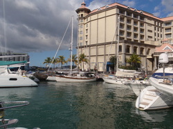
"Horizon" in busy Caudan Waterfront Marina
September 19 – October 31, 2011
Caudan Waterfront Marina, Port Louis, Mauritius, Indian Ocean
The island of Mauritius lies 500 n.m. east of Madagascar in the western Indian Ocean. Early Dutch explorers named the island after Prince Maurice of Nassau in 1598 and early settlers began replacing the ebony hardwood forests with sugar cane plantations. Sugar cane and other agricultural exports are still an important part of the economy but the country has diversified with offshore banking and tourism ventures.
1.
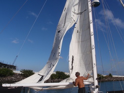
This was "Patches" last hoist.
As we mentioned earlier, "Patches," our mainsail, developed a tear that became a full scale blow-out. It is gratifying to see that earlier repairs (both with sewing machine and sail tape as well as Gorilla brand duct tape) all held together, but we know the time has come for a new one. Our first order of business was to research various options for a new mainsail; whether or not to go with a local company or order from an offshore loft. We decided to go with a local sailmaker, MU Sails, and will be following the progress of the construction of our new sail in the weeks to come.
12
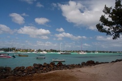
Busy anchorage at Grand Baie
We don’t have a big list of boat jobs to do while we’re here; mostly some stainless polishing and the cabin top needs a good waxing, so we’ll focus on getting those chores out of the way while we both recover from colds we caught shortly after we arrived. Then we’ll be free to relax and go sight seeing around the island. We did take a short bus ride up to Grand Baie a few days ago and visited the Grand Baie Yacht Club. There are several small islands and other tourist attractions in the area which appeal to many visiting yachts, but we prefer being in the Caudan Waterfront Marina – for the time being – in the heart of the city.
12
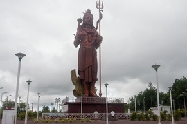
Massive statute of Lord Shiva at Grand Bassin
Rob Stevenson of MU Sailmakers suggested a lunch outing that took us on a tour through the mountains and along the western coast of Mauritius down to the Savanne District at the southern tip of the island. We stopped at the 108 foot statue of Lord Shiva, known as the “destroyer” god among the Hindu deities, which is situated near the Grand Bassin lake. Water from the Ganges River (in India) was brought in and introduced in 1972 which connects the two bodies of water, making this location suitable for an annual pilgrimage for the Maha Shivaratri festival.
12
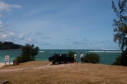
Popular kitesurfing beach on SW coast
Rob successfully navigated the narrow, winding road from the plateau down to the shoreline and pointed out several photo opportunities and local attractions. The volcanic soil is incredibly fertile and put to good use growing amazing vegetables for local consumption as well as for export, and brilliant flowers are naturally occurring along the roadside. The beaches, clear water and consistent wind are what bring the throngs of tourists from Europe and Asia. The sign on this beach warns against the strong current that flows along this stretch of coastline. The weather this time of year is perfect.
1.
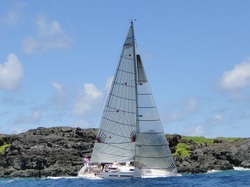
"Gaia" - Grand Soleil 37
When we made our second visit to the loft to see the progress of our new sail, we learned that Julien Cervello tests a lot of the new designs that MU Sailmakers makes for the new racing fleet. This photo is of s/v “Gaia,” their Grand Soliel 37, charging down the Mauritius coastline testing a new sail design using fabric usually more suitable for windsurfing sails. However, at the time of this photo (taken by Marine Noel) the sails were over a year old, campaigning in the local regatta races.
.
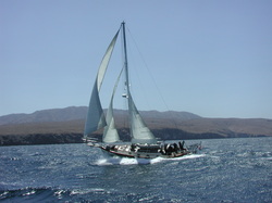
November 1 – 15, 2011
Final Passage across the Indian Ocean
from Port Louis, Mauritius to Richards Bay, South Africa
14.5 days - 1,764.5 n.m.
We were excited to get this passage under way for a couple of reasons; we wanted to put our new mainsail through its paces, we wanted to complete the last leg of our Indian Ocean crossing, and we were keen to get to the African continent. As soon as we hoist our new sail, we knew MU Sailmakers had done a nice job; this sail provides significantly more power than our previous sail, and is easier to properly trim. Any time you sail between the tropics and temperate climates, you can expect challenging weather conditions and this was no exception. As we crossed the Tropic of Capricorn, we faced light and contrary wind conditions along with swirling (and often foul) currents that kept our daily average speeds well below what we are normally able to achieve. Once our course took a more westerly direction, we were able to take advantage of some favorable winds and our progress improved as we entered the Mozambique Channel.
.
Our beautiful new main sail on a fine day
We participated in a daily SSB radio schedule with the Peri-Peri Net, where a land-based radio operator provides updated weather information and offshore vessels share information on the conditions they are experiencing. We were informed of a significant low pressure system that would bring strong winds with the associated cold front and advised it was best to weather this gale out in deeper waters, rather than near shore and the Agulhas Current. So, we intentionally slowed down in light conditions to time our arrival into Richards Bay, which wasn’t difficult in the light, variable winds. However, we did experience the most terrifying brilliant displays of lightning, surpassing even that of the Malacca Strait, when yellow tentacles flashed overhead from horizon to horizon and peals of thunder were felt rather than heard. Joseph disconnected all of our electronics and batteries and we sat helplessly below in total darkness as the cell passed. We had two successive nights of this. During these thunderstorms, the wind often goes from zero to 40 knots in seconds (in any direction) so our tactic is to lower the mainsail and just jog along with the staysail until the cell passes. On our second night this strategy paid off when the wind suddenly gusted from 4 to 40 knots; the force heeled “Horizon” hard over on her starboard side for just a moment, and then she righted herself. But this was all accompanied by a loud Bang and then violent shudders from the bow of the boat. A weld on the stainless steel chain plate that holds the staysail boom to the bow of the boat – failed – and the force of the high wind in the sail pulled the 30 lb. bronze striking plate off the cap rail. So now it’s the middle of the night and our staysail boom is dangling over the starboard lifelines with the sail flagging and a 30 lb weight swinging like a pendulum and lightning is flashing overhead and the wind is howling through the rigging – and we have to get control of the situation. Joseph braced himself and held the boom inboard while Marci gathered the sail and disconnected it from the forestay … the boom quit moving once the sail was down and it was a relatively straightforward process to secure the boom, the sails and all the lines. Sunrise gave us a chance to survey the damage, which turned out to be more cosmetic than structural (except for the chain plate weld) but we were unable to use the staysail for the remainder of the trip. We still had 80 miles to go and were trying to time our crossing of the Agulhas to avoid an oncoming Southerly Buster. A fast moving dark band of clouds signaled the arrival of the gale and we had just enough time to set the second reef, close the ports, batten down the hatches, and don our foul weather gear before it hit. And it hit with a vengeance. It was now that we truly appreciated our new mainsail as “Horizon” raced down the building seas as the wind topped 40 kts for the next four hours. The seas built as well, with many breaking wave sets over 5 meters (15 feet) and foam streaking across the surface. The clouds broke and we probably would have appreciated the beauty of the sun shining through the turquoise waves … just before they broke over the boat … but we were a little busy hand steering to keep Our Girl pointed the right direction. As usual, “Horizon” demonstrated why having a sound, sturdy boat is a Good Thing and, aside from getting a little wet, we all weathered the gale without incident. By midnight (thankfully with no lightning) we were 85 miles north of Richards Bay so we turned south, caught the current, and had a lovely sail down the coast. We arrived at the Tuzi Gazi Harbour at 2:00 a.m., took the first empty stall we encountered, hoist our “Q” flag and toasted our arrival to South Africa.
1.
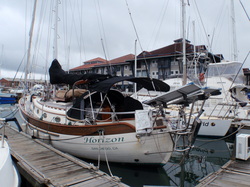
Horizon at Tuzi Gazi Harbour, Richards Bay
November 16 – December 16, 2011
Summary of Stay in Richards Bay, South Africa
Our first day in Richards Bay was spent putting “Horizon” back into respectable order; putting passage-making clothes away, stowing the charts, and wiping down the interior. Customs and Immigration officials both came by to take care of the administrative formalities and we were cleared to leave the marina. The Tuzi Gazi waterfront has several excellent restaurants and we are looking forward to supplementing our home cooking from time to time. We walked over to the Zululand Yacht Club and inspected the boatyard, and we may decide to haul “Horizon” while we are here.
1.
Marci and Joseph inspecting the staysail forestay.
Because of the damage caused to the forward chain plate during Mother Ocean’s tantrum, we spent quite a bit of time working on the boat, and a disproportionate amount of that time was spent just tracking down parts and services. It didn’t take long to dismantle the chain plate, remove the forestay and carefully inspect it, and inspect and repack the staysail. The delay came in securing a qualified welder, securing bedding compounds adequate for marine use, and then waiting for the repaired chain plates to be returned. Joseph made good use of the time in the interim by repainting the staysail boom (and fittings) and the Sampson post. We were pleased to note that we didn’t lose a single screw, shackle or fitting during the squall and everything went back together smoothly. More photos in Keeping Her Afloat.
.
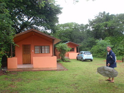
Joseph near our chalet at Bushbabies Lodge
One of the more rewarding aspects of cruising are the friendships you make along the way. We first met Mats and Ulla Wångdahl (of Gothenburg, Sweden) when their yacht “Hokus Pokus” followed us into Refuge Bay in Cocos (Keeling) in August. They sailed from Darwin and are also members of the OCC. We got to know them better after we all sailed from Cocos to the small Mascarene island of Rodrigues, and again in Mauritius. So we were delighted when they invited us to join them on a trip to the nearby St. Lucia Wetlands Reserve and Hluhluwe – iMfolozi Game Park. They had already sourced a lodge (based on other cruisers’ recommendations) and had booked a car. We had just enough time to tidy “Horizon” up after her boisterous voyage before packing up and heading north into the ZwaZulu Natal area.
1
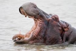
Not a happy hippo
We reached the St. Lucia Wetlands Reserve in time for the 2-hour estuary boat tour. Our experienced Captain, Natasha, brought our shallow draft barge very close to the feeding hippopotamus (Hippopotamus amphibious) and is familiar enough with the families as to be able to recognize individuals and explain their behavior. A “yawn” is actually meant to be a sign of aggression and is used when the animal feels threatened. These animals don’t actually swim but, rather, walk along the river floor and bob to the surface for air. While they may appear ponderous and slow, they can easily outrun a human so, if you find yourself being chased by an enraged hippopotamus, you must climb the nearest tree and wait for it to go away.
.
Hovering Pied Kingfisher
Natasha is also well versed on the abundant plant and bird species throughout the estuary. She pointed out well-camouflaged birds hidden among the grasses, reeds, and black and white mangrove trees. Some, like the bright yellow Southern Masked Weaver birds (Ploceus velatus) were easily visible in the colonies of nests in the reeds along the shore. Others, like the Pied Kingfisher (Ceryl rudis) were much harder to spot, until one hovered next to our boat! We also saw African Jacana (Actophilonis africana) with their massive feet walking in the floating grass (it looked as though they could walk on the water!). African Pygmy Geese (Nettapus auritus) are such brightly colored animals, they barely seem real; and the African Fish Eagle (Haliaeetus vocifer) perched up in the treetop reminded us of our national bird, the Bald Eagle.
.
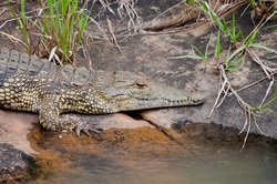
Nile crocodile (Crocodylus noloticus)
She also found several Nile crocodiles lying on the grassy shores, explaining that most of the population were currently in the northern section of the estuary for breeding season. She explained that the Park Management restricts tour boats from visiting those areas in an effort to promote successful breeding. The crocodiles eat birds, fish and small mammals and have been known to injure young hippos, but a contest between an adult croc and an adult hippo will always be won by the hippo.
.
Nasty weather off Cape Vidal
After lunch, we took a drive north within the Reserve to Cape Vidal. We were surprised by the herds of Impala (Aepycerous melampus), Greater Kudu (Tragelaphus strepsicoros) and Nyala (Tragelaphus angasii), animals that had previously been hunted for trophies, feeding in the rich savannah grasslands beside the road. The Reserve has done a nice job of minimizing the human footprint within the boundaries and the animals were not alarmed by our tiny little car. Cape Vidal is at the end of the road and the weather turned nasty by the time we reached the beach. It was interesting to be on the shore-side of the same bluffs we sailed past only four days earlier, before making our landfall in Richards Bay to the south. Those white sandy beaches were clearly visible several miles offshore and were our first view of the African continent.
.
An unwelcome visitor in Joseph's clothes!
We reached the Bushbabies Lodge during a huge downpour and were greeted by owners Pim and Thandie who showed us our chalets. Once we were settled and nightfall descended, Thandie brought out a plate of banana slices and the small bushbabies (which are actually called “Galago”), small nocturnal mammals for which the Lodge was named, came by for an evening snack. The cook served an excellent home style lasagna supper and we spent the evening reliving the excitement of the day and discussing our upcoming plans. We met Mats and Ulla and Pim at the dining center the following morning with a photo of the black scorpion we found on a pair of Joseph’s shorts! The weather was cool so the scorpion was slow and sluggish, and it wasn’t until we put it on the patio and ants started to bother it that the scorpion sprung to life. Pim assured us that such critters are common in “the bush” but, aside from a nasty sting, Joseph probably would not have suffered any ill effects.
.
African savannah in the spring
We drove to the Memorial Gate of the Hluhluwe Park entrance and were greeted by a female Warthog (Pacochoerus africanus) and her young as we waited to get access to the park. The Hluhluwe Game Park (pronounced shu-shlu-wee) has been connected with the iMfolozi Game Park (pronounced oom-fa-low-zee) and a well-maintained paved road runs thorough most of the parks. We planned to do a self-tour our first day and take a guided tour the second. It was not easy as some animals are more visible than others; the giraffes are actually well camouflaged, despite their height, but we saw rhinos that were only 30 feet from the car but nearly invisible behind the screen of vegetation. (See the Updated Gallery for photos of the animas we saw during our two-day tour of these parks.) The only animals we didn’t see – but held high hopes – were the Big Cats. But that doesn’t diminish the thrill of having rhino, giraffes, zebra, impala, kudu, nyala and cape buffalo grazing a few yards from our car. We saw two bull elephants beneath the trees a couple of miles from our hilltop vantage point, their flapping massive ears and tusks were easily visible from our position. Seeing miles of the savannah, rich and green after several weeks of spring rain, spread before us with herds of animals off in the distance was a magical experience.
.
Our tour vehicle in the savannah
We were on the road to Hluhluwe by 6 a.m. the following morning where we saw several herds of buffalo, zebra and giraffe before our 10 a.m. guided tour began at the Hilltop Lodge. “Welcome,” our tour guide, began by asking where we’d been recently, and explained that he has radio contact with other guides and often share knowledge of animal sightings. However, the rain drove many animals to find shelter beneath the trees, so we initially didn’t see the grazers that we’d seen earlier. Welcome pointed out things we would’ve missed, such as the strange black, orange-sized balls that moved on the dirt roads that turned out to be dung beetles pushing their hard-earned prizes down the roads, or the foamy frog’s nests that are built in the reeds suspended over ponds so the tadpoles fall into the water after hatching. He pointed out several Crested Guinea Fowl (Guttera pucherani) that were foraging among the scrub near the road and we saw an Egyptian Goose (Alopochen aegyptiacus)nested in the center of a distant watering hole. The tour was especially nice for Mats because he could relax and let someone else do the driving.
.
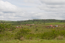
Small settlements along roadside to Hluehlue/iMfolozi Reserve
We returned the rental car and came back to the Tuzi Gazi Harbour to “Horizon” and it felt good to be home. We have a few boat jobs to accomplish and, more importantly, we need to let the weather settle down a little before we set off on our coastal-hopping trip down the eastern shore towards False Bay near Cape Town. We had hoped to visit another of the KwaZulu Natal game parks before venturing south but a suitable weather window has opened up for a short jaunt down to Durban, so we shall see what we see when we get there.
.
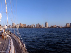
City of Durban from the inner harbour
December 17-18, 2011
Passage from Richards Bay to Durban, South Africa
97.7 n.m. - 15 hours
We had a great time in Richards Bay but an excellent weather window opened up for a short hop down the coast to Durban, so we took it. We completed all of the necessary bureaucratic formalities to secure an exit clearance (prior to departing), wished our new friends at the Tuzi Gazi waterfront businesses, dock neighbors and cruising friends happy holidays and fond farewells, and cast off our dock lines. After waiting for a massive cargo ship to clear the entrance, we motored “Horizon” out of the harbor and back into the Indian Ocean beneath clear skies with a steady easterly breeze. We quickly reached the fringe of the Agulhas Current under full sail and were soon maintaining 8 to 9 knots over the bottom! But the breeze faded in the wee hours of the morning and we spent several hours “only” sailing 5.5 to 6 knots, beneath the glittering stars and a late-rising half moon, so our arrival into Durban Harbor coincided with the sunrise. It is a straightforward entrance and we sailed all the way into the inner Harbor before dousing the sails and tying up on the International Customs Wharf. We forward to spending the next several days exploring this busy, vibrant city.
.
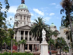
Colonial architecture in downtown Durban
December 18, 2011 – January 5, 2012
Durban Marina, Durban Harbour, South Africa
As we walked from the marina to the nearby Customs/Immigration building to inform the officials of our arrival, our first impression of Durban was that it is a modern city with a great deal of history. Downtown Durban is dotted with colonial-era structures, art deco buildings, several non-descript relics from the 60’s, and many up-scale high rises that reflect the architectural evolution of the past 100 years. As with many cities, many business have moved out to master-planned communities in the suburbs where massive malls and office centers (complete with loft-style housing, shopping and sports complexes) dot the landscape. The North Beach area boasts five-star hotels along white sand beaches which cater to holidaymakers from around the globe wishing to enjoy surfing, kite-boarding and windsurfing.
.
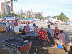
Cruisers relaxing after the Christmas braai
We opted to let a couple of small weather windows (which would have permitted us to continue south) to pass so we could enjoy the Christmas and New Years holidays with our cruising friends who are currently here in Durban. Both holidays were celebrated at the Point Yacht Club “braai” facilities with boerewors sausages, chicken and lamb chops sizzling on the grill, children swimming in the nearby pool, and good friends sharing stories at the picnic table. Mother Nature gifted us with good weather on both occasions and the “Horizon’s,” “Chaotic Harmony’s,” “Rover of Tacoma,” and “Whiskers” enjoyed the holiday South African Style.
.
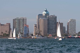
Durban yacht racing
We were assigned a slip next to “BMA,” a Beneteau First 40, and her owner, Stuart Ritchie, invited us to ride along during a Wednesday afternoon race hosted alternatively by the Point Yacht Club and the Royal Natal Yacht Club. Durban Marina has a fair number of keen racers, as we quickly learned, and the fleet made the most of a lovely afternoon racing in the inner harbour. “BMA” is a sleek, fast, responsive boat. Marci took still photos while Joseph operated the video camera, so check out our new video (on the video page) for a glimpse of racing in a fleet of competitive yachts on a summer afternoon.